
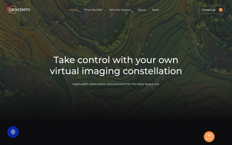
 Geocento is a UK procurement specialist whose Pyxis and Lyra platforms unify ordering across 20-plus suppliers.
Yes, legitimate: incorporated in England since 2011 and serving 65-plus countries.
This review covers catalog breadth, sourcing, pricing and the right procurement route.
Table of Contents
Key Takeaways
- Geocento is the right choice when you need a single ordering point across 20+ suppliers without separate contracts
- Its standout edge is a multi-modality catalog covering optical, SAR, hyperspectral, night imagery, and video
- The key caveat: there is no self-serve route, because access runs through a contracted platform deployment
About Geocento
Geocento neither operates satellites nor resells imagery. Its platforms connect a client to a curated pool of third-party suppliers, and each imagery purchase is contracted directly between that client and the data provider. The key facts below are drawn from Geocento’s published pages and UK Companies House records as of August 2026.
| Name | Geocento |
|---|---|
| Website | geocento.com |
| Legal name | Geocento Limited |
| Address | Farthings, Stoke Road, Hurstbourne Tarrant, Hampshire, SP11 0BA, United Kingdom |
| Founded | 2011 |
| Ownership | Private (grant-funded, backed by Innovate UK and ESA BIC UK) |
| Leadership | Kim Partington (Co-Founder and CEO); Thomas Lefort (Co-Founder and CTO); Maryia Urazaeva (Sales and Marketing Director) |
| Products & data | Pyxis Constellation (catalogue discovery, ordering, tasking, feasibility, ENVI processing); Lyra Constellation (the same platform as a white-label service); API access; virtual constellation design consultancy. EarthImages, the 2015 marketplace, is the legacy engine beneath both |
| Pricing | Consultancy fees plus platform management fees tied to provisioned functionality, usage and an agreed SLA; imagery is bought from the data providers directly, with no margin added by Geocento |
| Languages | English |
An aggregator this small is easy to underestimate, and in my experience that is a mistake worth avoiding: the value of a procurement layer is not its headcount but how many supplier contracts it saves you from signing, and on that measure I find Geocento competes with platforms many times its size.
The EarthImages catalogue behind the platforms reached 250-plus satellites and airborne sensors across more than 20 image suppliers, covering optical resolutions from 15 cm HD through medium-resolution, as well as SAR, hyperspectral, night imagery, and video.
Which of those suppliers a given client sees is now defined per deployment rather than fixed. Geocento was incubated by ESA BIC UK at Harwell Campus from 2012 to 2013, and the company maintains a Spanish subsidiary (Geocento Spain SL) handling operations in that market.
Is Geocento legit?
Geocento’s legitimacy is well-supported by the public record. The company is registered at UK Companies House as Geocento Limited (company number 07868159), incorporated December 2011, with an active status confirmed as of its last confirmation statement in May 2026. For any buyer with doubts, the Companies House record is a direct, verifiable primary source.
Ownership and funding
Geocento is privately held with no disclosed external equity investors beyond public grant bodies. Reported funding includes support from Innovate UK and the ESA BIC UK incubation programme, which gave the company access to Harwell Campus and ESA’s commercialisation network during its early years. The company operates lean, with a reported team of approximately four employees across its UK and Spanish entities.
The absence of a large institutional investor roster is consistent with a profitable services model rather than a venture-scale growth trajectory. It also means buyers should be aware that commercial continuity rests on a small founding team, which is worth factoring into long-term programme decisions.
Track record and customers
Over 14 years of continuous operation and clients spanning 65+ countries give Geocento a credible track record for a specialist EO procurement firm. The ESA BIC incubation and the confirmed integration with Sinergise’s Sentinel Hub platform signal that the company has earned institutional-level trust within the European EO ecosystem.
Geocento does not publish named reference customers on its public site, which is common for government and defence-adjacent suppliers. The use-case coverage documented on the platform spans government and defence procurement, disaster response, agriculture, maritime surveillance, and infrastructure monitoring, suggesting a diverse client base even without named accounts.
Compliance and data rights
Because the imagery comes from multiple third-party operators, licensing terms vary by collection. The licence sits between the client and that operator, so buyers should confirm the applicable end-user licence for each order with the provider itself, particularly for defence, intelligence, and derived-product workflows where licence chain documentation matters. Non-commercial free data from ESA, NASA, and USGS is included at no cost and carries its respective open licences.
Data and capabilities
Geocento’s platforms are built around the principle that a buyer should not need to navigate separate data supplier catalogues, contracts, and delivery workflows. EarthImages, the supplier-agnostic marketplace Geocento launched in 2015, now runs beneath them and presents a unified search, ordering, and delivery interface regardless of which underlying operator holds the data.
Optical imagery
The optical catalog spans the broadest resolution range on the platform, from 15 cm HD very-high-resolution commercial imagery down to medium-resolution products. Named optical suppliers confirmed on the platform include Airbus Defence and Space (Pléiades, Pléiades Neo, SPOT), Vantor (formerly Maxar Technologies, covering WorldView and GeoEye), Planet Labs (Dove, SkySat), Satellogic, SI Imaging Services (KOMPSAT series), Deimos Imaging, HEAD Aerospace and 21AT, MDA, and free data from ESA, NASA, and USGS including Landsat.
Both archive search and new tasking (future acquisition) are available. The Deimos-1 example documented on the platform illustrates the range: 22 m resolution, 650 km swath, and approximately 3-day revisit, which sits at the opposite end of the spectrum from the 15 cm HD optical products accessible via Airbus or Vantor.
SAR, hyperspectral, and other modalities
The platform explicitly covers SAR imagery, with Airbus and MDA named as SAR data providers. It also lists hyperspectral, night imagery, and video as distinct modality categories. The specific hyperspectral and night-imagery operators behind those categories are not enumerated on Geocento’s public pages as of the information available, so buyers requiring a specific hyperspectral sensor should contact Geocento directly to confirm current supplier availability.
Platform and API
Pyxis is the core deployment: catalogue discovery, ordering, tasking opportunities, collection feasibility where the provider supports it, and processing through ENVI workflows. Data is ordered from and delivered into the platform, and the user is notified once the product is available. An API layer supports multi-mission imagery planning and programmatic catalog access for teams integrating imagery procurement into automated workflows.
Enterprise and government clients can deploy Lyra, the white-label configuration, with their own selected supplier portfolio and negotiated terms, which effectively gives large buyers a branded virtual procurement network rather than a generic procurement interface. A confirmed integration with Sinergise’s Sentinel Hub allows purchased commercial imagery to be transferred automatically into a buyer’s Sentinel Hub account via the BYOC workflow, which meaningfully reduces post-order processing steps for teams already working within that platform.
Pricing
Geocento does not publish a price list. What a client pays Geocento is not the imagery: the fee covers consultancy for constellation design plus platform management, scaled to provisioned functionality, usage, and an agreed service level. The imagery itself is bought from the providers directly, with no margin added. The table below documents the model as described on Geocento’s own pages as of August 2026.
| Product | Model | From | Notes |
|---|---|---|---|
| Satellite imagery (all modalities) | Consultancy plus platform management fees | Not published | Fees scale with provisioned functionality, usage, and the agreed SLA. Imagery is contracted directly with each data provider, with no margin added by Geocento. |
| Non-commercial open data (ESA, NASA, USGS/Landsat) | Free | $0 | Included in platform at no cost where available. Applies to ESA Copernicus, NASA, and USGS datasets under their respective open licences. |
| Enterprise / white-label platform | Custom | Contact Geocento | Bespoke deployment with custom supplier portfolio and negotiated terms. Suitable for government agencies and large commercial clients. |
Paying for the platform rather than through it changes what a buyer compares. The imagery price stays whatever the client negotiated with each provider, and Geocento’s fee buys the ordering layer plus the advisory work around it. For a programme already running several supplier contracts, that separation makes the procurement cost visible instead of burying it in a per-scene margin.
The absence of a published floor price makes budget-setting harder compared to aggregators that publish per-km² rates upfront. Buyers with predictable annual imagery needs may find a direct conversation with Geocento about enterprise pricing or a framework agreement a more efficient route than per-order quoting.
Who it’s for
Geocento’s procurement-platform model is most valuable for buyers who need access to multiple sensor types or operators but do not want to negotiate and manage individual data supplier agreements at scale. The clearest fits are programme teams for whom sourcing flexibility and supplier breadth matter more than a direct relationship with a single operator.
Government and defence procurement
For government imagery procurement offices and defence geospatial teams, Geocento’s documented use-case coverage includes government and defence procurement, intelligence and security (OSINT), and disaster response. The white-label enterprise deployment model is particularly relevant here: a government agency can deploy Lyra as a branded portal with a curated supplier list and pre-negotiated terms, removing the overhead of managing dozens of individual operator contracts.
The company’s 14-year track record, ESA institutional relationships, and client base spanning 65+ countries suggest prior engagement with public-sector buyers, though named contract references are not publicly disclosed.
Multi-mission geospatial analysis
Research teams and commercial analysts running workflows that require combining optical, SAR, and hyperspectral data from multiple operators benefit most directly from a single-platform aggregator. The campaign search tool, which allows simultaneous search across sensors, operators, and acquisition dates, removes the need to replicate the same search across each supplier’s individual catalogue.
The Sentinel Hub BYOC integration makes Geocento a practical fit for teams already working in the Sentinel Hub analysis environment: purchased commercial imagery arrives directly in the workspace without manual ingestion steps, which reduces operational overhead for multi-source processing pipelines.
Where it’s less competitive
Buyers whose primary requirement is a single specific operator’s data, or who already have a direct contract with that operator, will find little incremental value in routing through Geocento’s procurement layer. Similarly, teams requiring real-time or near-real-time tasking delivery with SLA guarantees should verify current service levels directly, as the platform adds a coordination layer between buyer and operator.
For buyers on strict budgets who need transparent upfront pricing before initiating procurement, the contract-based model requires more early-stage engagement than platforms that publish public rate cards.
Strengths and limitations
Geocento’s position as a multi-supplier aggregator creates a specific pattern of structural advantages. The strengths concentrate in catalog breadth and procurement simplification:
- Single ordering point across 250+ satellites and 20+ image suppliers, spanning optical (15 cm HD VHR to medium-resolution), SAR, hyperspectral, night imagery, and video, including free non-commercial sources (ESA, NASA, USGS), eliminating the need for separate supplier contracts
- Enterprise and government white-label deployment option, enabling organisations to run a branded virtual procurement network with a custom supplier portfolio and negotiated terms
- Imagery contracted directly with each provider and no margin taken on data, which separates the cost of the ordering layer from the cost of the pixels
- Sentinel Hub BYOC integration, enabling automatic transfer of purchased commercial imagery into Sentinel Hub accounts for buyers already operating in that analysis environment
- ESA BIC UK incubation heritage and 14-year operating history, supporting institutional credibility for government and academic programme use
The limitations are worth weighing against your specific procurement requirements before committing to a programme:
- No published floor price or public rate card: all commercial imagery orders require a quote, which makes upfront budget estimation harder compared to platforms with transparent per-km² pricing
- Specific hyperspectral and night-imagery source operators are not enumerated on public pages; buyers requiring a confirmed sensor for those modalities need direct confirmation from Geocento
- Small company (~4 employees): commercial continuity depends on a compact founding team, which is a programme-risk factor for long-term government or enterprise contracts
- No confirmed presence on cloud marketplaces (AWS, Google Earth Engine, Azure), which limits direct integration for buyers working in those cloud analytics environments
The core commercial question for Geocento is whether the convenience of a single aggregated sourcing point justifies a contracted platform fee compared to going direct to individual operators. For buyers who regularly source imagery from multiple operators or modalities, the sourcing overhead reduction is real. For single-operator buyers, the procurement layer adds process without proportionate benefit.
Geocento alternatives
If Geocento’s procurement-platform model does not align with your sourcing requirements, several other platforms offer comparable or complementary imagery discovery and procurement approaches. The table below draws on verified specifications from primary sources for each provider.
| Provider | Model | Modalities | Pricing transparency | Key differentiator |
|---|---|---|---|---|
| Geocento | Enterprise procurement platform | Optical, SAR, hyperspectral, night, video | Consultancy plus platform fees | Lyra white-label deployment, 20+ suppliers, Sentinel Hub BYOC integration |
| SkyFi | Imagery marketplace / tasking broker | Optical, SAR | Published per-km² rates, self-serve ordering | Self-serve tasking with published rates and a consumer-facing mobile app |
| UP42 | Data and analytics marketplace | Optical, SAR, and analytics products | Credit-based, published catalog prices | Developer-first API, Airbus-backed, broad analytics product catalog alongside imagery |
| Apollo Mapping | Imagery reseller and consultancy | Optical, SAR | Quote-based, consultative sales | US-based reseller with strong government and GIS consulting heritage |
| Sfera Technologies | Imagery aggregator / tasking platform | Optical, SAR, hyperspectral | Self-serve ordering with transparent pricing | Multi-operator tasking and archive access through a single platform with self-serve workflows |
SkyFi and UP42 both publish public pricing, which makes them easier to evaluate at the outset of a procurement process. UP42’s credit-based model and developer API make it a closer fit for teams building programmatic imagery workflows, while SkyFi’s self-serve interface targets buyers who want a minimal-friction route to ad hoc tasking.
Apollo Mapping operates a similar consultative model to Geocento but is US-headquartered with a strong GIS services track record. Sfera Technologies offers multi-operator tasking and archive access with self-serve ordering, which suits buyers who want aggregator-level catalog breadth combined with upfront pricing rather than a contracted deployment.
Geocento is compared against other platforms in our roundup of the best satellite imagery aggregators.
Verdict
Geocento’s legitimacy is straightforward to confirm: the company is registered at UK Companies House, has operated continuously since 2011, was incubated by ESA BIC UK, and maintains an active platform serving clients in more than 65 countries. The more substantive buyer question is whether a contracted procurement platform fits your sourcing workflow.
For programme teams that regularly source imagery across multiple operators or modalities, Geocento’s single-platform aggregation of 20+ suppliers genuinely reduces procurement overhead. The white-label enterprise deployment capability is a meaningful differentiator for government and large commercial buyers who want a custom procurement network rather than a generic off-the-shelf interface. The Sentinel Hub BYOC integration adds further value for buyers already working in that analysis environment.
The primary caution is the absence of published pricing: buyers cannot self-serve a budget estimate without engaging with the platform or contacting Geocento, which introduces friction compared to marketplace competitors that publish per-km² rates. The company’s small team size is a continuity consideration worth factoring into programme risk assessments for long-term contracts.
For buyers sourcing across multiple sensor types, running government or enterprise imagery programmes, or looking for a white-label procurement platform, Geocento is a well-established and credible option. For buyers whose primary requirement is a single operator’s data, transparent self-serve pricing, or deep cloud marketplace integration, the alternatives table above is the more practical starting point.
Frequently asked questions
Below are answers to the questions buyers most commonly ask about Geocento. Each answer points to the section where the full detail lives.
How does Geocento work?
Geocento designs and runs virtual constellations: Pyxis for a single organisation, Lyra as a white-label service. Both unify ordering across more than 20 suppliers and 250+ satellites in one interface. Geocento does not resell the imagery: clients contract each data provider directly. Full detail is in “Data and capabilities“.
Is Geocento a legit company?
Yes. Geocento is registered at UK Companies House as Geocento Limited (company number 07868159), incorporated December 2011, with active status confirmed as of May 2026. The company was incubated by ESA BIC UK at Harwell Campus and has operated continuously for 14 years. See “Is Geocento legit?“
Who owns Geocento?
Geocento is privately held by its founders. The company was co-founded by Kim Partington (CEO) and Thomas Lefort (CTO), with Felipe Martín Crespo co-founding the Spanish subsidiary. Reported institutional backers include Innovate UK and ESA BIC UK, which provided grant funding rather than equity investment. Ownership details are in “Is Geocento legit?“
How much does Geocento cost?
Geocento charges the client directly: consultancy fees for constellation design plus platform management fees based on provisioned functionality, usage, and an agreed SLA. The imagery is not part of that bill: it is purchased from the data providers directly, with no margin added by Geocento. Full pricing context is in the “Pricing” section.
Does Geocento have a free tier?
No. Access runs through a contracted deployment of Pyxis or Lyra, and no self-serve tier exists; Geocento publishes neither a rate card nor a trial route for either the platform or the imagery behind it. Details are in “Pricing“.
Where is Geocento based?
Geocento’s registered address is in Hurstbourne Tarrant, Hampshire, UK, and its operational headquarters has been at Harwell Campus in Didcot, Oxfordshire, UK, where it was incubated by ESA BIC UK. The company also operates a Spanish subsidiary, Geocento Spain SL. The address and company details are in “About Geocento“.
When was Geocento founded?
Geocento was incorporated on 1 December 2011 as Geocento Limited under UK company number 07868159. The company was incubated by ESA BIC UK at Harwell Campus from 2012 to 2013, which provided its early-stage institutional grounding. Background is in “About Geocento“.
What data does Geocento offer?
The platforms reach optical, SAR, hyperspectral, and thermal data through provider adaptors, with the EarthImages catalogue behind them spanning 15 cm HD VHR to medium resolution plus night imagery and video, and the supplier mix defined per deployment. Named optical suppliers include Airbus, Vantor (formerly Maxar), Planet, Satellogic, SI Imaging Services, Deimos Imaging, HEAD Aerospace, and MDA, plus free open data from ESA, NASA, and USGS. Full detail is in “Data and capabilities“.
What are the best alternatives to Geocento?
The closest matches depend on your priorities: SkyFi and UP42 both offer published self-serve pricing with multi-operator catalog access, Apollo Mapping is a US-headquartered consultative reseller with strong government heritage, and Sfera Technologies offers multi-operator tasking and archive access with transparent self-serve ordering. A full comparison is in “Geocento alternatives“.

My passions are Earth Observation and Satellites, and my profession is Data Analysis. I combine both within ObservationData.com to show you the use cases of Earth Observation, to help you find the right provider, and to share your experiences.
