 SatVu is a UK-based satellite operator running the world’s highest-resolution commercial thermal infrared constellation, delivering 3.5-metre MWIR imagery day and night from its HotSat satellites.
Yes, it is a legitimate company, backed by the NATO Innovation Fund, Lockheed Martin, and In-Q-Tel, and holds a Category 1 ESA Copernicus Contributing Mission contract as the first UK company to do so.
This review covers SatVu’s sensor specifications, constellation roadmap, pricing approach, and real limitations so you can judge whether it is the right fit for your thermal intelligence requirements.
Table of Contents
Key Takeaways
- SatVu is the go-to operator for buyers who need sub-5-metre commercial thermal infrared imagery day and night from space
- The standout edge is thermal video up to 60 seconds alongside still imagery, unique at this resolution class
- The core caveat: SatVu is single-modality thermal-only, with no optical or SAR capability
About SatVu
SatVu operates its own MWIR thermal constellation from a single-modality focus that few commercial operators attempt, making it the only company where high-resolution thermal imagery, thermal video, and a rapidly scaling fleet of HotSat satellites come from one vendor. The key facts below are drawn from SatVu’s own published pages as of May 2026.
| Name | SatVu |
|---|---|
| Website | satellitevu.com |
| Legal name | Global Satellite Vu Limited |
| Address | 5th Floor, County Hall, Belvedere Road, London SE1 7PB, United Kingdom |
| Founded | 2016 |
| Ownership | Private, £60m total equity raised as of February 2026 |
| Leadership | Anthony Baker (Founder and CEO); Tobias Reinicke (Co-founder and CIO); Camilla Taylor (CFO and Director); Scott Herman (CTO) |
| Products & data | Thermal satellite imagery (MWIR, up to 3.5 m GSD, day and night); thermal video (up to 60 seconds); stacked imagery; Standard and Assured Tasking; archive catalog access; SatVu Platform (web app); RESTful API; Python SDK |
| Pricing | Quote-based; per-image pricing shown at catalog order step; tasking shows price estimate before confirmation; custom programmes on request |
| Languages | English |
SatVu’s own press releases document a funding trajectory that confirms serious institutional backing: a £30m round in February 2026 brought total equity to £60m ($80m), with the NATO Innovation Fund, British Business Bank, Lockheed Martin, and In-Q-Tel among the investors. The ESA Copernicus Contributing Mission contract (up to €3m, announced June 2025) is the first Category 1 award of its kind to a UK company.
Is SatVu legit?
In my analysis, SatVu’s legitimacy is not a serious question. The company is privately held, founded in 2016, has launched two satellites, holds active government contracts on two continents, and has £60m in total equity raised from institutional investors including Lockheed Martin, In-Q-Tel, and the NATO Innovation Fund. The more useful question for a buyer is whether SatVu’s thermal-only architecture meets your specific data requirements.
Ownership and funding
SatVu’s investor base reads as a deliberate mix of defence-aligned and climate-focused capital. Lockheed Martin and In-Q-Tel provide US defence and intelligence credibility, while the NATO Innovation Fund participation in the February 2026 £30m round signals formal alignment with NATO’s space intelligence priorities.
The British Business Bank and Space Frontiers Fund II on the same round reflect continued UK government support, building on the earlier UK Space Agency NSIP grant and a Defence Innovation Loan from DASA. Lead investor Molten Ventures, alongside Adara Ventures and Seraphim Space Fund, brings specialist deep-tech and space VC governance to the board.
Track record and customers
SatVu’s most credible institutional validation comes from its named contracts: the ESA Copernicus Category 1 Contributing Mission (up to €3m over three years), active participation in NATO’s Alliance Persistent Surveillance from Space programme, and inclusion in the NGA LUNO A/B defence data programme alongside five industry partners. The NGA Global Data Marketplace made HotSat-1 archive data accessible to US government agencies in a pilot, confirming demand on the US intelligence side.
Published case study partners include 38 North (nuclear security), Kayrros (geospatial intelligence), and Ordnance Survey, indicating engagement across security, energy analytics, and national mapping communities.
Compliance and data rights
SatVu holds Cyber Essentials Plus accreditation. Data deliverables are provided as Cloud Optimized GeoTIFF with STAC JSON metadata and a usable data mask, which aligns with the de-facto standards for cloud-native GIS pipelines and government procurement workflows. SatVu publishes a catalog withhold feature that lets tasking customers pay for an exclusivity window on their imagery before it enters the public catalog, a relevant data-rights control for buyers in sensitive programmes.
Commercial contact is handled entirely via the platform and contact form. SatVu publishes no rate card or SLA terms on its public pages, though UP42 lists the HotSat-1 archive at a published credit rate. Buyers in regulated environments should factor direct engagement with SatVu’s sales team into their procurement timelines.
Data and capabilities
SatVu’s entire product line flows from a single sensor modality: mid-wave infrared. That focus means the thermal specifications, delivery modes, and constellation roadmap are tightly defined rather than spread across multiple sensor families, which simplifies evaluation but also sets a clear scope boundary.
HotSat sensor specifications
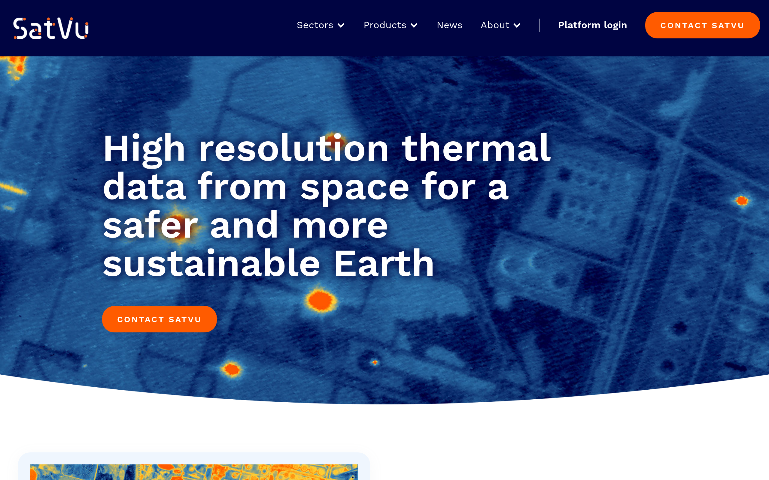
The HotSat MWIR sensor operates at 4.5–5 µm during the day and 3.7–5 µm at night, delivering up to 3.5 m GSD at nadir with a scene size of approximately 3.5 × 4.5 km (16 km²). Geolocation accuracy is published at 15 m CE90. The sensor performs 100% cloud assessment on all imagery, and the data can see through smoke, a capability documented in wildfire use cases on SatVu’s own sector pages.
Imagery is delivered in representative digital numbers (0 = coldest pixel, higher values = warmer) on SatVu’s standard colour scale. The stacked imagery product combines multiple frames per observation to improve signal-to-noise ratio, which is useful for faint thermal signatures such as subsurface thermal contamination or low-temperature industrial activity.
Imaging modes and video
SatVu offers two standard imaging modes, day and night, with the same 3.5 m resolution in both. Each mode supports three product types: Thermal Image, Stacked Image, and Video (up to 60 seconds). SatVu states it is the only commercial provider of satellite thermal data in both still and video form at this resolution, a claim with direct relevance for pattern-of-life analysis at strategic sites where a single still frame may miss activity timing.
Thermal video at 3.5 m adds a temporal dimension within a single pass that static imagery cannot replicate, enabling analysts to observe movement, activity cycles, and thermal discharge events that would otherwise require multiple revisit collections to infer.
Constellation status and roadmap
HotSat-2 launched on SpaceX Transporter-16 on 30 March 2026 from Vandenberg Space Force Base, established communications within three hours, and released first-light images on 7 May 2026 showing energy sites including Bandar Abbas Port, Iran. It is the currently active operational satellite.
HotSat-1, the pathfinder launched in June 2023, experienced an anomaly announced in December 2023 that SatVu stated was expected to impact ongoing operations. The company framed it as a pathfinder success and used the insurance proceeds as part of subsequent funding rounds.
Primary sources indicate HotSat-3 is under contract for 2026, with HotSat-4, HotSat-5, and long-lead elements of HotSat-6 also contracted as of February 2026. The constellation target is 8 satellites, with full-fleet revisit performance targeted at 10–20 revisits per day. The launch timing for HotSat-3 through HotSat-6 is described as 2025–2026 in SatVu’s funding announcements, though buyers should verify current schedules directly with SatVu.
Surrey Satellite Technology Ltd (SSTL) is the confirmed satellite manufacturer for both HotSat-1 and HotSat-2 under an SSTL clone contract.
Platform and access
SatVu provides access through three channels: the SatVu Platform web app (app.satellitevu.com) for tasking and catalog browsing, a RESTful API (docs.satellitevu.com), and a Python SDK. Standard Tasking accepts a date range and optimises the collection window, while Assured Tasking specifies a particular date and carries a premium priority uplift for time-critical requirements. Both routes include a feasibility check and price estimate step before order confirmation.
The catalog allows preview of existing data with per-image pricing revealed at the order step. Data deliverables include Cloud Optimized GeoTIFF (single image and stacked), JSON metadata (STAC), a usable data mask (UDM), and PNG overview and thumbnail files for rapid triage. The API and Python SDK make integration into existing geospatial pipelines straightforward for technical buyers.
Pricing
SatVu publishes no specific price numbers on its public site. Pricing is revealed at two points in the workflow: the catalog shows a per-image price at the order step for archive data, and the tasking flow includes a price estimation step before the order is confirmed.
| Product | Model | Pricing disclosed | Notes |
|---|---|---|---|
| Catalog (archive) imagery | Per image | At order step in platform | Each catalog image has an associated price shown before purchase confirmation |
| Standard Tasking | Per tasking order | Price estimate step before order | Date range window. SatVu selects optimal collection time. |
| Assured Tasking | Per tasking order | Price estimate step before order | Specified date and highest priority. Premium over Standard Tasking. |
| Catalog withhold | Per tasking order (add-on) | Contact sales | Keeps tasked imagery out of public catalog for a defined exclusivity window |
| Custom / government programmes | Contract | Contact sales | Large-area or ongoing programmes. SatVu holds active government contracts (ESA, NATO, NGA). |
There is no published free tier, trial, or self-serve pricing ladder. Buyers who want to evaluate SatVu’s imagery before committing to a programme should contact the sales team directly. For government and defence buyers, SatVu’s active participation in NGA and NATO procurement frameworks provides an existing contracting pathway that bypasses commercial negotiation.
Who it’s for
SatVu’s thermal-only architecture concentrates value for buyers where the thermal signal is the primary intelligence requirement, rather than an ancillary layer on top of optical or SAR data. The strongest fits cluster around use cases where activity detection, energy monitoring, or heat-signature analysis drives the decision.
Defence, intelligence, and national security
SatVu’s customer list confirms defence and intelligence as its best-developed market: ESA CCM, NATO APSS, NGA LUNO A/B, and the NGA Global Data Marketplace pilot are all named on the company’s own news pages. The MWIR sensor’s day-night capability and 3.5 m resolution enable detection of activity at naval bases, airfields, fuel depots, power stations, and border infrastructure that optical imagery cannot support at night.
Pattern-of-life analysis via thermal time-series and the unique video mode add analytical depth that single still-frame optical tasking cannot match. Defence buyers should expect to engage SatVu directly, as pricing and data rights for this segment are handled outside the self-serve catalog flow.
Energy and industrial monitoring
Oil refineries, LNG terminals, power plants, gas flaring sites, and data centres all produce distinctive thermal signatures that SatVu’s sensor resolves at the facility and asset level. The 3.5 m GSD enables anomaly detection at individual equipment level, not just facility-wide heat maps, which is the key differentiator versus 100-metre Landsat thermal band products.
Floodlight (industrial emissions monitoring) and Kayrros (geospatial intelligence and energy analytics) are confirmed Early Access Programme partners, indicating that the sensor specification has been validated for commercial energy monitoring workflows.
Climate, environment, and urban resilience
Urban heat island mapping, wildfire monitoring with smoke penetration, and thermal contamination of water bodies are documented use cases on SatVu’s sector pages. The company positions itself as “The World’s Thermometer from Space,” and ESA’s Copernicus CCM contract formalises the climate monitoring application at institutional level.
Urban planning organisations (OPO) and land and property data providers (Landmark Information Group) are confirmed partners, suggesting growing interest in thermal analytics for city infrastructure and real estate energy performance beyond the traditional remote sensing community.
Where it’s less competitive
SatVu is thermal-only, so buyers whose primary requirement is optical imagery, SAR, or multispectral data will need a separate provider for those modalities. The 16 km² scene size (~3.5 × 4.5 km) is small relative to wide-area SAR or optical constellations, which means large-area systematic monitoring requires more tasking orders and higher cost.
With HotSat-2 as the single active satellite, revisit frequency today is constrained compared to what the full 8-satellite fleet will deliver. Buyers planning programmes around 10–20 daily revisits should treat that as a roadmap target rather than a current specification.
Strengths and limitations
SatVu’s position as the world’s highest-resolution commercial thermal operator creates a clear set of structural advantages. The strengths concentrate in sensor uniqueness, institutional validation, and a well-funded constellation roadmap:
- World’s highest-resolution commercial thermal infrared imagery at 3.5 m MWIR GSD, day and night, enabling sub-facility activity detection that no competing commercial operator replicates at this resolution class
- Sole commercial provider of satellite thermal data in both still-image and up-to-60-second video form at this resolution, adding intra-pass temporal analysis capability
- Strong institutional validation: ESA Copernicus Category 1 CCM contract (first UK company), NATO Innovation Fund investor participation, NGA LUNO A/B programme membership, and active US government data access via NGA Global Data Marketplace
- Well-capitalised constellation roadmap: HotSat-2 active, HotSat-3 through HotSat-6 under contract, targeting an 8-satellite fleet with 10–20 revisits per day, and £60m total equity raised as of February 2026
- Accessible platform with RESTful API, Python SDK, Standard and Assured Tasking modes, and a catalog withhold feature for buyers requiring imagery exclusivity windows
- See-through-smoke capability and 100% cloud assessment on all imagery, with data deliverables in Cloud Optimized GeoTIFF + STAC JSON for cloud-native pipeline integration
The limitations are worth mapping against your specific requirements before committing to a programme:
- Thermal-only: no optical, SAR, or multispectral capability, so buyers needing broad-spectrum EO coverage must source other modalities from separate providers
- ~3.5 × 4.5 km scene size (16 km²) is small relative to wide-swath optical or SAR sensors, making large-area systematic mapping operationally intensive and cost-intensive to achieve via tasking
- SatVu publishes no rate card: engaging directly means contacting its sales team, and the only published per-scene number is the HotSat-1 archive listing on UP42
- Current operational fleet is a single satellite (HotSat-2), so the 10–20 daily revisit target depends on the full 8-satellite fleet, which primary sources indicate is launching through 2025–2026 but is not yet operational
- No free tier, trial data, or sample archive offered on the public site, meaning evaluation requires a direct sales relationship
- HotSat-1, the pathfinder satellite, experienced an operational anomaly in December 2023, and archive imagery from that period may appear in case studies, but the active data service relies on HotSat-2
In my analysis, the core commercial tension is between SatVu’s genuinely unique sensor capability and the early-stage fleet size that currently limits revisit frequency. For buyers whose primary requirement is thermal intelligence at 3.5 m resolution, no competing commercial operator offers a direct substitute. For buyers whose requirement is high-revisit thermal monitoring today rather than on an 8-satellite roadmap timeline, the current single-satellite constraint is a practical factor to weigh against the sensor’s unique specifications.
SatVu alternatives
If SatVu’s thermal-only architecture does not fully align with your primary requirement, three operators offer thermal or thermal-adjacent capabilities at different points on the resolution, revisit, and coverage spectrum. The table below draws on verified specifications from primary sources for each provider.
| Provider | Modality | Best resolution | Revisit | Key differentiator |
|---|---|---|---|---|
| SatVu | Thermal MWIR | 3.5 m (day and night) | Single satellite today, 10–20/day (full 8-sat fleet) | World’s highest-resolution commercial thermal imagery, sole provider of thermal video at this resolution |
| constellr | Thermal infrared (TIR/LWIR) | ~30 m (land surface temperature) | Scaling constellation for frequent revisit | High-frequency land surface temperature products focused on agriculture, water stress, and climate monitoring |
| OroraTech | Thermal infrared | ~200 m (Forest-2 class) | Multiple satellites, near-daily global | Wildfire detection and monitoring platform with a dedicated constellation and near-real-time alert service |
| Hydrosat | Thermal infrared (TIR) | ~30 m (sharpened LST), 70 m native | Frequent revisit via constellation | Agricultural water stress and evapotranspiration analytics via thermal data, with a strong agriculture and water management focus |
constellr targets land surface temperature at moderate resolution for agricultural and climate programmes, where SatVu’s 3.5 m MWIR GSD is neither required nor cost-effective. OroraTech’s near-real-time wildfire detection and alert service covers a specific operational use case with a dedicated platform and notification layer that SatVu’s tasking-and-catalog model does not replicate. Hydrosat’s evapotranspiration and water stress products target precision agriculture buyers who need derived analytics rather than raw thermal imagery tasking.
SatVu’s differentiation holds firmly at the resolution end: for buyers who need to resolve individual assets, structures, or activity signatures at 3.5 m in the thermal band, none of these three alternatives operates at that resolution class.
SatVu leads our guide to the best thermal satellite imagery providers.
Verdict
Legitimacy is not the question with SatVu: it is a privately held UK company founded in 2016, with two satellites launched, £60m in total equity raised, active contracts with ESA, NATO, and NGA-aligned programmes, and a board that includes Lockheed Martin and In-Q-Tel as investors. The real question is fit, and that splits along the resolution-versus-revisit axis.
For buyers whose primary requirement is the highest-resolution commercially available thermal infrared imagery at 3.5 m, SatVu is the only vendor on the market. The thermal video mode, the stacked imagery product, and the see-through-smoke capability add differentiation that no directly competing commercial operator replicates. The ESA Copernicus CCM contract and NGA marketplace access confirm that the sensor specification meets institutional standards.
The caveats are structural. With HotSat-2 as the single active satellite, the 10–20 revisit-per-day target is a constellation roadmap figure rather than today’s operational reality. Buyers planning programmes around high-revisit thermal monitoring should verify current satellite status and delivery commitments directly with SatVu before committing to a programme. Pricing is entirely opaque from the public site, so budget estimation requires a direct sales engagement rather than a self-serve calculation.
For defence and intelligence buyers, energy and infrastructure monitoring programmes, and climate or nuclear security analysts who specifically need 3.5 m thermal resolution, SatVu is a well-validated choice with no direct commercial equivalent. The alternatives table above is the practical starting point for buyers whose thermal requirement sits at coarser resolution or in a more analytics-focused product category.
Frequently asked questions
Below are answers to the questions buyers most commonly ask about SatVu. Each answer points to the section where the full detail lives.
How does SatVu work?
SatVu operates its own MWIR thermal satellites and makes imagery accessible via a web app, RESTful API, and Python SDK. Buyers either task a new collection (Standard or Assured Tasking) or purchase existing imagery from the catalog, with both routes including a feasibility check and price estimate step before confirmation. Full detail is in the “Data and capabilities” section.
Is SatVu a legit company?
Yes. SatVu (Global Satellite Vu Limited) is a UK-registered company founded in 2016, with two satellites launched, £60m in total equity raised, and active institutional contracts with ESA, NATO, and NGA-aligned programmes. Its investor base includes the NATO Innovation Fund, Lockheed Martin, and In-Q-Tel. See “Is SatVu legit?“
Who owns SatVu?
SatVu (Global Satellite Vu Limited) is privately held with no single majority owner listed on its public pages. The company was co-founded by Anthony Baker, who serves as Founder and CEO, and Tobias Reinicke (CIO), and its institutional investors include Molten Ventures, Adara Ventures, the NATO Innovation Fund, Lockheed Martin, In-Q-Tel, Seraphim Space Fund, and the British Business Bank, among others. Ownership details are in “Is SatVu legit?“
How much does SatVu cost?
SatVu publishes no specific price numbers on its public site. Catalog imagery reveals a per-image price at the order step and tasking shows an estimate before confirmation, but there is no self-serve pricing ladder. The HotSat-1 archive is separately listed on UP42 at 58,700 credits per scene. Budget evaluation requires direct engagement with SatVu’s sales team, and full context is in the “Pricing” section.
Where is SatVu based?
SatVu is headquartered at 5th Floor, County Hall, Belvedere Road, London SE1 7PB, United Kingdom. The legal entity is Global Satellite Vu Limited, a UK-registered company. Background is in the “About SatVu” section.
Who are SatVu’s customers?
SatVu’s own news pages name ESA (Copernicus CCM contract), NATO APSS / NCIA, the NGA LUNO A/B programme, US government agencies via the NGA Global Data Marketplace, the UK Ministry of Defence / DASA, Kayrros, Ordnance Survey, Floodlight, 38 North, and Landmark Information Group. The customer base spans defence, intelligence, energy analytics, and environmental monitoring. The full customer context is in “Is SatVu legit?“
When was SatVu founded?
SatVu was founded in 2016 by Anthony Baker and Tobias Reinicke. The company received its first UK Space Agency NSIP grant in 2021 and launched its first satellite, HotSat-1, in June 2023. Background is in the “About SatVu” section.
How does SatVu make money?
SatVu’s primary revenue model is per-order data licensing: buyers pay for individual catalog images at a price shown at the order step, or place tasking orders priced via an estimation step before confirmation. Government and institutional programmes are handled via direct contract rather than the self-serve platform. See “Pricing” for the model structure.
What are the best alternatives to SatVu?
The closest matches depend on your thermal use case: constellr for high-frequency land surface temperature at moderate resolution in agriculture and climate programmes, OroraTech for near-real-time wildfire detection with a dedicated alert platform, and Hydrosat for evapotranspiration analytics and agricultural water stress at moderate thermal resolution. A full comparison is in the “SatVu alternatives” section.
What use cases is SatVu best suited for?
SatVu is strongest for national security and ISR at strategic sites, nuclear facility monitoring, oil and gas infrastructure activity detection, pattern-of-life analysis, wildfire monitoring, urban heat island mapping, and any programme where 3.5 m MWIR resolution day and night is the defining requirement. It is less competitive where optical or SAR data is needed, or where broad-area coverage with high revisit frequency matters more than thermal resolution. Details are in the “Who it’s for” section.

My passions are Earth Observation and Satellites, and my profession is Data Analysis. I combine both within ObservationData.com to show you the use cases of Earth Observation, to help you find the right provider, and to share your experiences.