
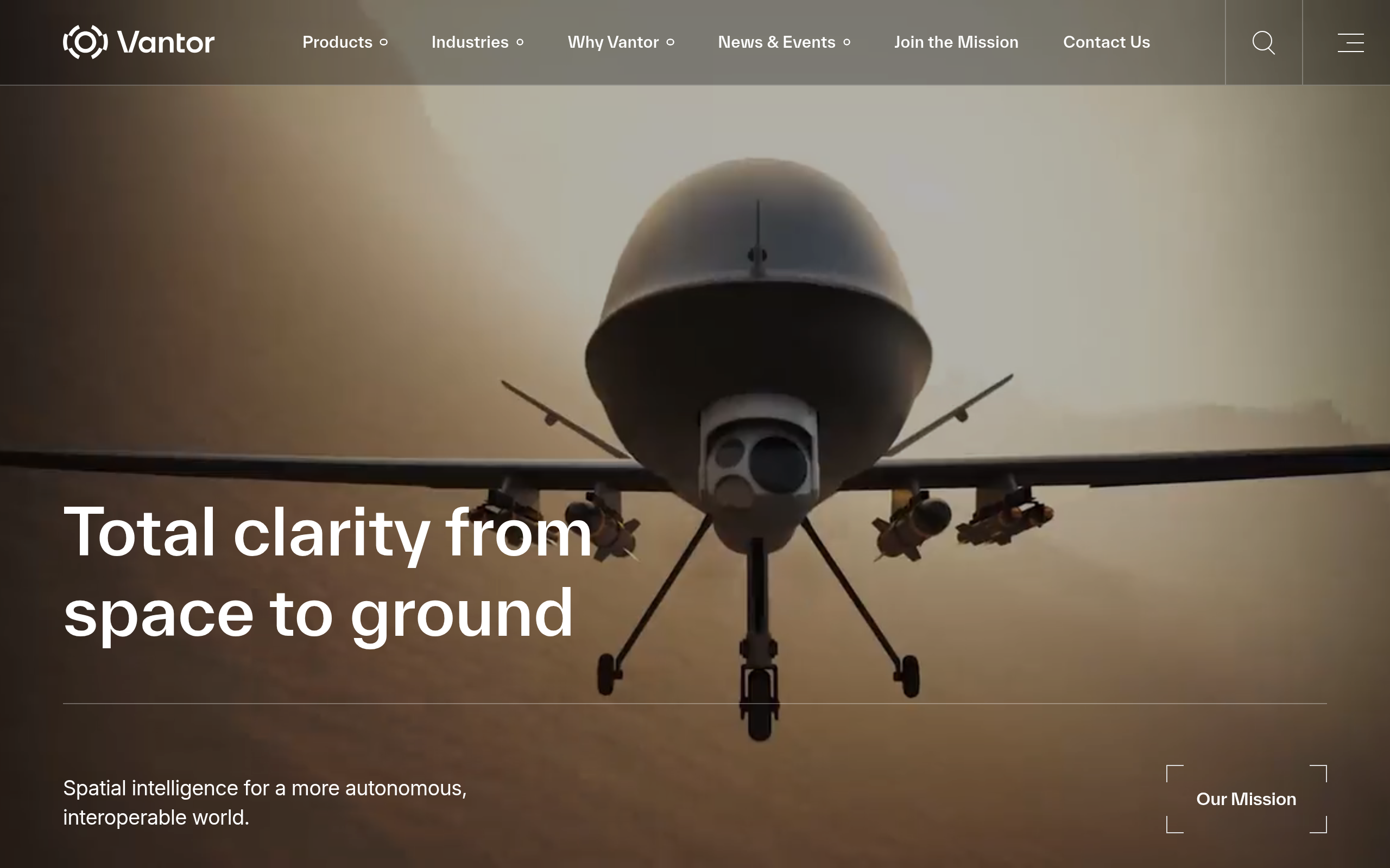
 Vantor, formerly Maxar Intelligence, is a US operator of the highest-capacity VHR fleet.
Established, with 30-plus years of DigitalGlobe heritage and a continuous defense record.
This review covers the rebrand, specs, pricing opacity and the fit for your requirements.
Table of Contents
Key Takeaways
- Vantor delivers the sharpest commercial optical pixels on orbit, at 30 cm-class with up to 15x daily revisit
- Its standout edge is the Tensorglobe AI platform, automating tasking-to-fusion and deployable in classified environments
- We weighed the strengths and limitations: the real caveat is pricing opacity, with published rates only on UP42
About Vantor
The name “Maxar” remains the dominant search term, but the company rebranded to Vantor on October 1, 2025, simultaneously unveiling the Tensorglobe AI-powered spatial intelligence platform. Maxar.com now redirects to vantor.com.
The imagery intelligence unit and the satellite manufacturing arm (which rebranded to Lanteris) had already been operating as separate entities since the Advent International acquisition in 2023. In January 2026 Lanteris was sold outright to Intuitive Machines, so the two businesses are no longer related. The facts below are drawn from Vantor’s own published pages as of July 2026.
| Name | Vantor (formerly Maxar Intelligence) |
|---|---|
| Legal entity | Vantor Holdings Inc., incorporated in Delaware |
| Website | vantor.com |
| HQ | Westminster, Colorado, USA |
| Ownership | Private (acquired by Advent International, formerly NYSE: MAXR) |
| Leadership | Dan Smoot (CEO); Peter Wilczynski (Chief Product Officer); Arvind Srinivasan (CTO) |
| Employees | ~2,000+ globally (per vantor.com/company/about/) |
| Products & data | WorldView 2D (30 cm-class VHR optical tasking); Vivid Mosaic basemaps (15 cm HD and 30 cm global); Vivid Terrain 3D models; Tensorglobe AI platform; WorldView Radar (SAR via Umbra); Vantor Hub self-serve portal; Sentry persistent monitoring; Raptor GPS-resilience software |
| Pricing | No public pricing on vantor.com; credits-based Hub model, quote-based enterprise programs; published credit rates on the UP42 marketplace |
| Languages | English |
The scale of Vantor’s collection capacity is notable: 10 imaging satellites on orbit as of May 2026, generating roughly 7 million square kilometers of imagery per day, including 3.5+ million square kilometers at 30 cm-class resolution. The WorldView constellation has been the backbone of US government foundational GEOINT since the DigitalGlobe era, powering the GEGD program that distributes geospatial intelligence to over 1 million users.
Is Vantor legit?
Vantor is unambiguously a real, operational company with a decades-long track record in both commercial and defense geospatial markets. The more useful question for a buyer is whether the product line and access model match your specific acquisition needs and budget.
Ownership and funding
Maxar Technologies went private in May 2023, acquired by the private equity firm Advent International at $53.00 per share in a deal worth roughly $6.4 billion. It had previously traded on the NYSE as MAXR, and the Canadian pension manager BCI joined the purchase as a minority co-investor.
That acquisition split the company in two: the imagery intelligence business (Maxar Intelligence) and the satellite manufacturing arm (Maxar Space Systems). The October 2025 rebrand renamed those already-separate entities to Vantor and Lanteris respectively.
They then parted company for good. In January 2026 Vantor sold Lanteris to Intuitive Machines for $800 million, split as $450 million in cash and $350 million in stock. Vantor no longer builds its own satellites, although the WorldView Legion spacecraft now in orbit were built by the manufacturing arm while it was still part of the group.
The operating entity is Vantor Holdings Inc., incorporated in Delaware and registered to the Westminster, Colorado address. Being privately held, it files no annual reports with the SEC.
Its single filing there is a January 2026 insider disclosure recording the Intuitive Machines shares it received for Lanteris. That document names Advent International as a joint filer, which confirms Advent’s continuing control. Whether BCI still holds a stake is disclosed nowhere.
What is clear from the site is that the business is actively funded and operational: new products launched at rebrand, a constellation expansion was announced in April 2026, and government contracts continue to be disclosed on the company’s blog.
Track record and customers
The heritage here is deep. DigitalGlobe, the direct predecessor, successfully launched QuickBird in 2001 and built the commercial VHR imagery market over the following decade. The WorldView constellation has been operational under successive brands for over 15 years, and the company has supplied imagery for applications ranging from disaster response and humanitarian mapping to US Army One World Terrain mission rehearsal and space domain awareness.
Named customers on Vantor’s own site include HERE Technologies, TomTom, and Mapbox (all using Vivid Mosaic basemaps), Google (Tensorglobe AI integration), Anduril, Lockheed Martin, BAE Systems, and Saab in defense. Zonda monitors 60,000-plus US housing construction projects using the platform. The Netherlands Ministry of Defence signed a multi-year Vantor Hub contract in 2025 valued at approximately $14 million, one of the few contract values the company has disclosed publicly.
Compliance and data rights
Vantor’s licensing structure is worth examining before signing any contract. The active end-user licenses (Internal Use License and Subscription Services License) both contain explicit restrictions on using licensed imagery to train machine learning models or improve any algorithm. This is a genuine constraint for organizations building AI/ML pipelines on top of VHR optical data.
The ARD (Analysis-Ready Data) tile product was deprecated as of January 2026. Current delivery runs via COG format with STAC-compliant catalog access through the Hub API. Redistribution of processed imagery requires a sublicense add-on, and the license architecture includes several distinct tiers depending on use case.

Data and capabilities
Vantor’s core product is VHR optical imagery from 10 imaging satellites, spanning the resolution range from 30 cm-class WorldView Legion and WorldView-3 down to the 50 cm WorldView-1. The constellation also incorporates third-party SAR and high-revisit optical sensors via Vantor’s virtual constellation framework.
Optical sensors and constellation
The six WorldView Legion (WVL) satellites completed their constellation over three launches: the first pair in May 2024, the second pair in August 2024, and the fifth and sixth satellites in February 2025. Each WVL satellite carries a panchromatic sensor with a native ground sample distance of 34 cm, which Vantor markets as “30 cm-class imagery” in product literature.
The older WorldView-3 has a slightly sharper native Pan GSD of 31 cm and adds 8-band VNIR and 8-band SWIR sensing plus a CAVIS atmospheric correction layer, making it the most spectral satellite in the fleet. WorldView-2, GeoEye-1, and WorldView-1 round out the legacy satellites with Pan GSDs of 46, 41, and 50 cm respectively.
The “15 cm HD” product marketed under the Vivid Mosaic brand is not a native sensor resolution. Vantor’s own site states explicitly that “our HD processing upscales 30 cm imagery to 15 cm clarity,” meaning it is a machine-learning super-resolution product. For visualization and basemap use cases the upscaling is well-regarded. For precision measurement tasks, however, the 34 cm or 31 cm native GSD is the operative figure.
The full constellation delivers up to 15 imaging opportunities per day at priority locations and a daily collection capacity of roughly 7 million square kilometers in total. Accuracy is rated at better than 5 m CE90 across the constellation, with Block Bundle Adjustment sharpening mosaic products to the same threshold globally.
SAR and third-party sensors
Through the WorldView Radar product, Vantor tasks and distributes SAR imagery collected by Umbra’s X-band satellites under a virtual constellation partnership. Vantor’s own datasheet offers four ground-plane resolutions, the finest being 25 cm for point targets, with 8 m CE90 accuracy over a 5 by 5 km scene. Self-serve tasking entered Hub beta in March 2026 and remains limited in availability.
Satellogic’s high-revisit optical imagery is also accessible through the virtual constellation for combined tasking. Vantor publishes no resolution figure for it, so any number quoted for that sensor originates with Satellogic rather than with Vantor.
Platform and archive access
Vantor Hub is the primary access point: a cloud-based self-serve portal with a credits-based ordering model, a STAC-compliant imagery catalog, satellite tasking, archive browsing, basemap streaming, and the Sentry monitoring API. The archive spans 20-plus years and holds more than 6 billion square kilometers of imagery at 30 cm resolution.
Two tasking tiers are available via WorldView 2D: FastView (guaranteed within 24 hours, highest priority) and FlexView (365-day scheduling window, less than 15% cloud cover guaranteed). For large enterprise and government accounts, the Direct Access program enables data delivery as fast as 15 minutes after collection, and Rapid Access guarantees six-hour delivery. Both priority programs require a direct-contract sales engagement rather than self-serve Hub ordering.
The Tensorglobe platform wraps the constellation into an AI-driven spatial intelligence pipeline with three modules: Cortex for constellation orchestration, Forge for sensor fusion and analytics, and Nexus for secure cloud or on-premises deployment. Sovereigns and classified environments can run Tensorglobe on-prem, enabling in-country intelligence production entirely within customer infrastructure.
Pricing
Vantor publishes no pricing for any of its imagery or platform products on vantor.com. The Hub uses a credits-based model that the site describes as having “transparent pricing,” yet neither credit prices nor per-area rates are shown anywhere.
It would be wrong, though, to call the imagery quote-only. The UP42 marketplace lists Vantor imagery at published credit rates, currently 1,350 credits per square kilometer from the catalog and 2,250 for new tasking, with a one square kilometer catalog minimum. Third-party resellers separately cite $29 to $45 per square kilometer for 30 cm imagery, but those figures come from reseller PDFs rather than from Vantor.
Government and enterprise bulk programs are negotiated directly and differ materially from spot rates. The pricing table below summarizes the access model for each major product line.

| Product | Model | Published Price | Notes |
|---|---|---|---|
| WorldView 2D tasking (30 cm-class) | Credits / quote | 2,250 credits/km² via UP42 only | Reseller estimates: ~$29-45/km² (third-party, unverified from Vantor directly) |
| Vivid Mosaic basemaps (15 cm and 30 cm) | Subscription | Not published | Streaming via Hub or direct enterprise delivery with custom quote |
| Vivid Terrain 3D models | Subscription / quote | Not published | 50 cm resolution, 3 m accuracy, 100M+ sq km coverage, enterprise pricing |
| WorldView Direct Access | Enterprise contract | Not published | 15-minute delivery SLA, requires direct sales engagement |
| WorldView Rapid Access | Enterprise contract | Not published | 6-hour guaranteed delivery, requires direct sales engagement |
| Tensorglobe platform | Quote / sovereign deployment | Not published | On-prem or cloud deployment, classified environment support, custom programs |
The Open Data Program provides free imagery for qualifying disaster response and humanitarian mapping use cases, which is one of the few truly no-cost access paths. Beyond that, buyers who want a price before speaking to anyone have exactly one route, which is the UP42 marketplace. Everything else, including the Hub credits model, begins with a conversation with a Vantor sales representative.
Who it’s for
The WorldView constellation is oriented toward buyers with demanding resolution requirements and the procurement infrastructure to negotiate enterprise contracts. Defense agencies, intelligence communities, and large government geospatial programs are the primary customer segment, as evidenced by the GEGD program, One World Terrain, and sovereign intelligence deployments. But commercial enterprise is substantial: digital mapping companies (HERE, TomTom, Mapbox), construction monitoring, property analytics, and 5G network planning all have confirmed use cases on Vantor’s own site.
Defense and government
The government application stack is the strongest fit. The GEGD program, which Vantor has operated since 2011, distributes foundational GEOINT to over a million users across US government. Sovereign intelligence packages, the Direct and Rapid Access programs, and Tensorglobe’s ability to run in classified on-prem environments are capabilities that have no real equivalent in the commercial VHR market.
Space domain awareness via WorldView Space (orbital imagery at better than 10 cm resolution) is another niche that few competitors in the commercial market touch.
Commercial enterprise and mapping
For commercial buyers, the most practical entry points are Vivid Mosaic basemaps (available via Hub subscription) and WorldView 2D tasking through the Hub credits model. The 20-plus-year archive is uniquely deep for change detection and longitudinal analysis, and the STAC-compliant API supports modern geospatial workflows. Teams running construction monitoring, infrastructure surveys, or digital-twin mapping will find the combination of 30 cm resolution and 15x daily revisit compelling for high-temporal-resolution monitoring of known sites.
Where it is less competitive
Buyers looking for frequent-revisit moderate-resolution monitoring at low cost per square kilometer will find Planet Labs a better fit. Organizations that need synthetic aperture radar as a primary sensor should evaluate dedicated SAR operators before relying on Vantor’s beta WorldView Radar product. Small teams or startups without the procurement bandwidth for enterprise negotiations will find the sales-led access model a genuine barrier.
Strengths and limitations
In my analysis of the WorldView constellation and the Vantor platform, the split between clear strengths and genuine friction points is worth stating plainly before reaching a verdict.
The five core strengths are:
- The highest-capacity VHR optical constellation in the commercial market: 10 satellites, 30 cm-class imagery, up to 15 imaging opportunities per day at priority locations
- Only commercial provider with a global 30 cm basemap product (Vivid Mosaic, 136 million sq km coverage) at better than 5 m CE90 accuracy
- Deep archive: 20-plus years and over 6 billion square kilometers at 30 cm resolution, unmatched for longitudinal analysis
- Tensorglobe can be deployed on-prem in classified or sovereign environments, a capability competitors have not matched
- Announced two constellation expansions: the 40 cm-class Pulse satellites from 2027, promising revisit as often as every 15 minutes, and the first two 20 cm-class Vantage satellites from 2029
The four key limitations are:
- No public pricing on vantor.com for any product; the credits-based Hub model is described as “transparent” but no prices are shown, and published per-area rates exist only on the UP42 marketplace
- ML training prohibition in active license terms (Subscription Services License and Internal Use License) constrains AI/ML pipeline development
- SAR product (WorldView Radar via Umbra) entered Hub beta in March 2026 and self-serve tasking is still limited in availability
- Ownership beyond Advent International is not disclosed on the company website, and no valuation has been published since the 2023 take-private
The combination of pricing opacity and a licensing structure that restricts ML training are the two factors I would flag most clearly for any buyer running a competitive evaluation.
Vantor alternatives
Buyers comparing Vantor to the broader VHR optical market have several well-documented options, each with a distinct sensor profile and pricing model.
| Provider | Type | Best-fit resolution | Key differentiator |
|---|---|---|---|
| Airbus Defence and Space | Satellite operator | 30 cm (Pléiades Neo) | European VHR operator with native SAR constellation (TerraSAR-X/TanDEM-X/PAZ) and combined optical + SAR tasking via OneAtlas |
| Planet Labs | Satellite operator | 3 m (monitoring) / 50 cm (tasking) | Near-daily global coverage at lower cost per sq km, better fit for frequent-revisit monitoring than single-pass VHR collection |
| BlackSky | Satellite operator | 35 cm (Gen-3) | Real-time optical tasking with sub-90-minute delivery, SPECTRA AI analytics platform, publicly traded (NYSE: BKSY) |
| Satellogic | Satellite operator | 70-100 cm (multispectral) | High-revisit sub-meter optical with native hyperspectral per satellite and a lower cost structure for frequent coverage |
| Sfera Technologies | Multi-sensor data aggregator | Depends on sensor selected | Brokers optical, SAR, thermal, hyperspectral, and RF data across multiple operators with unified tasking and global ground stations, useful for buyers who want sensor flexibility rather than committing to one VHR optical provider |
The decision ultimately comes down to three variables: resolution floor, delivery speed requirements, and procurement model. If your workflow demands the sharpest pixels in the commercial market with the deepest archive and sovereign-grade platform integration, Vantor has no direct peer. If you need sensor-type flexibility or want to compare prices across operators before committing, evaluating a multi-sensor aggregator alongside single-operator quotes makes practical sense.
Vantor tops our guide to the best high-resolution satellite imagery providers.
Verdict
Vantor is a legitimate, established operator: the question is fit, not credibility. Thirty-plus years of VHR imagery operations, 10 satellites on orbit, and a customer base that includes the US government’s foundational GEOINT program place it in a category where legitimacy is genuinely not the concern. The real question is whether your procurement timeline and budget can accommodate a sales-led access model, since the only published rates sit on a third-party marketplace.
For defense agencies, sovereign governments, and large commercial enterprises with dedicated geospatial procurement teams, Vantor is the natural benchmark. The 30 cm-class resolution, 15x daily revisit capacity, and Tensorglobe’s classified-environment deployment capability have no direct equivalent in the current commercial market. The announced expansions suggest the ceiling will keep rising, with the high-revisit Pulse satellites due from 2027 and the sharper Vantage pair from 2029.
The ML training restriction in licensing is worth flagging for organizations with AI-heavy workloads, and self-serve tasking of the SAR product (WorldView Radar via Umbra) is still only partly available. For smaller teams that need pricing transparency before starting a procurement process, the access model is a genuine barrier. Those buyers reach a decision faster through a multi-sensor aggregator, a competitor with published tariffs, or Vantor’s own UP42 listing.
Frequently asked questions
Below are answers to the most common buyer questions about Maxar and the Vantor rebrand.
What happened to Maxar?
Maxar Intelligence rebranded to Vantor on October 1, 2025, simultaneously launching the Tensorglobe AI platform. Maxar Space Systems (the satellite manufacturing division) rebranded to Lanteris at the same time and was sold to Intuitive Machines in January 2026. Maxar.com now fully redirects to vantor.com. For more context on the company, see the section “About Vantor.”
Is Maxar (Vantor) a legitimate company?
Yes. Vantor has a 30-plus-year operational history, supplies foundational imagery to the US government, and counts named enterprise customers including Google, HERE Technologies, and NATO-member defense ministries. That question is covered in depth in the “Is Vantor legit?” section, including the full ownership and compliance picture.
How much does Maxar imagery cost?
Vantor publishes no pricing on its website, and the Hub credits model shows no prices. Published rates do exist on the UP42 marketplace, at 1,350 credits per square kilometer for archive imagery and 2,250 for tasking. Third-party resellers separately cite $29 to $45 per square kilometer, but those are unverified estimates. Pricing details are in the “Pricing” section.
What resolution is Maxar imagery?
The WorldView constellation delivers 30 cm-class imagery commercially. The native panchromatic GSD is 34 cm for WorldView Legion and 31 cm for WorldView-3. The “15 cm HD” product is an ML-upscaled version of 30 cm native imagery, not a native 15 cm sensor. Full specs are in the “Data and capabilities” section.
Who owns Maxar (Vantor)?
Maxar Technologies was taken private by private equity firm Advent International in 2023 for about $6.4 billion (previously NYSE: MAXR), with the Canadian pension manager BCI as a minority co-investor. Post-rebrand, the imagery business operates as Vantor Holdings Inc., a Delaware company that Advent still controls. More detail is in the “Is Vantor legit?” section.
Does Maxar have a free tier?
There is no general free tier. The Open Data Program provides imagery at no cost for qualifying disaster response and humanitarian mapping use cases. Standard commercial access requires a Hub account and credits purchase or a direct enterprise contract. Pricing details are in the “Pricing” section.

My passions are Earth Observation and Satellites, and my profession is Data Analysis. I combine both within ObservationData.com to show you the use cases of Earth Observation, to help you find the right provider, and to share your experiences.
