 EOS Data Analytics is a US-based satellite imagery and analytics provider, best known for its agriculture-first crop monitoring platform.
Yes, it’s a legitimate operator, backed by a decade of operation and an institutional customer base rather than marketing claims.
This review breaks down its data, pricing, and real limitations, and weighs whether it’s the right fit for you against the main alternatives.
Table of Contents
Key Takeaways
- EOS Data Analytics is a legitimate, vertically integrated vendor for agri, forestry, and government buyers
- Its edge is an agriculture-first analytics stack over its own satellite plus 20+ partner constellations
- Across all the strengths and limitations we weighed, the one to plan around is its single live satellite
About EOS Data Analytics
EOS Data Analytics occupies an unusual position in the EO market: it runs its own EOS SAT-1 optical satellite while simultaneously distributing data from over 20 partner constellations through a suite of SaaS platforms. Below are the key facts verified from the company’s own website as of June 2026.
| Name | EOS Data Analytics |
|---|---|
| Website | eos.com |
| Legal name | EOS Data Analytics, Inc. |
| Address | 800 W El Camino Real, Suite 180, Mountain View, CA 94040, United States |
| Founded | 2015 |
| Ownership | Private (Noosphere space group) |
| Leadership | Artiom Anisimov (CEO); Dr. Max Polyakov (Founder & Chairman); Oleksii Shchehliuk (Managing Director) |
| Employees | ~160 globally |
| Products & data | EOS SAT-1 own optical imagery; multi-source archive (Sentinel-1 SAR, Landsat, MODIS); crop & agriculture analytics; soil moisture; deforestation monitoring; API |
| Pricing | Free tier; Crop Monitoring tiered subscription; LandViewer imagery from $1.7/km²; custom programs on request |
| Languages | English, Spanish, Portuguese, Ukrainian, Russian |
Among that ~160-strong team are 55 in-house data scientists and GIS specialists, and the company reports 96 million km² of Earth surface analyzed monthly with coverage across 150-plus countries, backed by partners including NASA/USGS, ESA, Satellogic, and BlackSky.
Is EOS Data Analytics legit?
In my analysis of EOSDA’s legitimacy across three dimensions (ownership, track record, and data rights), two come back solid and one remains opaque.
Ownership and funding
EOSDA is privately held within the Noosphere space group, with Noosphere Ventures as its sole investor and no external funding rounds or valuation disclosed. Artiom Anisimov is CEO, with Oleksii Shchehliuk as Managing Director and Dr. Max Polyakov as Founder and Chairman. For a group-owned private company this opacity is typical rather than a warning sign, though it does mean enterprise buyers won’t have audited financials to lean on during procurement.
Track record and customers
A decade of operations leaves a verifiable customer trail: the World Bank, Bayer, Syngenta, Greenpeace, and the governments of Azerbaijan and Kazakhstan for custom crop-classification and yield-prediction work, with further agritech partnerships across Kenya, Nigeria, and other African markets. Technical partnerships span NASA/USGS, ESA, and Dragonfly Aerospace (EOS SAT-1 manufacturer).
This customer and partnership breadth is a credible legitimacy signal for an organization of roughly 160 people. Few analytics vendors of that size serve a comparable institutional mix. Third-party recognition reinforces it: EOSDA won the 2022 GEO SDG Commercial Award (powered by NASA) and AgTech Breakthrough’s 2022 Yield Forecasting Solution of the Year for Crop Monitoring.
Compliance and data rights
EOS SAT-1 imagery operates under EOSDA’s own license terms. For third-party data accessed via LandViewer, licensing cascades from each respective provider, so buyers with strict EUDR compliance or government security requirements should verify the data-rights chain for each imagery source.
A documented platform limitation also applies here: EOSDA’s own user guide confirms that the Forest Monitoring tool interprets all forest cover loss as deforestation, including planned logging and natural change, without distinguishing cause, which matters for corporate sustainability reporting.
Data and capabilities
EOSDA’s stack is hybrid: one confirmed owned satellite, 20-plus partner constellations for aggregated data, and an analytics application layer on top. Buyers sometimes conflate EOS SAT-1 specs with the broader catalog, so the distinction matters for planning.

EOS SAT-1 sensors and bands
EOS SAT-1 is a 178 kg sun-synchronous satellite launched January 3, 2023, on SpaceX Transporter-6, built by Dragonfly Aerospace. Its 11-band imager covers panchromatic, RGB, two NIR channels, three RedEdge channels, WaterVapor, and Aerosol. The spectral selection is deliberate, with RedEdge and WaterVapor bands directly useful for NDVI, EVI, and chlorophyll-sensitive vegetation indices underpinning Crop Monitoring.
The absence of SWIR bands on EOS SAT-1 is a real constraint. Short-wave infrared is standard for burned-area detection and mineral mapping, and the SWIR-equipped EOS SAT-2 through 7 remain unconfirmed as launched.
Resolution, revisit, and archive
EOS SAT-1 delivers Pan 1.4 m / MS 2.8 m GSD. A 0.75 m super-resolution RGBN product is also available, though methodology is undocumented, so treat it as an enhanced derivative. Swath exceeds 22 km.
The three-day revisit figure reflects the full seven-satellite constellation design. With only EOS SAT-1 in orbit, effective revisit is longer, though priority tasking can bring revisit to about a day and the full data cycle to about 16–24 hours.
The partner-constellation catalog adds important archive depth: AMSR soil moisture back to 2002 and SMAP from 2015, so Crop Monitoring pulls multi-year baseline data that EOS SAT-1 alone could not supply.
Platform and API
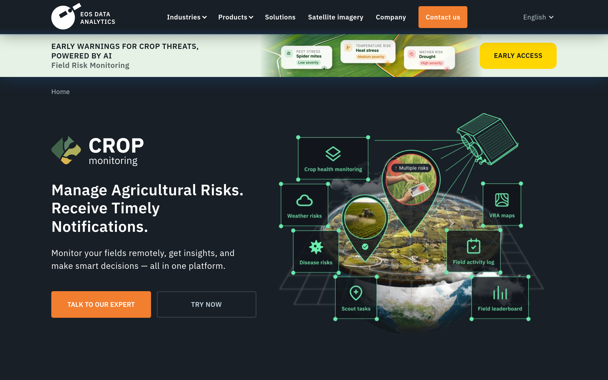
The platform spans four interfaces: LandViewer (browser GIS for imagery search across the catalog), Crop Monitoring (agri SaaS with vegetation indices, VRA maps, yield forecasting, and soil moisture), EOS RayVision (customized analytical reports), and API Connect (programmatic delivery of data and derived indices). The platform covers the full workflow from raw imagery to decision-ready output, reducing integration overhead for buyers who would otherwise combine separate imagery, processing, and analytics vendors.
For procurement, Crop Monitoring is also listed on the AWS Marketplace in standard, white-label, and reseller editions, which simplifies buying and deployment for teams already on AWS.
Pricing
EOSDA’s pricing splits into three tracks: the Crop Monitoring SaaS uses a tiered per-hectare model, high-resolution archive and tasking imagery has a public per-km² rate card on LandViewer, and custom EOS SAT-1 programs and RayVision analytics reports are quote-based.
The Crop Monitoring tiers carry one nuance worth flagging. EOSDA’s own marketing states that monitoring one field up to 300 ha is free, but the official user guide lists only three paid tiers (Essential, Professional, and Enterprise), so the free plan is a freemium entry point rather than a formally named tier.
The free plan itself is confirmed in EOSDA’s published material; what stays behind a login is the exact dollar pricing of the paid tiers. The table below maps the documented tier structure.
| Tier | Area limit | Notes |
|---|---|---|
| Free | Up to 300 ha (1 field) | Confirmed in EOSDA marketing. A freemium entry point, not itemized in the user guide’s formal tiers. |
| Essential | Up to 1,000 ha | Source: official user guide. Dollar amount not publicly disclosed, login required for live pricing. |
| Professional | User-chosen ha, add capacity at extra cost | Flexible area, pricing not published. |
| Enterprise | Over 5,000 ha | Custom solutions and tailored pricing for cooperatives, advisors, and IT integrators. |
High-resolution archive and tasking imagery is sold per km² on LandViewer, with public rates from $1.7/km² for archive and $10/km² for new tasking, rising with resolution to $16 and $24 per km² at 30–40 cm. Dedicated EOS SAT-1 programs and EOS RayVision analytics reports stay quote-based, so for those buyers should budget contact-sales time into the evaluation cycle.
Who it’s for
EOSDA’s product architecture maps most cleanly onto three buyer segments. Being honest about where it is less competitive is equally useful as the affirmative use-case pitch.
Precision agriculture
For precision agriculture teams, the platform is purpose-built: EOS SAT-1’s band selection, Crop Monitoring’s field-level SaaS, soil moisture API integration, and VRA map generation cover most agri workflows end-to-end. Government crop-classification and yield-prediction contracts with Azerbaijan and Kazakhstan, and the World Bank and Bayer relationships, confirm that the product holds up under institutional scrutiny at scale.
Forestry and sustainability
Forestry and sustainability teams face a qualified recommendation. EOSDA’s deforestation detection products are operational, but the platform-level limitation means that all forest cover loss is classified as deforestation with no cause-differentiation, so EUDR or carbon-standard reporters will need supplementary validation workflows. For general change monitoring, the capability is sound.
Government and NGOs
Government agencies and NGOs running large-area monitoring, disaster response, or agricultural insurance programs are a solid fit. The 150-country coverage and flexible API delivery lower the integration barrier for national-level deployments, and the institutional customer precedents support procurement sign-off.
Where it’s less competitive
Where EOSDA is less competitive: buyers needing confirmed sub-meter VHR tasking will find the 1.4 m panchromatic from a single-satellite constellation a meaningful constraint against operators with larger VHR fleets. SAR-based all-weather coverage requires a separate provider, since EOSDA’s own SAR project (eossar.com) is upcoming and not yet operational.
Teams requiring a confirmed daily global revisit should also note that this depends on the full seven-satellite build-out, which remains scheduled but unconfirmed.
Strengths and limitations
EOSDA’s position as both a satellite operator and a multi-constellation SaaS vendor creates a clear pattern of strengths and trade-offs. The strengths cluster in the agri-analytics niche:
- Agriculture-first spectral design (11 bands including RedEdge, WaterVapor, Aerosol) with purpose-built NDVI/EVI analytics
- End-to-end SaaS stack (LandViewer, Crop Monitoring, RayVision, and API) that cuts multi-vendor integration overhead
- Multi-constellation catalog (100+ satellites via 20+ partners) for broader coverage and archive than its own hardware alone
- Institutional customer base (World Bank, Bayer, Syngenta, and government programs in Azerbaijan and Kazakhstan)
- Soil moisture data (SMAP 250 m, AMSR 100 m) with archive back to 2002, beyond EOS SAT-1’s 2023 start
The limitations are mostly structural, and worth weighing against your requirements before committing:
- Only 1 of 7 planned satellites is operational, so the constellation is behind schedule
- No SWIR bands on EOS SAT-1, which limits burned-area mapping, mineral detection, and some vegetation-stress indices
- Forest Monitoring cannot distinguish planned logging from illegal deforestation, classifying all cover loss identically
- Dedicated EOS SAT-1 tasking and custom analytics reports are quote-only, with no public rate card
- No owned or commercial SAR tasking (only the free Sentinel-1 archive is in the catalog) and no on-orbit compute, so dedicated all-weather SAR or edge processing needs another provider
In my analysis of EOSDA’s positioning, the key commercial tension is between the depth of the analytics layer and the modest size of the owned constellation. For SaaS-focused buyers, partner catalog depth fills the coverage gap adequately. For buyers needing proprietary EOS SAT-1 data specifically, the single-satellite reality is a constraint worth building into SLA expectations.
EOS Data Analytics alternatives
If EOSDA’s hybrid model does not fit your requirements, three providers offer meaningfully different architectures covering higher resolution, a larger owned fleet, or a different coverage cadence. The table below draws on each provider’s verified specifications from primary sources.
| Provider | Best resolution | Revisit | Constellation size | Key differentiator |
|---|---|---|---|---|
| EOS Data Analytics | 1.4 m Pan / 2.8 m MS (0.75 m super-res, inferred) | 3 days (1 day on tasking) | 1 of 7 (rest planned) | Agriculture analytics SaaS + multi-constellation catalog |
| Planet | 50 cm (SkySat) | Near-daily | ~200 satellites across constellations | Largest commercial fleet |
| Satellogic | 70 cm native (50 cm super-res) | Up to 7 passes/day | 57 launched (NewSat/Aleph-1) | Multispectral + hyperspectral on every satellite |
| BlackSky | 35 cm (Gen-3, current generation) | Sub-daily (scaling to hourly) | 4 Gen-3 + Gen-2 fleet operational | Mid-inclination orbit for time-diverse monitoring |
Planet’s fleet scale suits global near-daily monitoring. Satellogic brings the dual multispectral/hyperspectral payload on a non-ITAR architecture, and BlackSky’s Gen-3 targets change detection and defense. EOSDA’s distinguishing position is the agriculture analytics stack built over a hybrid catalog, which none of these three competitors replicates at the same agri-specific depth.
Verdict
The bottom line: legitimacy isn’t the question with EOSDA, it’s an established operator with real institutional customers. What matters is fit, and that splits along your core data need: a strong choice for agriculture-first analytics, a weaker one if you need a large owned fleet, sub-meter tasking, or all-weather SAR.
The key caveat is the constellation reality: as of mid-2026, only EOS SAT-1 is confirmed operational, and the full seven-satellite build-out remains behind schedule. If your workflow requires a daily global revisit guarantee, the gap between planned and confirmed capacity is material and should be addressed contractually.
For buyers focused on the Crop Monitoring SaaS, the soil moisture API, or the LandViewer multi-constellation catalog, partner data fills the coverage gap while the analytics layer delivers the value.
For precision agriculture, EUDR-adjacent deforestation monitoring (with the cause-differentiation caveat), and government agricultural programs, EOSDA is a well-matched choice. For sub-30 cm VHR tasking, a large owned fleet with confirmed daily coverage, or SAR-based all-weather monitoring, a different provider will serve you better. The alternatives comparison above is a practical starting point for that evaluation.
Frequently asked questions
Here are answers to the questions buyers most commonly ask about EOSDA. Each answer points to the section where the full analysis lives.
How does EOS Data Analytics work?
EOSDA owns and operates EOS SAT-1 while simultaneously aggregating imagery from 20-plus partner constellations into SaaS platforms: LandViewer (imagery search), Crop Monitoring (agri SaaS), and EOS RayVision (analytics reports). Customers access these via browser or API with no satellite hardware of their own. More detail is in “Data and capabilities.”
Is EOS Data Analytics a legit company?
Yes. EOSDA is active, founded in 2015, with named customers including the World Bank, Bayer, Syngenta, and the governments of Azerbaijan and Kazakhstan. Its decade of operational history and institutional track record are the primary legitimacy signals. See “Is EOS Data Analytics legit?“
Who owns EOS Data Analytics?
EOSDA is privately held within the Noosphere space group (Dr. Max Polyakov, Founder and Chairman), with Oleksii Shchehliuk as Managing Director, and no external funding rounds are publicly disclosed. Ownership details are in “Is EOS Data Analytics legit?“
How much does EOS Data Analytics cost?
Crop Monitoring uses tiered per-hectare subscriptions (Essential / Professional / Enterprise), with a free plan up to 300 ha. High-resolution imagery is sold per km² on LandViewer (archive from $1.7/km²), while dedicated EOS SAT-1 tasking and RayVision analytics are priced via quote. Full details are in the “Pricing” section.
Does EOS Data Analytics have a free tier?
Yes. EOSDA states that monitoring one field up to 300 ha is free, though the official user guide lists it as a freemium entry point rather than a formally named tier alongside Essential, Professional, and Enterprise. See “Pricing.”
Who are EOS Data Analytics’ customers?
Named customers include the World Bank, Bayer, Syngenta, Greenpeace, and the governments of Azerbaijan and Kazakhstan, plus agritech partnerships across Kenya, Nigeria, and other African markets. The institutional breadth spans commercial agriculture, NGOs, and public sector programs. Details are under “Is EOS Data Analytics legit?“
What satellites does EOS Data Analytics operate?
As of mid-2026, EOSDA operates one confirmed satellite: EOS SAT-1 (launched January 3, 2023), part of a planned seven-satellite constellation where the original 2023–2025 deployment plan is behind schedule. Full specs are under “Data and capabilities.”
What are the best alternatives to EOS Data Analytics?
The closest matches are Planet for near-daily global optical monitoring, Satellogic for sub-meter VHR with hyperspectral, and BlackSky’s Gen-3 for 35 cm change-detection with defense analytics. See “EOS Data Analytics alternatives” for a full comparison table.
What use cases is EOSDA best suited for?
The platform is strongest for precision agriculture, soil moisture monitoring, deforestation detection (with the cause-differentiation caveat), and government agricultural programs, while being less competitive for sub-meter VHR tasking, SAR-based monitoring, and confirmed global daily coverage. See “Who it’s for.”

My passions are Earth Observation and Satellites, and my profession is Data Analysis. I combine both within ObservationData.com to show you the use cases of Earth Observation, to help you find the right provider, and to share your experiences.