
 SkyFi is a US imagery marketplace, aggregating optical, SAR and aerial data from 40-plus partners.
Yes, legitimate: incorporated as Optisense, with an active partner network of known operators.
This review covers catalog breadth, platform mechanics and how the pricing works.
Table of Contents
Key Takeaways
- SkyFi is a strong fit for buyers who want self-serve, contract-free imagery ordering from multiple sensor types in one place
- Standout: transparent upfront pricing with instant cost calculation before checkout, unusual for a catalog this broad
- Key caveat: catalog breadth comes with varying provider terms, not a single unified SkyFi data license
About SkyFi
What convinces me that a marketplace is real is not its own partner page but whether the operators say the same thing, and several of SkyFi’s do, in their own announcements. That is the difference between a listing and a working integration.
SkyFi is the commercial brand of Optisense, Inc., an Austin, Texas company that builds and operates an imagery marketplace for commercial, government, and consumer buyers. It does not own satellites or ground stations: the platform’s value is in connecting buyers to a vetted set of sensor operators through a single checkout flow, a REST API, and iOS and Android apps. The key facts below are drawn from SkyFi’s published pages as of June 2026.
| Name | SkyFi |
|---|---|
| Website | skyfi.com |
| Legal name | Optisense, Inc. |
| Address | Austin, Texas, USA |
| Ownership | Private |
| Leadership | Luke Fischer (CEO and Co-founder); Bill Perkins (Founder and Owner); Mike Panos (COO); Julian Sirakov (CTO) |
| Products & data | Optical archive and tasking (Vantor WorldView 30–50 cm, Planet SkySat 50 cm, Satellogic); SAR archive and tasking (ICEYE US, Umbra 25 cm); aerial imagery (Vexcel, Near Space Labs, Urban Sky); open multispectral data (Sentinel-2); geospatial analytics (change detection, DSM, AIS maritime, oil inventory) |
| Pricing | Pay-per-image, no contract required; optical archive from $15/image; SAR archive from $450/scene; aerial from $35/image; analytics from $5; open data free |
| Languages | English |
SkyFi describes itself as giving users access to 150-plus satellites in orbit via its partner network, with availability in 179 countries and a stated delivery time under 24 hours for archive orders. The platform also powers dedicated white-label storefronts for three of its largest partners: Vantor Connect (vantor.skyfi.com), Planet Select (planet.skyfi.com), and ICEYE US Direct (iceyeus.skyfi.com), which positions SkyFi as both a public marketplace and a private-label EO platform infrastructure vendor.
Is SkyFi legit?
SkyFi is a legitimate, active commercial platform. The legal entity, Optisense, Inc., is identified in the Terms of Service, the platform is SOC 2 Type II certified, and it operates white-label infrastructure for established satellite operators including Planet and ICEYE US, arrangements that would not exist with an unvetted marketplace vendor.
Ownership and funding
Optisense, Inc. is a private company. Luke Fischer (CEO and co-founder) and Bill Perkins (Founder and Owner) are the visible principals, with a six-person executive team covering operations, technology, revenue, and government sectors. The public site does not disclose funding history or investor information, which is worth noting for enterprise procurement teams running vendor due diligence. The government advisory board, composed of former DIA, USSOCOM, and Army leadership, signals deliberate positioning toward defense buyers.
Track record and platform trust signals
The clearest credibility signal is operational: Planet (NYSE-listed), Vantor (successor to Maxar’s commercial imagery unit), and ICEYE US each run dedicated white-label storefronts built on SkyFi’s infrastructure. Running mission-critical distribution for publicly accountable operators is a meaningful third-party endorsement of platform reliability. SOC 2 Type II certification satisfies a standard procurement gate for government and enterprise buyers. SkyFi does not publish named end-customer references, so direct reference checks require a sales conversation.
Compliance and data rights
Because SkyFi is a reseller, data rights flow from each originating operator’s license, not a single SkyFi master agreement. The Terms of Service include an ITAR and export compliance clause, relevant to defense sector buyers. Imagery delivery is subject to provider-level geographic restrictions, so verify your AOI access before checkout. SkyFi is governed by Texas law.
Data and capabilities
SkyFi’s catalog spans four sensor modalities sourced from named third-party operators. Because the platform does not own any of these sensors, specification guarantees sit with each originating operator, not with SkyFi.
Optical imagery
The optical catalog draws from several satellite operators offering sub-meter to 1 m resolution. Vantor (the successor to Maxar’s commercial imagery unit) contributes the WorldView constellation at 30 to 50 cm resolution, with a 20-plus year archive. Planet contributes SkySat at 50 cm. Satellogic offers multispectral imagery below 1 m with high-frequency revisit.
Geosat and IMPRO (GÖKTÜRK-1, a Turkish government satellite) round out the partner list for optical. All of these sources cover standard RGB and NIR bands, though band availability varies per provider.
Aerial and stratospheric imagery from Vexcel, Near Space Labs, and Urban Sky extends the catalog to resolutions as fine as 7.5 cm over areas with coverage. The 7.5 cm figure refers to Vexcel aerial ortho, not satellite, and coverage is geography-dependent rather than global. This distinction matters for buyers comparing headline resolution numbers.
SAR imagery
The SAR catalog comes from ICEYE US and Umbra, both X-band operators. Umbra delivers 25 cm spotlight SAR, among the finest commercially available resolutions. ICEYE US spans 50 cm to 15 m depending on mode, with archive coverage from 2019. Both are available for tasking and archive, and ICEYE US operates a dedicated white-label storefront at iceyeus.skyfi.com built on SkyFi’s platform infrastructure.
Open data and analytics
SkyFi makes Sentinel-2 multispectral imagery available at no cost through its Open Data program. Sentinel-2 delivers 10 m imagery across visible, NIR, Red-Edge, and SWIR bands with a 5-day global revisit and 290 km swath, providing a practical baseline before committing commercial spend.
Analytics add-ons extend the catalog beyond raw imagery: change detection, digital surface models, AIS maritime tracking, oil inventory, and building detection start at $5 per analysis. Analytics partners include OroraTech (wildfire), Ursa Space (SAR analytics), Pixxel and Wyvern (hyperspectral), and Kpler (commodity intelligence). This breadth of analytics partners means SkyFi operates as a light analytics aggregator as well as an imagery marketplace.
Platform and API access
The platform is accessible via browser at app.skyfi.com, iOS and Android apps, and a REST API. The area-of-interest selector, sensor filter, and pricing calculation all happen before checkout, so buyers never enter a quote workflow for standard orders. The ATAK plugin extends ordering to defense field devices. For developers integrating imagery ordering into existing workflows, the API at skyfi.com/en/api supports the full product catalog.
Pricing
SkyFi is pay-as-you-go: no contracts, no minimum spend, no subscription. The price calculates instantly from the selected sensor, resolution, and area of interest. Note that detailed per-km² tiered tables by resolution band from earlier site versions are no longer published; the current pricing page shows starting prices only.
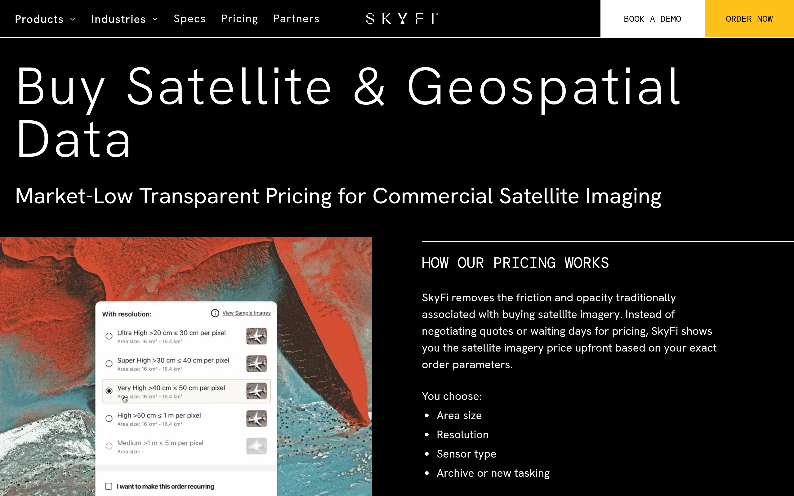
| Category | Model | Starting price | Notes |
|---|---|---|---|
| Optical archive | Per image | $15/image | FAQ also cites “from $5/km²” for Vantor, Planet, and Satellogic archive. Planet SkySat archive from $6/km² on the Planet Select product page |
| Optical tasking | Per image | $200/image | Planet SkySat tasking from $12/km². Vantor tasking pricing shown per order in checkout |
| SAR archive (ICEYE US, Umbra) | Per scene | $450/scene | Confirmed on pricing page and FAQ as of June 2026 |
| SAR tasking (ICEYE US, Umbra) | Per scene | $675/scene | Confirmed in FAQ: “$675/scene for on-demand tasking” |
| Aerial imagery | Per image | $35/image | Vexcel, Near Space Labs, Urban Sky. Coverage-dependent |
| Analytics | Per analysis | $5/analysis | Change detection, DSM, AIS, oil inventory, building detection, lithium detection |
| Open data (Sentinel-2) | Free | $0 | No account required. Sentinel-2 multispectral |
Payment is by debit or credit card at checkout, with no subscription, contract, or minimum spend required for self-serve buyers. Those with high-volume or enterprise requirements can contact SkyFi sales directly for custom arrangements. The open data program provides a free Sentinel-2 baseline for evaluation before any commercial spend.
Who it’s for
SkyFi’s self-serve, pay-as-you-go model serves buyers who need imagery without the friction of a sales cycle, minimum commit, or long-term contract. The use cases span a wide range, but the fit is strongest where on-demand access matters more than volume discounts.
Defense, intelligence, and government
The ATAK plugin, the government advisory board, and SOC 2 Type II certification together signal deliberate investment in the defense and intelligence buyer segment. OSINT analysts and field operators who need a single tasking order without a procurement cycle are a natural fit. Combining 30 cm optical from Vantor, 25 cm SAR from Umbra, and ICEYE US near-daily SAR covers most tactical imagery requirements through a single account.
Maritime surveillance and insurance
ICEYE US near-daily SAR, Umbra 25 cm spotlight, and the built-in AIS layer from Kpler make SkyFi a practical single-stop for maritime surveillance including dark vessel detection and port monitoring. Insurance underwriters can order before-and-after archive imagery for a specific site without a subscription or minimum spend, which fits event-driven claim workflows cleanly.
Journalism, OSINT, and research
Per-image pricing starting at $15 and the consumer-grade mobile app make SkyFi one of the more accessible entry points for one-off imagery purchases in the market. Investigative journalists and OSINT practitioners who need a single image of a specific site can complete an order without a vendor relationship or minimum spend. The free Sentinel-2 layer provides a useful baseline before committing to commercial imagery.
Where the fit weakens
High-volume monitoring programs will find per-image pricing less cost-efficient than the area-under-management subscriptions that direct operators offer. Procurement processes requiring a single master data agreement across the full catalog will run into the multi-vendor licensing reality. Buyers needing deep operator-API integration or sector-specific analytics are better served going directly to the originating operator.
Strengths and limitations
SkyFi’s strengths concentrate in access, pricing clarity, and catalog breadth across sensor types that would otherwise require separate vendor relationships:
- Fully self-serve ordering with instant price calculation before checkout, no contract or minimum spend, available in 179 countries
- Multi-sensor catalog covering optical (30 cm Vantor WorldView), SAR (25 cm Umbra, ICEYE US), aerial (7.5 cm Vexcel), and free open multispectral (Sentinel-2) through a single account
- SOC 2 Type II certified with ATAK plugin and a government advisory board, demonstrating real investment in the defense and government buyer segment
- White-label platform infrastructure for Vantor, Planet, and ICEYE US signals that mission-critical operators trust SkyFi’s platform for their own customer-facing storefronts
- Analytics add-ons (change detection, AIS maritime, DSM, Pixxel hyperspectral, Wyvern hyperspectral) extend the platform beyond raw imagery without requiring separate analytics vendor accounts
The limitations reflect the structural realities of the aggregator model itself, not flaws specific to SkyFi:
- Data licensing terms vary by originating provider (SkyFi is not the licensor) and no single master data agreement covers the full catalog
- Per-image pricing makes sense for one-off orders but becomes expensive for high-volume or ongoing monitoring programs compared to subscription-based operators
- Founding year and investor/funding information are not published, which limits financial transparency for enterprise due diligence workflows
- High-volume and enterprise pricing is not published and requires a direct sales conversation, so per-area costs at scale are not transparent upfront
- No named end-customer references are published, which means third-party validation requires a direct sales reference request
In my analysis, SkyFi solves a genuine workflow problem: most buyers need more than one sensor type but cannot sustain separate vendor relationships for each. The transparent pricing and no-contract model lower that barrier significantly. The caveat is that aggregation simplifies procurement but does not simplify licensing, and buyers who need deep operator-API integration or a single master data agreement will eventually outgrow the marketplace layer.
SkyFi alternatives
If SkyFi’s marketplace model does not fit your requirements, or if you need a specific capability it does not cover, the alternatives below represent other approaches to multi-source imagery access. The table draws on verified specifications from primary sources for each provider.
| Provider | Data sources | Pricing model | Tasking | Key differentiator |
|---|---|---|---|---|
| SkyFi | Optical, SAR, aerial, open data (40+ partners) | Pay-per-image, no contract | Yes (optical + SAR) | Transparent upfront pricing, mobile app, ATAK plugin, white-label EO platform for partners |
| UP42 | Optical, SAR, analytics (broad catalog) | Credit-based marketplace | Yes | Developer-focused platform with cloud processing. One of the longest-established commercial EO marketplaces |
| Sfera Technologies | Optical, SAR (Capella, KOMPSAT-5), thermal (SatVu, Aistech), hyperspectral (Wyvern), RF/ELINT (Unseenlabs) | Per-km² transparent for optical. Quote-based for SAR, thermal, hyperspectral, RF | Yes (optical + SAR + hyperspectral) | Widest modality range of any aggregator reviewed here, including thermal and RF. Also operates a commercial ground station network |
| Capella Space | SAR only (own constellation) | Subscription and per-order | Yes | Purpose-built SAR operator: 25 cm Spotlight Ultra, up to 12 daily revisits, direct data license with the sensor operator |
| Umbra | SAR only (own constellation) | Per-scene | Yes | 25 cm commercial SAR. Going directly to Umbra gives a richer API and direct data rights vs. the SkyFi resale layer |
UP42 is the closest structural peer, with a credit-based ordering system and stronger developer-pipeline tooling. SkyFi’s mobile-first design and transparent per-image pricing favor episodic buyers, while UP42 favors automated geospatial workflows. Sfera Technologies covers modalities SkyFi does not carry, including thermal and RF/ELINT data, alongside transparent per-km² optical pricing and a standalone ground station service.
For buyers whose primary requirement is SAR, going directly to Capella Space or Umbra gives a direct data license and the originating operator’s full API. That trade-off is worth making when contractual data rights outweigh the convenience of a unified storefront.
SkyFi is compared against seven other platforms in our roundup of the best satellite imagery aggregators.
Verdict
SkyFi is a legitimate, active platform, and the question for most buyers is fit rather than legitimacy. The fit is clearest when you need imagery from multiple sensor types without a procurement commitment: one optical order, one SAR tasking, one analytics layer, all from one account with a price shown before you pay.
That model works well for OSINT, journalism, defense field operators using ATAK, and maritime surveillance teams combining SAR and AIS data. Per-image pricing and availability in 179 countries lower the barrier to a first order significantly compared to most EO vendors.
The structural limits are the same as for any reseller: licensing terms vary by provider, a unified master agreement is not available, and high-volume monitoring will cost more per area than operator-direct subscriptions. Enterprise and high-volume pricing is handled through direct sales rather than published rates, so large buyers cannot model per-area costs upfront.
For ongoing programs or workflows requiring a direct contractual relationship with the sensor operator, the alternatives above are worth evaluating alongside it.
Frequently asked questions
Below are answers to the most common buyer questions about SkyFi. Each answer points to the section where the full detail lives.
How does SkyFi work?
SkyFi is a marketplace: you select a location, choose a sensor type and resolution, and the platform shows a price before checkout. You can order from archive imagery or task a new collection, depending on the provider. Delivery for archive orders is documented at under 24 hours. No satellite hardware or provider account is needed on your side. Full detail is in “Data and capabilities.”
Is SkyFi a legit company?
Yes. SkyFi is the commercial brand of Optisense, Inc., an Austin-based private company that is SOC 2 Type II certified and powers white-label platforms for established satellite operators including Planet and ICEYE US. Powering mission-critical distribution infrastructure for publicly accountable operators is a strong credibility signal. The full analysis is in “Is SkyFi legit?“
Who owns SkyFi?
SkyFi is owned by Optisense, Inc., a private company. The co-founders are Luke Fischer (CEO) and Bill Perkins (Founder and Owner), with a six-person executive team covering operations, technology, revenue, and government. Funding and investor information are not disclosed on the public site. See “Is SkyFi legit?“
How much does SkyFi cost?
Pricing is pay-as-you-go with no contract or minimum spend. Optical archive starts at $15 per image, SAR archive at $450 per scene, SAR tasking at $675 per scene, aerial at $35 per image, and analytics add-ons at $5 per analysis. Access to Sentinel-2 open data is free with no account required. Full rates are in the “Pricing” section.
Does SkyFi have a free tier?
SkyFi offers free access to Sentinel-2 multispectral open data through its Open Data program, available without an account. This gives you 10 m resolution global multispectral imagery at no cost. Note that commercial imagery has no free trial: you pay per order from the first purchase. Details are in “Pricing.”
Who are SkyFi’s customers?
SkyFi serves commercial, government, and individual buyers across 179 countries. Named customer segments include defense and intelligence operators (evidenced by the ATAK plugin and government advisory board), maritime surveillance teams, journalists, and OSINT analysts. The public site lists no specific named enterprise customers. The customer context is in “Who it’s for.”
How does SkyFi make money?
SkyFi earns a margin on each imagery transaction brokered through the platform: buyers pay SkyFi, and SkyFi passes the order to the originating provider. The white-label platform business, powering storefronts for Vantor, Planet, and ICEYE US, represents a separate B2B infrastructure revenue stream alongside the consumer and enterprise marketplace. See “Pricing” for the transaction model.
Where is SkyFi based?
SkyFi is based in Austin, Texas, USA. The legal entity is Optisense, Inc., incorporated under Texas law, though the company’s public pages list no street address. The location context is in “About SkyFi.”
What are the best alternatives to SkyFi?
The closest marketplace peer is UP42 for developer-oriented multi-source workflows. Sfera Technologies covers a broader modality range including thermal and RF data alongside optical and SAR. For buyers whose primary need is SAR, going directly to Capella Space or Umbra gives a direct data license and the full operator API. A full comparison is in “SkyFi alternatives.”

My passions are Earth Observation and Satellites, and my profession is Data Analysis. I combine both within ObservationData.com to show you the use cases of Earth Observation, to help you find the right provider, and to share your experiences.
