SAR imagery cuts through clouds, smoke, and darkness where optical sensors go blind, but comparing providers is harder than it looks: resolution specs, frequency bands, scene sizes, and tasking latency vary enormously, and pricing is rarely published. Sentinel-1 C-band is free and covers coarse monitoring needs at 5–20 m, but the moment you need sub-metre precision or rapid revisit, you are in commercial territory. This guide is for that decision.
Eight providers are ranked here, spanning purpose-built X-band operators and one multi-source access platform. Each was selected on SAR capability, not marketing reach, and scored against six criteria with no paid placements. The list mixes dedicated commercial SAR constellations with a reseller giving access to multiple operators without a direct contract, which matters for buyers whose workload spans sensor types or who want cost visibility before committing.
The profiles below show each provider’s band, best resolution, revisit, tasking model, and honest limitations, so you can match the pick to your mission. Capella Space earns the top position on resolution-plus-revisit, though the best fit depends on your band, coverage need, and budget.
Table of Contents
Key takeaways
- Capella Space leads on X-band spotlight resolution and mixed-orbit revisit for tasking-intensive missions
- ICEYE wins for buyers who need the largest constellation and persistent monitoring at global scale
- Rankings weight resolution, revisit, band, and price transparency by what a procurement team can act on
How we picked the best SAR data providers
Six criteria shaped this ranking. For SAR, resolution in spotlight mode and frequency band matter most: X-band delivers finer spatial detail and sharper target discrimination, while C-band offers longer-wavelength penetration useful for vegetation and ice monitoring. A platform that hides pricing behind a contract for every order, or cannot resolve fine detail, adds real procurement friction.
- Resolution (spotlight cm): the finest single-look ground-projected resolution available in catalog, not a demonstration figure
- Frequency band (X/C/L): X-band dominates commercial fine-resolution SAR while C-band covers broad-area and heritage use cases, and band choice affects penetration, coherence, and interferometric applications
- Revisit and constellation size: daily or sub-daily repeat coverage for persistent monitoring and rapid tasking, with orbit geometry (SSO vs. mid-inclination) shaping where revisit density peaks
- All-weather, day-night capability: SAR is inherently cloud-independent, so differences lie in imaging mode flexibility, duty cycles, and tasking lead times
- Tasking latency and access model: self-serve API and web console versus human-assisted workflows, collection tier flexibility, and time from order to confirmation
- Pricing transparency: whether per-scene or per-km² rates are published without a quote call, and whether data licensing is restrictive or open
The comparison table below captures the most decision-critical criteria at a glance. Delivery and integration details (API, STAC, GIS tooling) and trust signals (certifications, named customers, government contracts) appear in each provider’s profile in the section below. Providers are ordered from strongest overall SAR capability to most specialized.
SAR data providers compared
The table brings all eight providers side by side on five attributes most relevant to a SAR procurement decision. One fact per cell, giving you an at-a-glance overview before reading the full profiles.
| Provider | Band | Best resolution | Revisit | Tasking | Best for |
|---|---|---|---|---|---|
| Capella Space | X-band | 0.25 m (Spotlight Ultra) | 2–15 opportunities/day (SSO + MIO) | Yes (self-serve Console + API) | Rapid-tasking X-band missions with mixed-orbit revisit |
| ICEYE | X-band | 0.25 m Dwell Precise (0.16 m Gen4) | Daily to sub-daily, 4–12 h revisit | Yes (API + Tactical Access) | Persistent monitoring at scale with the world’s largest SAR fleet |
| Airbus Defence and Space | X-band | 0.25 m (Staring SpotLight) | Global mean under 24 h (3-sat constellation) | Yes (One Tasking, PREMIUM NRT) | Heritage X-band SAR paired with a full optical and DEM product suite |
| Umbra | X-band | 0.25 m Spotlight (published pricing) | Sub-daily mid-latitudes (11-sat constellation) | Yes (Canopy web + API) | Transparent published pricing with open CC BY 4.0 licensing |
| Synspective | X-band | 0.25 m azimuth (Staring Spotlight 4) | Daily visits, growing fleet (9 sats, target 30) | Yes (Data Platform) | Japanese X-band SAR with ready-to-use analytics solutions |
| MDA Space | C-band | ~1 m (Spotlight mode, RADARSAT-2) | 3-day with yaw steering (RADARSAT-2) | Yes (via [email protected]) | Broad-area C-band SAR with a 18-year archive and proven government heritage |
| Hisdesat | X-band | 0.25 m (Staring Spotlight, PAZ) | 4–7 days in TSX/TDX/PAZ constellation | Yes (via Hisdesat or Airbus DS, twice daily) | European government and allied-nation X-band SAR requirements |
| Sfera | X-band (multi-source) | 0.25 m (Capella or PAZ via Sfera) | Operator-dependent (Capella: up to 12/day) | Yes (app.sfera.earth + quote for SAR) | Multi-source SAR access without a direct operator contract |
Every fact in the profiles below traces to the provider’s own published specifications, and where data was unavailable publicly, that gap is noted rather than filled with an estimate.
The 8 best SAR data providers
The profiles below give full detail on resolution, band, tasking model, delivery, and ideal buyer for each provider, ordered from the strongest overall SAR capability to the most specialized.
1. Capella Space
 Best for rapid-tasking X-band SAR with the highest revisit flexibility of any single commercial operator. Capella Space, incorporated as Capella Space Corp. and operating since 2020 as the first American commercial SAR constellation, now operates as a subsidiary of IonQ Inc. (NYSE: IONQ) following the acquisition completed July 2025. Its Acadia-class third-generation satellites deliver 0.25 m azimuth resolution in Spotlight Ultra mode, with up to 600 MHz imaging bandwidth and 10-minute duty cycles per orbit.
The constellation’s dual-orbit architecture combines sun-synchronous (SSO) and 45-degree mid-inclination orbits (MIO), producing 2–15 revisit opportunities per day over most locations. Tasking runs through Capella Console (self-serve web) and a REST API with 20-minute scheduler cycles and sub-20-minute tasking confirmation. Data products include SLC, GEO, GEC, SICD, SIDD, CPHD, and CSI formats, all STAC-compliant and delivered via AWS GovCloud. A commercial taskable InSAR service at 3-day repeat cadence launched in May 2026.
| Type | Satellite operator, imagery provider |
|---|---|
| HQ | Louisville, CO, USA |
| Founded | 2016 |
| Ownership | Subsidiary of IonQ Inc. (NYSE: IONQ) |
| Website | capellaspace.com |
Trust signals are strong: named customers include the NRO (Commercial Radar Contract), NASA (CSDA multi-year blanket purchase agreement), US Space Force, and the US Department of Defense. Capella is also distributed via UP42. The open data program releases archive scenes on AWS S3 at no cost, which is useful for algorithm development ahead of a commercial commitment.
The primary limitation is that no pricing is published for commercial tasking, and all orders are quote- or contract-based. Buyers who need transparent per-scene cost visibility before engaging a sales conversation may find that friction significant. The IonQ acquisition also introduces a post-M&A integration variable worth monitoring. Our Capella Space review covers the tasking workflow and product tiers in detail.
2. ICEYE
 Best for persistent SAR monitoring at global scale with the world’s largest operational constellation. ICEYE, registered as ICEYE Oy in Espoo, Finland, has launched 70 X-band SAR satellites since 2018 (as of March 2026), a fleet that no other single operator matches. Its Gen4 platform, commercially available from September 2025, reaches up to 16 cm resolution with 1200 MHz imaging bandwidth and a 400 km high-resolution field of regard, though the headline commercial catalog resolution remains 25 cm in Dwell Precise mode.
Daily and sub-daily Coherent Ground Track Repeat enables persistent monitoring of the same location every 4–12 hours across hundreds of sites. The imaging mode range is wide: Dwell Precise (25 cm), Spot Fine (50 cm), Strip (3 m, 30×50 km), Scan (up to 15 m, 100×100 km), and Scan Wide (27 m, up to 200×600 km). Delivery defaults to 8 hours from acquisition (average under 4 hours). The Tactical Access subscription delivers under 1 hour via EDGE processor and dedicated Direct Downlink antenna.
| Type | Satellite operator, imagery provider, analytics provider |
|---|---|
| HQ | Espoo, Finland |
| Founded | 2014 |
| Ownership | Private (Series F, EUR 1B General Atlantic-led Jun 2026, valuation over EUR 10B) |
| Website | iceye.com |
ICEYE’s insurance analytics franchise, covering flood, wildfire, and hurricane damage at building level, adds a ready-made vertical-market layer beyond raw imagery. Named customers include the Polish Armed Forces, the Greek National Space Program, the Royal Netherlands Air Force, NATO Allied Command Operations, Munich Re, and AXA. ISO/IEC 27001:2022 and ISO 9001:2015 certifications are held. The constellation is also ITAR-free, a meaningful advantage for non-US sovereign buyers. In-depth coverage is in our ICEYE review.
The watch-out is that no pricing is published, and the factor-driven contract model (six pricing parameters including region, priority, SLA, and EULA type) means two identical tasks under different contracts can cost differently. Buyers who need upfront cost certainty must either negotiate a contract or accept reseller pricing, since ICEYE itself publishes no public rate card.
3. Airbus Defence and Space
 Best for buyers who need X-band SAR combined with a full optical and elevation product catalog from a single heritage operator. Airbus Defence and Space, the commercial EO intelligence division of Airbus SE (Euronext: AIR.PA), operates the Radar Constellation of three X-band SAR satellites: TerraSAR-X (2007), TanDEM-X (2010), and PAZ (2018, operated by Hisdesat). Staring SpotLight mode delivers 0.25 m resolution over a 4×3.7 km scene, with a global mean revisit under 24 hours across the three-satellite group.
The PREMIUM NRT service delivers SAR imagery with an average latency of plus-or-minus one hour globally (1–2 hours for the Americas), which is competitive with any SAR operator on this list for time-critical applications. Data is accessible via the OneAtlas Radar Portal, the SAR-API at docs.sar.api.intelligence.airbus.com, and FTPS or cloud bucket delivery. A February 2026 framework agreement with Synspective adds up to 25 cm StriX X-band imagery to the catalog, improving equatorial revisit coverage. Archive depth extends to 2007 (TerraSAR-X first light), one of the longest SAR commercial archives available.
| Type | Satellite operator, imagery provider, analytics provider |
|---|---|
| HQ | Toulouse, France |
| Founded | 1986 (EO operations start) |
| Ownership | Division of Airbus SE (Euronext: AIR.PA) |
| Website | space-solutions.airbus.com |
Named customers span the French Ministry of Defence, German Bundeswehr, NATO AGS Force, and French Marine Nationale (Spationav program). The 106-reseller distribution network in 49 countries and the 29 Direct Receiving Stations give Airbus coverage no other provider here matches for institutional buyers who need local support. A radar Guest Access trial is available for test-before-commit evaluation.
The limitation worth flagging is that TerraSAR-X and TanDEM-X, launched in 2007 and 2010 respectively, are aging assets with no stated end-of-life date on the site. Pléiades Neo Next (20 cm optical) is the only announced next-generation program, and a SAR successor has not been publicly named beyond PAZ 2. Our Airbus Defence and Space review covers the full OneAtlas product suite and pricing structure.
4. Umbra
 Best for buyers who want transparent, published SAR pricing with open data licensing. Umbra, registered as Umbra Lab, Inc. in Santa Barbara, California, is an outlier in commercial SAR: it publishes a full public price table and licenses all commercial data under CC BY 4.0, meaning buyers know exactly what a scene costs before opening an account. Its 25 cm Spotlight at $3,250 per 5×5 km single-look scene is one of the few true 25 cm catalog products with a fixed public price on this list.
Its 1200 MHz imaging bandwidth is among the widest in commercial SAR, a figure ICEYE’s Gen4 line now also reaches, which sharpens fine-resolution collection. The squinting-agile satellites support three distinct collection geometries: Spotlight (25–100 cm, 5×5 km standard or up to 10×14 km Natural Footprint), Dwell (extended coherent integration for noise-reduced GeoTIFF, CSI, and SAR Video up to 25 seconds), and Scan (off-track cross-path collection at 50 cm to 2 m, up to 8×100 km). That Scan geometry is a collection capability most SAR operators cannot match. Canopy provides a web app and a full REST API with STAC-compatible archive delivery on AWS.
| Type | Satellite operator, imagery provider |
|---|---|
| HQ | Santa Barbara, CA, USA |
| Founded | 2015 |
| Ownership | Private (independent) |
| Website | umbra.space |
US government trust signals are solid: Umbra holds an NRO Strategic Commercial Enhancements Stage III contract, a US Space Development Agency integration contract, a DARPA DRIFT Phase II contract, and NASA CSDA participation. The Open Data Program has released over $4 million in free archive SAR data on AWS, supporting research and pre-commercial evaluation.
Umbra explicitly does not offer analytics (“Our mission stops at producing high quality data”), which is a clean positioning but means buyers who need derived products must bring their own processing or analytics partner. The constellation at 11 named satellites (as of late 2025) is smaller than ICEYE’s or Capella’s, which translates to fewer daily revisit opportunities at equatorial latitudes.
5. Synspective
 Best for buyers in infrastructure, construction, and disaster risk management who want SAR data bundled with ready-to-use analytics from a single vendor. Synspective Inc., founded in Tokyo in 2018 by Dr. Motoyuki Arai and listed on the Tokyo Stock Exchange Growth Market since December 2024, has launched 9 StriX X-band SAR microsatellites through May 2026, targeting a 30-satellite constellation by end of the 2020s. The Staring Spotlight 4 mode achieves 25 cm azimuth resolution at a 10×3 km scene, confirmed as Japan’s highest commercial SAR resolution in a July 2024 press release.
The business model goes beyond raw data: Synspective offers six cloud-based analytics solutions including Land Displacement Monitoring (millimeter-scale InSAR via consecutive-orbit pairs), Flood Damage Assessment, Disaster Damage Assessment, Offshore Wind and Wave characterization, Forest Inventory Management, and Object Detection. A June 2024 test observation confirmed daily InSAR pair acquisition from StriX-3 and StriX-1. Synspective also became an authorized ALOS-4 (JAXA L-band SAR) data service provider in 2025, expanding coverage to a second band without operating those satellites. The Synspective Data Platform offers web UI, archive API, and tasking API access.
| Type | Satellite operator, imagery provider, analytics provider |
|---|---|
| HQ | Tokyo, Japan |
| Founded | 2018 |
| Ownership | Public (TSE Growth Market, 28.1B JPY total funding) |
| Website | synspective.com |
Named customers include JICA, Japan’s Cabinet Office, the Fukuoka Expressway (road displacement monitoring), and Vietnam’s National Remote Sensing Agency. ISO/IEC 27001 certification was achieved in 2021. Distribution partnerships with SkyFi (May 2026), e-GEOS, and Airbus (February 2026) are expanding reach outside Japan and Asia-Pacific.
The watch-out is that pricing is not published for any product, and all access is quote-based, which slows time-to-first-order. With 9 operational satellites as of mid-2026, revisit frequency is more limited than ICEYE or Capella for non-Japanese regions, and the constellation is still actively scaling toward the 30-satellite target.
6. MDA Space
 Best for buyers who need broad-area C-band SAR with a 18-year deep archive and proven government-grade reliability. MDA Space Ltd. (TSX and NYSE: MDA), Canada’s largest space technology company and the publicly traded successor to Macdonald, Dettwiler and Associates (founded 1969), has operated RADARSAT-2 since December 2007 as a public-private partnership with the Canadian Space Agency. The satellite offers 20 imaging modes from 144 km² to 265,000 km² per scene, producing 75,000-plus images per year with customers in 45-plus countries.
C-band SAR has longer wavelength than X-band, making it particularly suited to sea ice monitoring, maritime surveillance, vegetation penetration, and interferometric coherence over forested or agricultural terrain. MDA is also building MDA CHORUS, a next-generation C-band plus X-band SAR pair in a unique mid-inclination orbit (targeting launch late 2026 on SpaceX Falcon 9) with a 700 km wide swath and sub-metre spotlight. CHORUS already has 41 early customer contracts and letters of interest from across Asia-Pacific, Latin America, Europe, North America, and the Middle East. MDA also signed a distribution agreement with ICEYE in December 2021 to provide X-band SAR data to select RADARSAT-2 customers ahead of CHORUS.
| Type | Satellite operator, imagery provider, satellite manufacturer |
|---|---|
| HQ | Brampton, Ontario, Canada |
| Founded | 1969 |
| Ownership | Public (TSX and NYSE: MDA, market cap ~CAD $8.5B) |
| Website | mda.space |
Institutional trust signals are strong: the Canadian DFO extended RADARSAT-2 maritime awareness contracts in 2024, NATO Project Triton, the Australian Fisheries Management Authority, and the Pacific Islands Fisheries Forum Agency all rely on RADARSAT-2 data. Revenue of CAD ~$1.7B (LTM Q1 2026) and a $3.7B backlog reflect a scaled commercial and government franchise.
The limitation that buyers should understand: per-mode resolution specifications for RADARSAT-2 are no longer published on the live mda.space website (the original spec page returns a 404 error), and no public API or self-serve ordering portal is described on the current site. Orders go through [email protected] or legacy customer systems, which means the procurement path is slower than self-serve platforms. The CHORUS launch timeline (late 2026) is still planned and carries the usual pre-launch execution risk.
7. Hisdesat
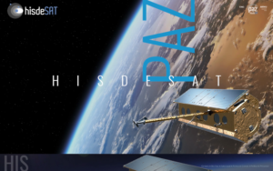 Best for European government and allied-nation buyers who require Spanish or jointly operated NATO-aligned X-band SAR under a sovereign mandate. Hisdesat Servicios Estratégicos S.A., founded in Madrid in 2001, operates PAZ, Spain’s only national X-band SAR satellite, launched in February 2018. PAZ uses the same orbit plane as TerraSAR-X and TanDEM-X at 514 km SSO, enabling a three-satellite constellation that reduces revisit from 11 days solo to 4–7 days and supports cross-platform interferometry under harmonized product standards.
Imaging modes match TerraSAR-X specifications: Staring Spotlight (up to 0.25 m, 5×5 km), Spotlight (1 m, 10×10 km), Stripmap (3 m, 30×50 km), ScanSAR (16 m, 100 km swath), and Wide ScanSAR (up to 40 m, 270 km swath). Single- and dual-polarization (HH, VV, HV, VH) are supported. Products use TerraSAR-X harmonized standards (SSC, MGD, GEC, EEC) and are ordered through a joint Hisdesat/Airbus DS workflow twice daily. Direct Access Stations enable near-real-time delivery. The ownership consortium includes 29.9% ISDEFE (Spanish Ministry of Defense), 43% Hispasat (now majority-owned by Indra since January 2026), and 15% Airbus Defence and Space, giving the operation a strong government mandate and three certifications: ISO 9001, ISO 14001, and ISO 27001.
| Type | Satellite operator, imagery provider |
|---|---|
| HQ | Madrid, Spain |
| Founded | 2001 |
| Ownership | Public-private consortium (Hispasat 43%, ISDEFE 29.9%, Airbus DS 15%) |
| Website | hisdesat.es |
Hisdesat’s role in the TSX/TDX/PAZ constellation means the imagery quality and product standards are directly interchangeable with TerraSAR-X, which is a meaningful consistency advantage for users who already work with Airbus radar data. PAZ data coverage over Europe, the Mediterranean, and the Middle East is particularly strong given the orbital geometry.
For commercial buyers outside the European institutional market, Hisdesat is harder to engage: there is no self-serve web portal, no published API, no public pricing, and the ordering workflow runs on twice-daily scheduling windows through Hisdesat or Airbus DS customer services. This is a provider purpose-built for institutional channels, not self-serve commercial procurement.
8. Sfera
 Best for multi-source SAR access without negotiating a direct operator contract, particularly for buyers who need SAR alongside optical, thermal, hyperspectral, or RF data from one vendor. Sfera, registered as Sfera Technologies Ltd. and founded in 2019 in Sofia, Bulgaria, is a data aggregator rather than a satellite operator. It brokers X-band SAR from three named source operators: Capella Space (Spotlight Ultra 0.25 m to Stripmap 1.2 m), SIIS/KOMPSAT-5 (0.85 m to 20 m), and Hisdesat/PAZ (0.25 m to 40 m) through a single commercial contact point at app.sfera.earth.
The value proposition is access breadth rather than operator-level depth: buyers who already need optical (0.3–3.2 m from 21AT, SIIS, Satellogic), thermal (SatVu MWIR at 3.5 m and Aistech LWIR), hyperspectral (Wyvern, 5.3 m, 31 bands), and RF/ELINT (Unseenlabs maritime) can source all five sensor types through Sfera without separate operator agreements. Optical tiers carry transparent per-km² pricing from $4/km² (1.0 m archive) to $30/km² (0.3 m daily tasking), with minimum areas as low as 15 km². SAR, thermal, hyperspectral, and RF are all quote-based. The ground station network (12 active sites across Europe, Middle East, Asia, Americas, Africa, and Oceania) is also available as a standalone B2B service from €3/minute.
| Type | Data aggregator, imagery provider, ground-station services |
|---|---|
| HQ | Sofia, Bulgaria |
| Founded | 2019 |
| Ownership | Independent (Bulgarian Angels Club backer confirmed) |
| Website | sfera.earth |
The multi-sensor capability across optical, SAR, thermal, hyperspectral, and RF from one account is a real differentiator for GEOINT teams or research buyers who need rapid cross-sensor coverage without separate procurement channels. The feasibility tool for SAR tasking via app.sfera.earth is a self-serve step ahead of other SAR resellers on this list. In-depth coverage of the access model, pricing structure, and limitations appears in our Sfera Technologies review.
Because Sfera resells capacity from the operators above it in this ranking, the limitation is inherent: buyers accessing Capella SAR through Sfera are adding an intermediary layer over going direct to Capella, which typically means higher per-scene cost and less control over collection tier parameters. SAR pricing remains contact-based rather than self-serve, which limits the pricing transparency advantage Sfera has for optical, and the platform lists no named commercial reference customers.
How to choose a SAR data provider
The right SAR provider depends on four variables: the frequency band you need, the resolution your application requires, how quickly you need imagery after tasking, and whether you want to build a direct operator relationship or access SAR as part of a broader multi-sensor procurement, and starting with band rather than brand narrows the field fastest.
Start with band, not brand
X-band (around 9.6 GHz, wavelength ~3 cm) is the dominant choice for fine-resolution commercial SAR: it supports sub-metre spotlight imaging, tight geometric accuracy, and strong contrast on built surfaces and metallic objects. It is the right choice for infrastructure monitoring, vessel detection, urban change detection, and any mission where spatial detail matters more than vegetation penetration.
C-band (around 5.4 GHz, wavelength ~5.6 cm) penetrates vegetated canopies more effectively and maintains coherence over agricultural surfaces across longer temporal baselines, making RADARSAT-2 and the incoming MDA CHORUS better suited for crop monitoring, ice and sea state characterization, and interferometry over forested areas. If your application is maritime ice or forest biomass rather than precise target discrimination, the C-band option belongs at the top of your evaluation.
Match resolution to your application
Sub-0.5 m spotlight SAR (Capella, ICEYE Dwell Precise/Gen4, Umbra, Airbus Staring SpotLight) is necessary for identifying individual vehicles, vessels, or structures, and for detecting small-area change. Stripmap modes at 2–5 m work well for change detection over medium-scale scenes and for InSAR deformation studies where phase coherence over swath width matters more than pixel size. Wide-area ScanSAR at 15–40 m suits rapid disaster response and maritime surveillance of wide ocean regions where total coverage area per pass outweighs feature resolution.
Weigh constellation size against tasking model
If sub-4-hour revisit or persistent monitoring is the requirement, ICEYE’s 70-satellite fleet is the only option on this list that can credibly deliver it at most latitudes without a dedicated satellite reservation. Capella’s mixed SSO and MIO architecture offers the broadest revisit flexibility for a single-operator pure tasking scenario. For buyers who do not need frequent revisit but want a fine single collect at a known price, Umbra’s 25 cm Spotlight with CC BY 4.0 licensing and published pricing removes procurement friction that other operators still impose.
Consider access model and integration overhead
Capella Console, Umbra Canopy, and ICEYE’s Tasking API all provide REST APIs and STAC-compatible delivery that fit into standard geospatial pipelines. Synspective’s Data Platform and Sfera’s app.sfera.earth add web UI access for non-developer teams. MDA and Hisdesat rely on email and customer-service workflows, which are appropriate for large government contracts but slow for ad hoc commercial orders. If your team needs to build an automated SAR pipeline, start with providers that publish STAC endpoints and documented API schemas rather than expecting quote-based integrations to support automation.
Verdict
For missions where X-band spotlight resolution and rapid tasking responsiveness are the primary requirements, Capella Space’s mixed-orbit architecture, sub-20-minute tasking confirmation, and Spotlight Ultra at 0.25 m make it the top pick. The IonQ acquisition context adds a corporate variable to watch, but the operational platform and government contract track record are the strongest combination in this list for time-critical applications. Its open data program also gives buyers a low-friction way to evaluate imagery quality before committing.
ICEYE is the right choice for persistent monitoring at scale: no other operator comes close to 70-plus satellites providing daily-to-sub-daily revisit globally, and the Gen4 platform’s 16 cm resolution capability is the long-term trajectory of the industry. The insurance and disaster analytics add-ons mean ICEYE is already productized for sectors beyond defense and GEOINT. Airbus Defence and Space wins when the mission requires X-band SAR combined with a matching optical, elevation, and analytics suite from a single long-standing supplier, and the PREMIUM NRT near-real-time delivery is genuinely competitive on latency.
Umbra is the standout for any buyer who values pricing clarity and open licensing over the largest constellation: full price tables, CC BY 4.0 on all commercial data, and an exceptionally wide 1200 MHz imaging bandwidth. Synspective fills the niche for Japan and Asia-Pacific buyers who want operational analytics built on top of their SAR data rather than raw imagery only. MDA’s C-band heritage and CHORUS roadmap make it the right choice when band matters more than the X-band concentration of the rest of this list. Hisdesat and the PAZ satellite suit buyers in European government or allied-nation frameworks where a sovereign Spanish satellite and TSX-harmonized products are an explicit requirement.
Sfera sits in a different lane from the pure operators: it is the right entry point for procurement teams that need SAR as one modality among several, want to avoid separate operator negotiations, or are evaluating SAR alongside optical and RF intelligence from a single invoice. Its mid-field position reflects honest positioning as a reseller layer over the operators that lead this list, not a SAR operator in its own right.
Frequently asked questions
The questions below address the most common decision points when evaluating a commercial SAR data provider for the first time.
What is SAR and why does it matter for satellite imagery?
Synthetic Aperture Radar is an active microwave sensor that lights the ground with its own signal and reads the reflected energy, so it works through cloud, smoke, and darkness where optical sensors fail. That makes SAR the primary choice for all-weather persistent monitoring, disaster response, and maritime surveillance. Learn more in the “How we picked” section.
What is the difference between X-band and C-band SAR?
X-band SAR operates near 9.6 GHz with a roughly 3 cm wavelength, giving sub-metre spotlight detail and strong contrast from built surfaces, vehicles, and vessels. C-band SAR near 5.4 GHz has a longer 5.6 cm wavelength that penetrates vegetation and holds interferometric coherence better over farmland and forest. Most providers here are X-band, while MDA Space runs RADARSAT-2 in C-band, as the “How to choose” section explains.
Which SAR provider has the best resolution?
Several providers reach 0.25 m in their finest spotlight mode, among them Capella Space, ICEYE (with Gen4 reaching 16 cm), Airbus, Umbra, Synspective, and Hisdesat. Umbra stands out because that 0.25 m sits in its standard published catalog at $3,250 per 5×5 km scene, while most rivals require a contract first. Compare all eight in the “SAR data providers compared” table.
Which SAR provider offers the best revisit?
ICEYE leads on revisit with 70-plus satellites enabling daily to sub-daily Coherent Ground Track Repeat and 4–12 hour revisit over hundreds of locations. Capella’s mixed SSO and mid-inclination orbit architecture delivers 2–15 revisit opportunities per day and is the best option for a single-operator tasking scenario requiring flexible orbital geometry across latitudes. See the “The 8 best SAR data providers” section for revisit data by platform.
Is there a SAR provider with transparent pricing?
Umbra is the only dedicated SAR operator here to publish full public price tables, running from 1.0 m Spotlight at $675 per 5×5 km scene to 0.25 m at $3,250, all licensed CC BY 4.0. Most other operators require a contract before disclosing per-scene prices directly, though ICEYE archive and tasking can be bought at published rates through resellers like SkyFi. Browse the “The 8 best SAR data providers” section for access details.
Can you get SAR data without a direct operator contract?
Yes. Sfera aggregates X-band SAR from Capella Space, SIIS/KOMPSAT-5, and Hisdesat/PAZ through app.sfera.earth, and UP42 distributes Capella, ICEYE, Umbra, Airbus, and Synspective SAR from a single API. SkyFi offers Umbra and ICEYE US SAR at confirmed prices without a contract. See the “How to choose” section for access-model options.
What delivery formats do commercial SAR providers use?
The dominant formats are SLC (Single Look Complex, full phase for interferometry), GRD or GEC (amplitude, geocorrected for mapping), and SICD/SIDD (NGA complex formats). Capella, ICEYE, and Umbra deliver STAC-compliant data via cloud storage, while Airbus uses SSC, MGD, GEC, and EEC formats from the TerraSAR-X lineage. Interferometric work needs an SLC repeat-track pair, which not every operator offers as a standard taskable product, as the “The 8 best SAR data providers” section details.

My passions are Earth Observation and Satellites, and my profession is Data Analysis. I combine both within ObservationData.com to show you the use cases of Earth Observation, to help you find the right provider, and to share your experiences.