Very high-resolution satellite and aerial imagery is available from more vendors than ever, but the specs rarely sit on one page, the pricing is often opaque, and the mix of satellite operators and aerial programs can make a like-for-like comparison genuinely hard. For wide-area or lower-detail applications, 30-50 cm optical or freely available public data is far cheaper than VHR, and that trade-off deserves an honest mention before you budget for sub-meter tasking.
This guide covers eight providers that consistently appear in buyer evaluations for high-resolution imagery. Two of them, Nearmap and Vexcel Data Program, capture with aircraft rather than satellites, and the aerial-versus-satellite trade-off matters: aerial imagery reaches finer ground resolutions than any current satellite but is limited to specific geographies and infrequent refresh cadences. The satellite picks are ranked on resolution, revisit, access, and pricing transparency, with profiles built exclusively from primary sources.
If you want a single starting point, our top pick for satellite VHR is Vantor, though the best fit depends on your revisit requirement, ITAR posture, and whether you need aerial-grade cm resolution. Vantor, formerly Maxar Intelligence, holds the most powerful commercial optical constellation in orbit today. The Key takeaways below break down why, and where the alternatives beat it.
Table of Contents
Key takeaways
- Vantor’s WorldView Legion delivers 30 cm-class imagery up to 15 times per day over the same target, more capacity than any other operator here
- For aerial cm-grade resolution, Nearmap and Vexcel offer 4.4–15 cm GSD across US, AU, and 45+ countries that no satellite can match in sharpness
- Planet, Satellogic, and Sfera Technologies all publish per-km² optical pricing without a sales call, a material advantage for lean procurement teams
How we picked the best high-resolution satellite imagery providers
Eight providers made this list. To qualify, each had to offer genuine sub-meter imagery (or aerial equivalent) either directly or through a clearly documented commercial access route. We evaluated each against the following criteria.
- Resolution: native or delivered GSD for the primary product, and whether any enhanced products (AI upscaling, super-resolution) are disclosed as such rather than sold as native captures.
- Coverage and revisit: global or geography-limited; how many collection opportunities per day or year are documented and whether those figures are clearly conditioned on constellation size.
- Pricing transparency: whether per-km² or per-image prices are published on the provider’s own site, versus quote-only or credits-only access.
- Platform access: self-serve web UI and API availability, STAC compliance for downstream integration, and whether ordering requires a sales conversation first.
- Trust signals: named reference customers, financial disclosures, or certifications that indicate program continuity and organizational maturity.
- Satellite versus aerial type: clearly flagged for the two aerial entries, with a plain statement of what geography and cadence limitations apply.
The comparison table below distills those criteria across all eight providers. Profiles follow in the section below, ranked from strongest all-round optical satellite pick to most category-specific.
High-resolution satellite imagery providers compared
The table brings all eight providers side by side on the five attributes that matter most in a sub-meter imagery procurement. Full profiles follow below.
| Provider | Type | Best resolution | Self-serve access | Pricing transparency | Best for |
|---|---|---|---|---|---|
| Vantor | Satellite operator (optical VHR) | 34 cm Pan (WorldView Legion) | Yes (Vantor Hub) | Credits model, no public per-km² rates | Best overall VHR satellite, fastest delivery |
| Airbus Defence and Space | Satellite operator (optical + SAR) | 30 cm Pan (Pléiades Neo) | Yes (OneAtlas) | Quote direct; published credit rates on UP42 | 30 cm archive + optical and SAR from one vendor |
| Planet | Satellite operator (optical + hyperspectral) | 50 cm SkySat, 30 cm Pelican Gen-2 planned | Yes (Planet Insights Platform) | Published ($6–$40/km² SkySat) | VHR tasking with near-daily 3 m monitoring context |
| BlackSky | Satellite operator (optical VHR) | 35 cm (Gen-3) | Yes (Spectra platform) | Subscription direct; published credit rates on UP42 | Rapid VHR revisit, time-diverse monitoring |
| Satellogic | Satellite operator (optical + hyperspectral) | 50 cm (super-resolution L1 Ortho SR) | Yes (Aleph platform) | Published per-km² on site | Affordable sub-meter with bundled hyperspectral |
| Nearmap | Aerial imagery provider (not satellite) | 4.4–7.5 cm GSD (HyperCamera3) | Yes (MapBrowser, API) | Subscription, no public per-km² rates | Ultra-high-res aerial, US/AU/NZ/Canada |
| Vexcel Data Program | Aerial imagery provider (not satellite) | 7.5–15 cm ortho GSD (UltraCam) | Yes (Viewer, API) | Contract-based, no public pricing | Global aerial VHR programs, 45+ countries |
| Sfera Technologies | Multi-sensor data platform | 0.3 m optical (daily tasking) | Yes (app.sfera.earth) | Published per-km² (optical only) | Comparing multiple VHR sources, upfront per-km² pricing |
Every fact in the profiles below comes from the providers’ own published pages and primary sources. Where data was not publicly available, that gap is noted rather than filled with a guess.
The 8 best high-resolution satellite imagery providers
Profiles are ranked by overall fit for buyers who need sub-meter or aerial VHR imagery. Each “Best for” line reflects the primary strength against the criteria above, not a claim to market leadership.
1. Vantor
 Best for best-overall VHR satellite imagery. Vantor, formerly operating as Maxar Intelligence and rebranded on October 1, 2025, is a private company owned by Advent International and operates the most capable commercial optical constellation in orbit today. Its ten-satellite fleet spans six WorldView Legion spacecraft at 34 cm Pan GSD, plus WorldView-3 (31 cm Pan native), WorldView-2, GeoEye-1, and WorldView-1. The WorldView Legion satellites, all six operational since February 2025, enable up to 15 revisits per day over a single target and a daily collection capacity of approximately 7 million sq km total, including 3.5 million sq km at 30 cm-class resolution. Named customers include the Netherlands Ministry of Defence (approximately EUR 13.6 million Hub contract in 2025), Google (Google Earth AI integration), HERE Technologies, Mapbox, TomTom, and the U.S. Army One World Terrain program. The Vantor Hub provides self-serve tasking and archive access via a credits-based model, and the underlying API is STAC-compliant. The Direct Access program, for customers with dedicated receiving facilities, delivers imagery as fast as 15 minutes after collection; Rapid Access guarantees 6-hour delivery for less time-sensitive orders. Read our in-depth Vantor review for constellation specs, delivery tiers, and what the rebrand changed operationally.
| Type | Satellite operator (optical VHR) |
|---|---|
| HQ | Westminster, CO, USA |
| Founded | Not publicly stated on site |
| Ownership | Private (Advent International) |
| Website | vantor.com |
No per-km² pricing is published on vantor.com. The credits model references “transparent pricing” on the Vantor Hub page, but actual rates are not shown publicly. All individual scene and bulk orders require contacting a sales representative. The “15 cm HD” Vivid Mosaic product is ML-upscaled from 30 cm native imagery, not a native 15 cm capture, a distinction worth noting in any specification document you take to procurement.
2. Airbus Defence and Space
 Best for 30 cm tasking, archive, and combined optical-SAR from one European vendor. Airbus Defence and Space SAS is a division of Airbus SE and one of the two providers on this list, alongside Vantor, that reaches 30 cm-class native optical resolution. Its Pléiades Neo constellation currently consists of two operational satellites at 30 cm Pan GSD (Neo 5 and 6 were lost in the Vega-C VV22 launch failure of December 2022), delivering daily revisit anywhere on Earth and intraday revisit in priority areas. The OneAtlas platform covers optical, radar, and elevation products in a single interface, which distinguishes Airbus from every pure-optical operator on this list. The Radar Constellation, TerraSAR-X (2007), TanDEM-X (2010), and PAZ (2018), extends the product range to 25 cm Staring SpotLight SAR with a global mean revisit under 24 hours. A January 2026 framework agreement with Synspective adds Japanese X-band SAR capacity up to 25 cm to the same catalog. The PREMIUM NRT service delivers radar data with an average of approximately one hour globally. Named government customers include the French Ministry of Defence, German Bundeswehr, and NATO AGS Force. The OneAtlas API is STAC-compliant with a dedicated SAR-API endpoint. Read our detailed Airbus Defence and Space review for a complete breakdown of optical and SAR tasking, the Living Library subscription, and OneAtlas platform access.
| Type | Satellite operator (optical + SAR) |
|---|---|
| HQ | Toulouse, France |
| Founded | EO operations since 1986 (SPOT 1) |
| Ownership | Subsidiary of Airbus SE |
| Website | space-solutions.airbus.com |
TerraSAR-X and TanDEM-X launched in 2007 and 2010 respectively. Both are aging assets and no replacement timeline is published on the Airbus site, which creates a service continuity risk for programs dependent on SAR-specific modes from those platforms. No pricing is published for any product category. All orders require contact or a quote.
3. Planet
 Best for VHR tasking with near-daily monitoring context. Planet Labs PBC operates the SkySat constellation for sub-meter tasking alongside the PlanetScope SuperDove monitoring fleet, giving buyers access to 50 cm VHR imagery and near-daily 3-7 m coverage under a single vendor agreement. SkySat published tasking prices, at $12/km² Flexible and $40/km² Assured with delivery as fast as 3 hours from capture, remain among the clearest pricing commitments in commercial VHR tasking. A minimum area of 25 km² applies. The newer Pelican satellites, with Gen-1 at 50 cm and Gen-2 planned at 30 cm in 2026, will extend the fleet’s resolution range. The Planet Insights Platform API is REST-based and STAC-compliant, built on Sentinel Hub with a Python SDK. Named customers include the Rural Payments Agency UK, Bayer, NASA, and Carbon Mapper, covering a cross-section of government, agriculture, and environmental programs. The Tanager hyperspectral satellite (424 bands VSWIR, 30 m GSD, launched August 2024) adds methane and CO² emission detection to the same platform, making Planet the only entry on this list that pairs VHR optical tasking with VSWIR hyperspectral in a single commercial agreement. Read our in-depth Planet review for pricing tiers, constellation specs, and a breakdown of the SkySat versus Pelican product differences.
| Type | Satellite operator (optical + hyperspectral) |
|---|---|
| HQ | San Francisco, CA, USA |
| Founded | 2010 |
| Ownership | Public (NYSE: PL) |
| Website | planet.com |
Planet’s VHR tasking is optical only. For SAR or thermal alongside it, a second supplier is still required, and the Tanager hyperspectral camera operates at 30 m GSD, which is coarser than the VHR optical products by an order of magnitude. Buyers who need true sub-meter hyperspectral will need to look elsewhere.
4. BlackSky
 Best for rapid VHR revisit and time-diverse optical monitoring. BlackSky Technology Inc. operates a Gen-3 constellation at 35 cm resolution (NIIRS-5+) in a mid-inclination orbit, roughly 42 to 59 degrees, rather than the dawn-dusk sun-synchronous orbit that most VHR operators use. That orbital design produces time-diverse passes, so the same location can be imaged at multiple times of day, which matters for activity monitoring where the hour of acquisition changes what you can observe. The site states “up to 15 time-diverse images of your location throughout the day” with a full constellation. Four Gen-3 satellites were in commercial operations as of March 2026. Delivery runs under 90 minutes from collection, faster than any satellite-delivery SLA confirmed for Planet or Airbus optical. The BlackSky Spectra platform (powered by OpenWhere) includes a self-serve web UI, API access, AI object detection across 35-plus object types, and burst imagery collecting five frames in a single satellite pass. Named customers include NGA (Luno contract) and the U.S. Air Force AFRL (IDIQ up to $99 million). The platform covers a range of specialized collection modes including nighttime imaging, stereo pairs, and area-2×1 mosaics. Read our full BlackSky review for a breakdown of the mid-inclination orbit advantage, Spectra platform capabilities, and how the Assured tier works in practice.
| Type | Satellite operator (optical VHR) |
|---|---|
| HQ | Herndon, VA, USA |
| Founded | Circa 2014 |
| Ownership | Public (NYSE: BKSY) |
| Website | blacksky.com |
The up-to-15-images-per-day figure is conditioned on a full 16-satellite constellation. With four Gen-3 spacecraft operational in early 2026, the current revisit rate is materially lower than that headline figure. Buyers committing to BlackSky’s time-diverse monitoring proposition should confirm the current Gen-3 count before signing. No pricing is published.
5. Satellogic
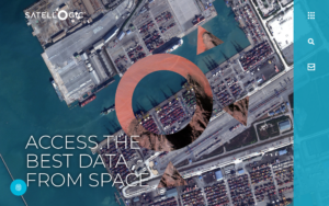 Best for affordable sub-meter imagery at scale. Satellogic Inc. is one of the few direct satellite operators on this list with fully transparent per-km² optical pricing published on its website, and pricing starts at levels well below what third-party resellers quote for equivalent-resolution imagery from other operators. The NewSat constellation, 57 satellites launched in total with approximately 17 operational plus satellites in commissioning as of the company’s own filings, delivers native 70 cm imagery at 470 km altitude with a super-resolution product that reaches 50 cm GSD in the L1 Ortho SR delivery. Up to 7 daily revisits over a point of interest are reported. A unique differentiator is that every Satellogic satellite carries a 32-band VNIR hyperspectral camera at 25 m GSD alongside the main optical payload, delivering hyperspectral coverage without a separate tasking contract. The NextGen platform at 30 cm class is planned with the first satellite in 2027. Delivery is via the Aleph platform UI and API, with a tasking-to-delivery standard of under 6 hours globally and a boosted option under 3 hours cited in company press materials. Imagery is delivered as GeoTIFF with STAC-compatible metadata.
| Type | Satellite operator (optical + hyperspectral) |
|---|---|
| HQ | Charlotte (Davidson), NC, USA |
| Founded | 2010 |
| Ownership | Public (NASDAQ: SATL) |
| Website | satellogic.com |
Financial going-concern risk is disclosed in Satellogic’s SEC filings, the company announced a CFO transition in June 2026, and 2024 revenue was approximately $12.9 million. These are material uncertainties for any multi-year program. Buyers should review the most recent 10-K and confirm service continuity commitments before entering a long-term contract. Read our full Satellogic review for pricing tiers, constellation specs, and an honest assessment of the business risk.
6. Nearmap
 Best for ultra-high-resolution aerial imagery in covered markets. Nearmap is an aerial imagery provider, not a satellite operator. Its HyperCamera3 system, mounted on fixed-wing aircraft, captures vertical imagery at 4.4 to 7.5 cm GSD, roughly four to seven times sharper than any satellite on this list, over 87 percent of the US population across 1,973 urban and regional areas, plus Australia, New Zealand, and Canada. Capture frequency is up to three times per year per area, with a historical archive going back to 2014 in the US. Oblique imagery at 4-direction 45-degree angle, True Ortho, Panorama, 3D reality mesh, and Near-Infrared products round out the portfolio. The site explicitly notes the system is “attached to an aircraft, not satellites,” which is the key constraint: coverage is limited to the geographies Nearmap flies. Nearmap is owned by Thoma Bravo (PE, acquired 2022) and has absorbed Betterview (insurance AI) and itel (building materials pricing). Named customers include Tesla, Kin Insurance, several US municipal governments, and engineering firms including Walter P Moore. The MapBrowser web platform and WMTS/WMS tile API give GIS-native access without custom integration. Absolute horizontal accuracy is 21.9 cm RMSEr for the HyperCamera3 system.
| Type | Aerial imagery provider (not satellite) |
|---|---|
| HQ | Lehi, Utah, USA |
| Founded | 2007 |
| Ownership | Private (Thoma Bravo) |
| Website | nearmap.com |
Nearmap’s coverage is the defining limitation: areas outside the US, Australia, New Zealand, and parts of Canada are not covered at all by the standard program. If your target area is outside those markets, this pick does not apply. Pricing is subscription-based with no public rates; a sales conversation is required.
7. Vexcel Data Program
Best for global aerial VHR programs in insurance, government, and AEC markets. Vexcel Data Program, operated by Vexcel Imaging US, Inc., runs what it describes as the world’s largest aerial imagery program, spanning 45-plus countries and territories including the US, UK, Germany, Japan, and Australia. The program uses UltraCam large-format cameras designed in-house by Vexcel Imaging GmbH (Graz, Austria) and a dedicated fleet of fixed-wing aircraft through Keystone Aerial Surveys. Ortho GSD is 7.5 to 15 cm, with oblique capture at 7.5 cm in four cardinal directions, and coverage in the US reaches 99.6 percent of the population across 127 million households. Elements AI extracts 40-plus building and property attributes from the captured imagery. Vexcel was the original operations partner for the Geospatial Insurance Consortium (GIC), which is now unified under the Vexcel brand. The Gray Sky Program provides rapid post-disaster aerial imagery after hurricanes, tornadoes, and wildfires, and has been running since 2017. Named customers include Chubb, Munich Re, Tokio Marine, FM Global, Citizens Insurance, and Microsoft (Flight Simulator imagery). The platform integrates with Esri ArcGIS via Image Services, Cesium for 3D, and LexisNexis for insurance data workflows. An On Demand product allows custom aerial captures outside the standard program schedule, and a University Access Program provides free academic access.
| Type | Aerial imagery provider (not satellite) |
|---|---|
| HQ | Centennial, Colorado, USA |
| Founded | Not publicly stated on site |
| Ownership | Private (Vexcel Imaging US, Inc.) |
| Website | vexceldata.com |
Vexcel publishes no pricing. Access to the program is via demo request or collective contract (for insurance customers via the GIC model), and refresh cadence varies by country and program year rather than following a fixed schedule. For areas outside the standard 45-country footprint, coverage may not exist at all.
8. Sfera Technologies
 Best for comparing multiple VHR sources with upfront per-km² pricing. Sfera Technologies is a data aggregator and platform, not a satellite operator. It brokers access to optical imagery from multiple operators (including BJ-3N at 0.30 m and Superview Neo-1 at 0.30 m) under a single commercial agreement with per-km² prices published on sfera.earth. Optical pricing starts at $4/km² for 1.0 m archive and reaches $30/km² for 0.3 m daily tasking, with a minimum area of 100 km² at that resolution. The web application at app.sfera.earth provides a self-serve interface and a feasibility tool for SAR tasking. The company is privately held, founded in 2019 and headquartered in Sofia, Bulgaria. Alongside optical, the platform also routes X-band SAR from Capella Space, thermal MWIR from SatVu, hyperspectral from Wyvern at 5.3 m across 31 bands, and RF/ELINT from Unseenlabs, all accessible in a single account. A separate commercial ground station network at 12 active sites across Europe, the Middle East, Asia, the Americas, Africa, and Oceania operates as a standalone B2B service at EUR 3 per minute via API. SAR, thermal, hyperspectral, and RF pricing requires a quote. Read our full Sfera Technologies review for a detailed breakdown of each sensor modality, the ground station service, and the platform interface.
| Type | Multi-sensor data platform / aggregator |
|---|---|
| HQ | Sofia, Bulgaria |
| Founded | 2019 |
| Ownership | Private |
| Website | sfera.earth |
Transparent pricing covers optical only. SAR, thermal, hyperspectral, and RF all require direct contact for a quote. No named reference customers appear publicly, which buyers building a mission-critical program should factor into their vendor evaluation alongside Sfera Technologies’ small team size and early-stage business profile.
How to choose a high-resolution satellite imagery provider
Resolution is where my scepticism starts on this list, because the headline number is often a processed product rather than what the sensor collects. When I compare these providers I read the native GSD first and treat every upsampled figure as a marketing tier, not a capability.
The right choice turns on a small number of questions that are worth settling before you look at any provider’s spec sheet. The most important is what you actually need the imagery for, because that alone usually rules out half the list.
Satellite or aerial
Aerial imagery from Nearmap or Vexcel reaches 4.4 to 15 cm GSD, a detail level no satellite currently achieves. The constraint is geography: both programs are limited to specific countries and urban areas, and neither offers on-demand tasking over arbitrary global coordinates. If your work is in the US, Australia, or Western Europe and you need centimeter-grade detail for property, infrastructure, or insurance workflows, an aerial program is likely the better fit. If your target areas span multiple continents or include regions those programs do not fly, satellite VHR is the only option.
Resolution versus revisit rate
Vantor offers the highest confirmed optical resolution (34 cm native Pan via WorldView Legion) and the highest daily revisit rate (up to 15 per day at prime locations). Airbus Pléiades Neo matches 30 cm native and adds a SAR option. Planet, BlackSky, and Satellogic sit at 50-70 cm native with differing revisit architectures: Planet has published prices and a monitoring context layer; BlackSky’s mid-inclination orbit provides time-diverse passes that SSO operators cannot replicate; Satellogic delivers the lowest cost per km² of the satellite operators at sub-meter resolution. The key question is whether you need the same location imaged multiple times in a single day, or whether daily or every-few-days coverage is sufficient.
Pricing transparency and minimum orders
Planet (SkySat) and Satellogic are the only satellite operators here that publish optical tasking prices. Planet’s SkySat floor is $12/km² Flexible with a 25 km² minimum; Satellogic’s archive entry is even lower and similarly structured. Sfera Technologies publishes optical pricing from $4 to $30/km² across a range of resolutions and revisit tiers, and offers the lowest published entry point in the list. Vantor, Airbus, and BlackSky publish no rate cards of their own, though all three are resold on UP42 at published credit rates. Buying from them directly still means a procurement conversation.
Delivery speed and integration
Vantor’s Direct Access program, for customers with dedicated ground stations, delivers in 15 minutes. The standard Rapid Access program delivers in 6 hours. Planet’s Assured SkySat tier delivers in as little as 3 hours from capture at a published price. BlackSky delivers under 90 minutes from collection. Satellogic’s boosted pipeline targets under 3 hours globally. All five of those satellite operators offer STAC-compliant APIs. If your program requires direct cloud delivery to S3 or equivalent without manual steps, confirm the specific API capabilities for your tier during the sales process.
Business risk and continuity
For programs running longer than 12 months, financial stability matters as much as spec sheet performance. Vantor (private, Advent International backing), Airbus (Airbus SE subsidiary), and Planet (NYSE: PL, FY26 adjusted-EBITDA positive) represent three of the more stable business postures on this list. Satellogic’s going-concern disclosure in its SEC filings is the clearest risk signal here and should be a direct input into any multi-year contract decision. BlackSky carries significant long-term debt but is growing revenue and has raised guidance for FY2026.
Sub-meter imagery is rarely bought for its own sake. Six vertical guides set out what the resolution is for: urban planning, real estate, construction, insurance, telecommunications and archaeology. Reading the relevant one first changes the shortlist more than any spec comparison will.
Verdict
Vantor earns the top spot on the satellite side because no other operator combines a 34 cm native resolution, up to 15 daily revisits, a 15-minute delivery option, and a ten-satellite fleet that is already fully operational. The credits model without published per-km² rates is a real gap in pricing transparency, but the constellation advantage is not something another single operator matches today.
Airbus Defence and Space is the right answer if you need optical and SAR from one European vendor with a proven 40-year heritage and a PREMIUM NRT radar delivery option. The two operational Pléiades Neo satellites do limit the daily revisit potential compared to what the original four-satellite design would have delivered, and the aging TerraSAR-X and TanDEM-X assets carry a continuity risk that programs depending on InSAR should evaluate carefully.
Planet sits at three for the combination of published tasking prices, a STAC-compliant API, and near-daily 3 m monitoring context alongside the VHR SkySat and Pelican products. For programs that need to budget and integrate without a long sales cycle, Planet is the most accessible entry point among the direct operators. BlackSky and Satellogic fill specific niches: BlackSky for time-of-day monitoring where the mid-inclination orbit actually changes the product, and Satellogic for the lowest cost per km² from a direct operator that includes bundled hyperspectral, offset against a financial risk that deserves scrutiny before any multi-year commitment.
Nearmap and Vexcel are the picks for aerial VHR where centimeter-grade detail matters more than global reach. Both operate well outside the satellite paradigm and are not interchangeable with the satellite options above. Sfera Technologies closes the list as the clearest choice for buyers who want transparent pricing across multiple optical resolution tiers and the ability to add SAR, thermal, hyperspectral, or RF under the same account, without the commitment to a single satellite operator’s catalog.
Frequently asked questions
These answers address the most common decision points when evaluating high-resolution imagery providers for the first time.
What counts as high-resolution satellite imagery?
In commercial EO, “high resolution” typically means imagery at 1 m GSD or better, while “very high resolution” (VHR) describes sub-50 cm optical products from systems like WorldView Legion (34 cm), Pléiades Neo (30 cm), SkySat (50 cm), and Gen-3 BlackSky (35 cm). Aerial systems go further still, reaching 4 to 15 cm GSD, though they are limited to specific geographies. See the “Satellite or aerial” section for when that distinction changes your choice.
What is the best resolution available from a commercial satellite?
Pléiades Neo (Airbus) and Vantor’s WorldView-3 both deliver 30 to 31 cm native Pan GSD today. Vantor’s WorldView Legion is at 34 cm native, marketed as a “30 cm-class” delivery product. No commercial optical satellite currently offers native imagery below 30 cm, though Vantor has announced a 20 cm-class Vantage satellite planned for 2029. For a side-by-side view, see the “Providers compared” table.
Which high-resolution imagery provider has the best price?
Among the satellite operators, Satellogic publishes the lowest per-km² optical prices directly on its site. Planet’s SkySat Flexible tier is $12/km² with a 25 km² minimum. Sfera Technologies’ optical catalog starts at $4/km² for 1.0 m archive. Vantor, Airbus, and BlackSky publish no rate cards themselves, but all three carry published credit rates on UP42. Full pricing details are in the “Pricing transparency” section.
Is aerial imagery better than satellite for high-resolution work?
Aerial imagery from Nearmap (4.4 to 7.5 cm GSD) or Vexcel (7.5 to 15 cm GSD) is sharper than any satellite product listed here, but it is only available for covered geographies, primarily the US, Australia, parts of Europe, and select other markets. For global coverage or arbitrary target coordinates, satellite is the only practical option. The trade-off is summarized in the “Satellite or aerial” section.
How long does it take to get high-resolution satellite imagery?
Delivery times depend on whether you are ordering from archive or tasking a new acquisition. Archive orders from most providers ship within hours; tasking latency ranges from under 3 hours (Planet Assured SkySat) to 15 minutes for Vantor Direct Access customers with dedicated ground stations. BlackSky publishes a sub-90-minute from-collection figure for its On-Demand tier. For per-provider SLAs, refer to the “Providers compared” table and each provider’s profile above.

My passions are Earth Observation and Satellites, and my profession is Data Analysis. I combine both within ObservationData.com to show you the use cases of Earth Observation, to help you find the right provider, and to share your experiences.