Choosing a commercial optical imagery provider is harder than it looks. Resolution figures, revisit claims, and archive depths vary widely, and published pricing is the exception, not the rule. For straightforward monitoring needs, free 10 m Sentinel-2 or 30 m Landsat imagery can be enough, but the moment you need sub-meter resolution, same-day capture, or calibrated multispectral for analytics, you are in commercial territory.
This guide covers eight providers, evaluated against a consistent set of criteria: resolution, self-serve access, pricing transparency, revisit performance, and delivery speed. The list mixes satellite constellation operators that own and fly their own hardware with access-and-aggregation platforms that source imagery from multiple operators under a single contract. Both types have a legitimate place depending on what you are buying and how often.
After working through the specs and platform capabilities for each, Planet stands out as the strongest all-round pick for optical imagery, with daily global coverage, a next-generation high-resolution fleet, and published per-km² tasking prices. That said, the best fit depends on your resolution requirements and volume, and the profiles below explain why a different provider may serve you better.
Table of Contents
Key takeaways
- Planet’s near-daily 3.7 m global coverage and published SkySat prices make it the strongest all-round choice
- Vantor’s multi-decade WorldView archive and 15-minute Direct Access delivery are unmatched among VHR operators
- Pricing transparency varies: Planet, Satellogic, Sfera Technologies, and SkyFi publish per-km² rates without a sales call
How we picked the best optical satellite imagery providers
Eight providers made this list. Each had to offer commercial optical satellite imagery at 3 m resolution or finer, with a credible delivery track record. We scored them against six decision criteria that matter most to procurement teams.
- Resolution and sensor quality: native GSD, bit depth, and whether the advertised figure requires AI upscaling or super-resolution processing vs. native optical capture.
- Coverage and revisit: how frequently a target location can be imaged, including archive depth for historical analysis.
- Pricing transparency: whether per-km² or per-scene rates are published without a sales call, and what the minimum order floor looks like for small-area buyers.
- Self-serve and API access: whether you can order, configure, and retrieve imagery without waiting for a human to respond, including STAC compliance for GIS and analytics pipelines.
- Delivery speed: published SLAs for tasked and archive imagery, from capture to delivery.
- Business and fleet stability: financial health, constellation maturity, and any going-concern or operational flags that matter for multi-year program planning.
The table below distills those criteria into the columns a procurement team checks first. The eight providers are ordered from the strongest all-round optical pick to the most specialized.
Optical satellite imagery providers compared
The comparison below places all eight providers side by side on the attributes that drive most optical imagery procurement decisions. Full profiles follow immediately below.
| Provider | Best resolution | Self-serve ordering | Pricing transparency | Revisit / coverage | Best for |
|---|---|---|---|---|---|
| Planet | 50 cm (SkySat/Pelican), 3.7 m (PlanetScope) | Yes (Planet Select / API) | Published ($6–$40/km²) | Near-daily global (PlanetScope), sub-daily (SkySat) | Daily global monitoring |
| Airbus Defence and Space | 30 cm (Pléiades Neo) | OneAtlas platform | Quote only | Daily revisit (Pléiades Neo/SPOT) | Premium optical depth and 40-year archive |
| Vantor | 34 cm Pan (WorldView Legion) | Vantor Hub / API | Credits model, no public per-km² | Up to 15 revisits/day (WorldView Legion) | Deepest VHR archive and fastest delivery |
| Satellogic | 50 cm (super-resolution L1 Ortho SR) | API (STAC-compliant) | Published per-km² | Up to 7 revisits/day | Low-cost sub-meter at scale |
| BlackSky | 35 cm (Gen-3) | Spectra platform / API | Subscription direct; published credit rates on UP42 | Up to 15 time-diverse images/day (at 16-sat target) | Rapid intraday revisit |
| EarthDaily Analytics | 5 m, 22 bands (VIS-TIR) | EarthOne platform / API | Quote/Pioneer Program only | Daily global (10-sat target, Aug 2026) | Science-grade calibrated multispectral |
| Sfera Technologies | 30 cm (aggregated optical) | app.sfera.earth / API | Published ($4–$30/km²) | Daily best case (multi-operator) | Transparent low-cost access, multi-source |
| SkyFi | 30 cm (via Vantor WorldView) | Yes (web, iOS, Android, API) | From $15/image, $5/km² FAQ floor | Depends on operator | Self-serve, app-based buying |
Every fact in the profiles below comes from each provider’s own published pages and primary-source verification. Where data was not publicly confirmed, the gap is noted rather than filled.
The 8 best optical satellite imagery providers
Profiles are ranked by overall fit for buyers evaluating optical imagery commercially. Each “Best for” line reflects the primary strength on the criteria above, not a claim to market leadership.
1. Planet
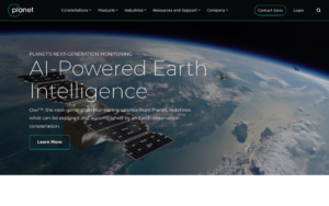 Best for daily global monitoring. Planet Labs PBC operates the largest commercial Earth observation fleet, combining PlanetScope (SuperDove, ~200 satellites, 3.7 m GSD, 8-band multispectral, near-daily global coverage), SkySat (50 cm, sub-daily revisit), and the newer Pelican generation (Gen-1 at 50 cm, commercial ops since 2025; Gen-2 at 30 cm planned for 2026). The combination of a near-daily monitoring backbone and a sub-daily high-resolution tasking layer gives Planet a breadth that no single-constellation operator matches.
| Type | Satellite operator |
|---|---|
| HQ | San Francisco, CA, USA |
| Founded | 2010 |
| Ownership | Public (NYSE: PL) |
| Website | planet.com |
Access runs through the Planet Insights Platform (REST API, Python SDK, STAC-compliant) and a self-serve tasking portal via Planet Select, powered by SkyFi. SkySat tasking prices are published on the pricing page: $6/km² archive, $12/km² Flexible Tasking, and $40/km² Assured Tasking, with delivery as fast as 3 hours from capture on the Assured tier. Named customers include Bayer, NASA, Carbon Mapper, and the Rural Payments Agency UK. The Pelican fleet carries an NVIDIA Jetson Orin AI platform for on-orbit edge processing. For a full breakdown of pricing tiers, fleet specs, and API access options, see our in-depth Planet review.
The main limitation is sensor scope: Planet’s tasking centers on optical. Hyperspectral is available through Tanager at 30 m, but for SAR or thermal imagery alongside optical data you will still need a second supplier.
2. Airbus Defence and Space
 Best for premium optical depth. Airbus Defence and Space SAS operates Pléiades Neo (30 cm native Pan GSD, two satellites operational after the Vega-C launch failure in December 2022 destroyed Neo 5 and Neo 6), Pléiades 1A/1B (50 cm), and SPOT 6 (1.5 m, 60 km swath, 3 million km² per day), all accessible through the OneAtlas platform under a single vendor agreement. The 40-year optical archive, stretching back to SPOT 1 in 1986, is one of the most extensive commercial baselines available, and the HD15 product delivers AI-enhanced 15 cm visual resolution from native 30 cm captures for select applications.
| Type | Satellite operator (optical + SAR) |
|---|---|
| HQ | Toulouse, France |
| Founded | EO operations since SPOT 1, 1986 |
| Ownership | Subsidiary of Airbus SE |
| Website | space-solutions.airbus.com |
The OneAtlas API is STAC-compliant with a separate SAR endpoint; Airbus holds 29 direct receiving stations globally. Named government customers include the French Ministry of Defence, German Bundeswehr, and NATO AGS Force; commercial references include Nestlé and Satelytics. A Synspective SAR distribution partnership signed in January 2026 adds a second X-band SAR source. Pléiades Neo Next, a 20 cm-class generation, was announced in 2024. Our Airbus Defence and Space review covers the full tasking workflow, the Living Library subscription, and what the Vega-C loss changed operationally.
The significant limitation is pricing: no per-km² rates are published for any Airbus optical product. All orders require a quote or direct contact. Budget-planning is harder than with operators who publish prices upfront.
3. Vantor
 Best for the deepest VHR archive. Vantor, formerly Maxar Intelligence, rebranded on October 1, 2025. The company operates 10 imaging satellites including six WorldView Legion spacecraft (34 cm Pan GSD, all six on orbit since early 2025) plus WorldView-3, WorldView-2, GeoEye-1, and WorldView-1. WorldView Legion enables up to 15 revisits per day over a given target. The Direct Access tier delivers imagery in as little as 15 minutes, the fastest confirmed delivery SLA in this comparison; Rapid Access offers 6-hour delivery for less time-sensitive orders.
| Type | Satellite operator (optical VHR) |
|---|---|
| HQ | Westminster, CO, USA |
| Founded | Not publicly confirmed |
| Ownership | Private (Advent International) |
| Website | vantor.com |
The Vantor Hub provides self-serve access and a REST API with STAC support. Imagery products include Vivid Mosaic at 15 cm (AI-enhanced from 30 cm native) and 30 cm, both with under 5 m CE90 accuracy. Constellation expansion plans announced in April 2026 include Vantage (20 cm-class, first satellites expected 2029) and Pulse (40 cm-class, 40 satellites, 15-minute revisit cadence, first expected 2027). The WorldView archive extends over two decades and covers high-interest areas with multi-year historical depth. Our Vantor review covers the constellation specs, delivery tiers, and what the Advent acquisition changed operationally.
No per-km² pricing is published on vantor.com. The pricing model uses a credits structure that requires a sales conversation before any rate appears, which slows procurement for buyers who need an upfront budget figure.
4. Satellogic
 Best for low-cost sub-meter at scale. Satellogic Inc. is one of two direct optical operators on this list to publish per-km² pricing without a sales call. The NewSat/Aleph-1 constellation captures native 70 cm optical imagery, with super-resolution processing delivering a 50 cm L1 Ortho SR product. A standout feature is that its satellites pair a VNIR hyperspectral camera with the main optical payload, so hyperspectral coverage can come on the same tasking order without a separate contract. Daily revisit of up to seven times over a point of interest is reported.
| Type | Satellite operator (optical + hyperspectral) |
|---|---|
| HQ | Charlotte (Davidson), NC, USA |
| Founded | 2010 |
| Ownership | Public (NASDAQ: SATL) |
| Website | satellogic.com |
The API is STAC-metadata compliant; delivery format is GeoTIFF with ISO metadata and RSA 4096-bit digital signing for content integrity. The NextGen platform at 30 cm class is planned with first satellite in 2027. Delivery SLA is not published. Satellogic’s 2024 revenue was approximately $12.9 million, and the CFO departed in June 2026. Going-concern risk is noted in financial filings. These are material uncertainties for any multi-year program. For pricing tiers, hyperspectral camera specs, and an honest assessment of the business risk, see our Satellogic review.
The financial going-concern risk is the single biggest caveat. Buyers should review the most recent 10-K and confirm service continuity commitments before entering a long-term contract.
5. BlackSky
 Best for rapid intraday revisit. BlackSky Technology Inc. operates a Gen-3 constellation at 35 cm resolution (NIIRS-5+), flying primarily in mid-inclination orbits rather than the sun-synchronous orbits most operators use. That orbital design produces time-diverse revisits, with the potential for up to 15 time-stamped images of the same location in a single day, which is valuable for activity monitoring where time-of-day variation matters. Delivery of collected imagery runs under 90 minutes from capture. Four Gen-3 satellites had launched by March 2026, with the most recent still in commissioning.
| Type | Satellite operator (optical VHR) |
|---|---|
| HQ | Herndon, VA, USA |
| Founded | Circa 2014 |
| Ownership | Public (NYSE: BKSY) |
| Website | blacksky.com |
The Gen-3 sensor captures RGB, panchromatic, and SWIR bands. The BlackSky Spectra platform (powered by OpenWhere) provides API access alongside AI object detection covering 35-plus object types. Two subscription tiers are available: On-Demand for flexible tasking and Assured for guaranteed capacity. Burst imagery (five frames in a single pass), stereo pairs, and nighttime collection are all available. Named customers include NGA (Luno contract) and U.S. Air Force AFRL, reflecting a primarily defense-oriented customer base. Our BlackSky review covers the mid-inclination orbit advantage, Spectra platform capabilities, and how the Assured tier works in practice.
The up-to-15 daily revisit figure is conditional on the full 16-satellite target fleet. With four Gen-3 spacecraft in commercial operations in early 2026, the current revisit rate is materially lower. Buyers should confirm the operational constellation size before contracting.
6. EarthDaily Analytics
 Best for science-grade calibrated multispectral. EarthDaily Analytics Corp. is building a 10-satellite optical constellation (EarthDaily Constellation, EDC-01 through EDC-10) purpose-built for broad-area change detection. Each satellite carries 16 imaging systems across 22 spectral bands spanning the visible to thermal infrared, delivering calibrated, CEOS-ARD compliant, AI-ready imagery at 5 m resolution from a sun-synchronous orbit at approximately 594 km. Seven satellites were in orbit by June 2026, with full commercial operations targeted for August 2026. The company acquired Descartes Labs in October 2024, adding analytics platform heritage and a U.S. federal division (EarthDaily Federal).
| Type | Satellite operator (multispectral) |
|---|---|
| HQ | Vancouver, BC, Canada |
| Founded | 2021 |
| Ownership | Private (Antarctica Capital) |
| Website | earthdaily.com |
The EarthOne platform provides cloud-native API access; a Pioneer Program offers early evaluation access with over 500 agreements signed. Data products are structured as AiRD (AI-ready, optimized for analytics), Maritime, and Science (calibrated top-of-atmosphere). A $1.2 million NRO contract was awarded in 2026. Vertical market applications span agriculture, mining, wildfire, insurance, and defense. Our EarthDaily Analytics review covers the constellation deployment timeline, the Descartes Labs acquisition, and the product tiers in detail.
No pricing is published. All constellation data access is via the Pioneer Program or direct sales contact. The constellation is not yet at full commercial scale, which means buyers evaluating for immediate production workloads should verify current data availability before committing.
7. Sfera Technologies
 Best for transparent, low-cost optical access without operator lock-in. Sfera Technologies Ltd., registered as a private company and headquartered in Sofia, Bulgaria, is not a satellite operator. It aggregates optical imagery from multiple third-party constellation operators under a single commercial agreement, including sub-meter sources at 0.3 m through resellers. Optical pricing is published without a sales call, running from $4/km² for 1.0 m archive (minimum 25 km²) up to $30/km² for 0.3 m daily tasking (minimum 100 km²), with a floor order as low as ~$90 at the 0.8 m tier. The web platform at app.sfera.earth covers optical ordering, SAR feasibility checking, and hyperspectral archive browsing.
| Type | Multi-source data platform (aggregator) |
|---|---|
| HQ | Sofia, Bulgaria |
| Founded | 2019 |
| Ownership | Private |
| Website | sfera.earth |
Beyond optical, Sfera Technologies also routes SAR, thermal, hyperspectral, and RF orders, making it the only entry on this list that spans all five modalities under a single point of contact. SAR tasking is self-serve through the app with a feasibility tool, while thermal, hyperspectral, and RF orders route through a quote. The platform API supports ground station services (12 active sites globally, usage-based from €3/minute). For a full breakdown of each sensor modality and the pricing structure, see our Sfera Technologies review.
Sfera Technologies is a small team, and no named reference customers appear publicly. Buyers building a mission-critical program should evaluate service continuity posture, and note that non-optical pricing requires direct contact, which adds friction compared to fully transparent platforms.
8. SkyFi
 Best for self-serve, app-based buying. SkyFi, operated by Optisense, Inc. and headquartered in Austin, Texas, is a satellite imagery marketplace with web, iOS, and Android apps alongside a REST API. The catalog spans 40-plus analytics and data partners, with optical imagery from Vantor WorldView (30 cm), Planet SkySat (50 cm), and Satellogic, plus SAR from ICEYE US and Umbra. The self-serve workflow covers archive search, tasking requests, and delivery from a single interface without a sales call. Archive optical starts from $15/image; SAR archive starts at $450/scene and SAR tasking at $675/scene.
| Type | Satellite imagery marketplace |
|---|---|
| HQ | Austin, Texas, USA |
| Founded | Not published |
| Ownership | Private |
| Website | skyfi.com |
SkyFi also distributes Sentinel-2 and Landsat open data at no cost through its Open Data program, making it a convenient single interface for teams who mix free and commercial sources. White-label portals are available for Vantor, Planet, and ICEYE US. The API supports programmatic ordering. SkyFi names NATO among the customers on its defense and government platform, a useful trust signal for procurement teams. For a detailed walkthrough of the ordering workflow, the catalog depth, and how white-label access compares to buying directly, see our SkyFi review.
Because SkyFi is a marketplace, it adds a markup layer over the source operator, and imagery specifications depend entirely on the underlying operator’s current capabilities. Buyers with high-volume or recurring needs should verify whether going direct to the operator makes more economic sense.
How to choose an optical satellite imagery provider
Before you open any provider’s product page, settle three questions: what resolution do you actually need for your use case, how often you need to revisit the same location, and whether pricing transparency affects your procurement process. The answers will cut the list from eight to two or three credible options in most buying scenarios.
Resolution vs. coverage trade-off
PlanetScope at 3.7 m gives you near-daily global coverage for monitoring work. If you need sub-meter imagery for detailed target analysis, you are moving into SkySat, Pelican, Pléiades Neo, or WorldView Legion territory, all of which deliver 50 cm or finer but at a much smaller footprint per collect and at significantly higher per-km² cost. In my analysis of the optical spectrum here, the resolution-coverage trade-off is the single sharpest divide in the market, and buyers who try to get both in one contract often end up paying for more than they need on one dimension.
Archive vs. tasking
If your use case is historical, archive imagery is almost always cheaper than tasked collection. Planet, Vantor, Airbus, and Satellogic all hold multi-year archives; Vantor’s WorldView collection spans more than two decades for high-interest areas. SkyFi surfaces archive from multiple operators in a single search. If you need new acquisition over a specific time window, tasking costs increase materially, and not all providers confirm a SLA upfront. Planet’s 3-hour Assured commitment and Vantor’s 15-minute Direct Access are the most clearly documented delivery SLAs in this group.
Pricing transparency and budget planning
For buyers who need to produce a budget estimate without a sales engagement, the published options are Planet, Satellogic, Sfera Technologies, and SkyFi. Planet’s SkySat tiers start at $6/km² archive with a 25 km² minimum; Sfera Technologies’ optical floor is $4/km² (1.0 m, 25 km² minimum) up to $30/km² for daily tasking at 0.3 m. Satellogic publishes pricing on its site as well. Airbus, Vantor, BlackSky, and EarthDaily require a direct conversation before any numbers appear. SkyFi’s $15/image entry and FAQ-cited $5/km² floor give some orientation, though the exact price depends on the specific operator and scene selected.
Self-serve vs. enterprise workflows
SkyFi is the clearest choice for teams that need a mobile or web-first buying experience. Planet Select and the Vantor Hub provide direct self-serve access for operator purchases. Sfera Technologies’ app.sfera.earth covers optical and SAR ordering. EarthDaily and Airbus sit firmly on the enterprise end of the spectrum, requiring sales contact for all orders. If your team integrates imagery into automated pipelines, check STAC compliance and SDK availability: Planet, BlackSky, Satellogic, and Sfera Technologies all confirm STAC support in their API documentation.
The largest single application for optical imagery on this site is agriculture, and that guide covers index products, revisit requirements and the free Sentinel and Landsat baselines that every commercial optical offer is measured against.
Verdict
Planet earns the top spot because the combination of a published self-serve pricing structure, near-daily global 3.7 m coverage, sub-daily SkySat and Pelican tasking, and a REST API with STAC support exists nowhere else on this list under a single contract at press time. The pricing transparency and fleet scale distinguish it clearly from the rest of the field.
Vantor is the right call for programs where archive depth and delivery speed matter most. The multi-decade WorldView library, 15-minute Direct Access SLA, and up to 15 daily WorldView Legion revisits put it ahead of every other optical operator on raw VHR capability, even though no pricing is published.
Airbus Defence and Space is the stronger choice for buyers who want a European vendor, a combined optical-plus-SAR agreement, or the SPOT archive going back to 1986. The loss of two Pléiades Neo satellites in 2022 is worth noting for customers whose programs depend on the 30 cm constellation specifically.
Satellogic’s low published per-km² price and the bundled hyperspectral camera make it attractive for high-frequency monitoring on a budget, but the going-concern risk flag means it should enter a competitive evaluation rather than a sole-source selection. BlackSky fills a specific niche for intraday activity monitoring using the time-diverse mid-inclination orbit, though the full revisit potential is only realized once the 16-satellite fleet target is reached. EarthDaily is positioned for science-grade time-series analytics work, with the full constellation entering commercial operations in August 2026.
Sfera Technologies and SkyFi serve buyers who want aggregated access without a direct operator contract. Sfera Technologies’ per-km² transparency and the ability to combine optical, SAR, thermal, hyperspectral, and RF from a single commercial point makes it the practical choice for multi-sensor workflows. SkyFi is the clearest option when the priority is a frictionless app-based experience, rapid archive search across operators, or mixing free Sentinel-2 with commercial VHR in the same interface.
Frequently asked questions
These answers cover the most common questions when evaluating optical satellite imagery for the first time.
What resolution do I need for optical satellite imagery?
For broad area change detection and vegetation monitoring, 3–5 m imagery (PlanetScope, EarthDaily) is typically sufficient and enables near-daily coverage. Sub-meter imagery (50 cm or finer) is needed when the task requires identifying individual objects or structures rather than broad land-cover change. See the “Resolution vs. coverage trade-off” section for a more detailed breakdown.
Which optical satellite imagery provider has the best price?
Only three providers on this list publish pricing without a sales call: Planet, Satellogic, and Sfera Technologies. Sfera Technologies’ optical archive starts at $4/km² for 1.0 m imagery; Planet’s SkySat archive starts at $6/km². For a side-by-side view, revisit the pricing transparency column in the “Optical satellite imagery providers compared” table.
What is the difference between archive and tasked optical imagery?
Archive imagery was collected previously and is available for immediate download, typically at a lower per-km² cost. Tasked imagery requires scheduling a new satellite acquisition over your area of interest at a future time window. Tasking adds cost and lead time but guarantees a fresh collect. For per-provider SLAs and pricing differences between archive and tasked, see the “Archive vs. tasking” section.
Can I order optical satellite imagery without talking to sales?
Yes, for several providers on this list. Planet (via Planet Select), SkyFi (web, mobile, API), Sfera Technologies (app.sfera.earth), and the Vantor Hub all support self-serve ordering for at least archive imagery. Airbus, EarthDaily, and BlackSky require direct contact for most orders. See the “Self-serve vs. enterprise workflows” section for a detailed comparison.
How often can a commercial optical satellite image the same location?
Revisit frequency depends on the constellation and orbit design. PlanetScope provides near-daily global coverage; Vantor’s WorldView Legion enables up to 15 revisits per day over a given target; BlackSky’s mid-inclination orbit produces time-diverse intraday revisits when the full fleet is deployed. Cloud cover, satellite tasking demand, and constellation size all affect actual revisit rates in practice. The “Optical satellite imagery providers compared” table shows published revisit figures for each provider.

My passions are Earth Observation and Satellites, and my profession is Data Analysis. I combine both within ObservationData.com to show you the use cases of Earth Observation, to help you find the right provider, and to share your experiences.