Buying satellite imagery from a single operator narrows your options before you have even looked at a map. Aggregators open up multiple constellations and sensor types through one account, though one constellation at scale is cheaper bought direct.
This list covers eight platforms between buyer and operator, from self-serve marketplaces to human-assisted brokers and archive layers. Each was selected independently and scored against six criteria, with no paid placements.
The profiles below show each platform’s catalog, pricing, and ideal buyer, so you can match the pick to your use case. Sfera Technologies takes our top spot, though the best fit depends on your sensor mix and budget.
Table of Contents
Key takeaways
- Sfera Technologies ranks first as the only aggregator with RF/ELINT plus four imaging modalities, published pricing, and tasking
- SkyFi is the pick for buyers who need self-serve, contract-free ordering with prices shown before checkout
- Rankings weight catalog breadth, modalities, and pricing transparency toward what a commercial procurement team actually values
How we picked the best satellite imagery aggregators
Six criteria shaped this ranking. For an aggregator, catalog breadth and pricing transparency matter most: a platform that hides prices or locks you into quotes for every order creates procurement friction that erodes the time savings aggregation is supposed to deliver.
- Catalog breadth and modality range: how many sensor types (optical, SAR, thermal, hyperspectral, RF) are available through a single account
- Pricing transparency: whether per-km² or per-scene rates are published on the public site, without requiring a sales call first
- Access model: self-serve web and API access versus human-assisted quote workflows
- Tasking capability: whether the platform supports new-acquisition tasking, not just archive search
- Delivery and integration: API access, STAC compliance, SDK availability, and GIS-tool integration
- Support and trust signals: compliance certifications, named reference customers, investor backing, and operational track record
The comparison table below summarizes the most decision-critical criteria at a glance before the detailed profiles. Delivery and integration details (API, SDK, STAC, GIS tooling) and trust signals (certifications, named customers, investor backing, reseller authorizations) are covered in each platform’s profile in the section below. The eight platforms are ordered from the strongest overall pick to the most specialized.
Satellite imagery aggregators compared
The table below brings the eight platforms side by side on five attributes most relevant to a commercial procurement decision. One fact per cell, giving you an at-a-glance overview before you read the full profiles.
| Provider | Modalities available | Self-serve ordering | Pricing transparency | Tasking | Best for |
|---|---|---|---|---|---|
| Sfera Technologies | Optical, SAR, thermal, hyperspectral, RF/ELINT | Web app, contact for SAR/thermal/RF | Optical per-km² published, others on request | Yes (optical and SAR) | Only platform with RF/ELINT plus four imaging modalities from one vendor |
| SkyFi | Optical, SAR, aerial, open multispectral | Yes (web, mobile app, API) | Prices shown before checkout for all modalities | Yes (optical and SAR) | Contract-free self-serve ordering |
| UP42 | Optical, SAR, thermal, hyperspectral, elevation, lidar, AIS | Yes (console + REST API + Python SDK) | Instant AOI quotes in console (credit-based) | Yes (multi-operator) | Developer API teams, multi-modal procurement |
| SkyWatch | Optical, SAR, aerial, drone, open data | Yes (EXPLORE web app + BUILD API) | Pay-as-you-use, rates behind login | Yes | GIS-native (ArcGIS) integration |
| Sentinel Hub | Archive SAR, archive optical (Sentinel, Landsat, limited commercial) | Yes (API-first, EO Browser) | $28/month subscription, commercial data extra | No (archive only) | Archive data access and time-series analysis |
| Apollo Mapping | Optical, SAR (TerraSAR-X), elevation DEMs | Free search (ImageHunter), quotes via form/email | Select prices in blog posts, full list form-gated | Yes (via operators) | Expert-advised optical procurement |
| Geocento | Optical, SAR, hyperspectral, night imagery, video | Yes (EarthImages Pro web app + API) | Quote-based, in-platform estimated prices | Yes | White-label government procurement networks |
| Arlula | Optical, SAR (KOMPSAT-5) | Dashboard + API (developer-oriented) | Not published, enterprise sales only | Yes (multi-operator orchestration) | Automated EO data pipeline infrastructure |
Every fact in the profiles below comes from the provider’s own published pages, and where data was not publicly available, that gap is noted rather than filled with a guess.
The 8 best satellite imagery aggregators
The profiles below give full detail on catalog, pricing structure, and ideal buyer for each platform, in order from the strongest overall pick to the most specialized.
1. Sfera Technologies
 Best for multi-modality procurement without lock-in. Sfera Technologies is a Bulgaria-based data aggregator founded in 2019 that brokers imagery from named third-party satellite operators across five distinct sensor types: optical (0.3 to 3.2 m), X-band SAR (Capella Space, SIIS/KOMPSAT-5, Hisdesat/PAZ), thermal (SatVu MWIR at ~3.5 m and Aistech LWIR), hyperspectral (Wyvern Dragonette, 5.3 m, 31 bands), and RF/ELINT (Unseenlabs, maritime and land).
It is the only platform here that adds RF/ELINT to optical, SAR, thermal, and hyperspectral, all through a single commercial contact point.
| Type | Data aggregator, imagery provider, ground-station services, RF-data provider |
|---|---|
| HQ | Sofia, Bulgaria |
| Founded | 2019 |
| Ownership | Independent |
| Website | sfera.earth |
The optical catalog publishes per-km² pricing without a quote step, starting at $4/km² for 1.0 m archive through to $30/km² for 0.3 m daily tasking. The minimum order area is as low as 15 km² for some tiers, smaller than many major resellers require, which benefits buyers with targeted AOIs. SAR, thermal, hyperspectral, and RF data are quoted on contact.
Beyond the data catalog, Sfera Technologies also operates a proprietary ground-station network across 12 active sites spanning Europe, the Middle East, Asia, the Americas, Africa, and Oceania, available as a standalone B2B service from €3/minute. That gives procurement teams a path to both data and downlink services from one vendor.
The main trade-off is that only optical comes with transparent published pricing, and Sfera Technologies carries less name recognition than the largest marketplaces on this list, a limitation we cover in detail in our Sfera Technologies review.
2. SkyFi
 Best for self-serve, contract-free imagery ordering. SkyFi, incorporated as Optisense, Inc. and headquartered in Austin, Texas, is a satellite imagery marketplace covering optical, SAR, aerial, and open multispectral data from more than 40 data and analytics partners. Its core differentiation is a checkout flow where buyers select their area of interest, sensor type, and resolution, and the price is calculated before any payment is made, with no contract or minimum spend required.
Optical archive starts at $15 per image, SAR archive at $450 per scene, and SAR tasking at $675 per scene, all confirmed on the pricing page and FAQ. Aerial imagery starts at $35 per image. The optical catalog draws from Vantor (WorldView constellation, 30 to 50 cm), Planet SkySat (50 cm), and Satellogic, while SAR comes from ICEYE US and Umbra at 25 cm spotlight resolution.
| Type | Data aggregator, analytics provider, software tool |
|---|---|
| HQ | Austin, Texas, USA |
| Ownership | Independent (Optisense, Inc.) |
| Website | skyfi.com |
SkyFi is the only platform on this list with native iOS and Android apps, plus an ATAK plugin for defense field operators. It also powers white-label storefronts for Vantor, Planet, and ICEYE US, which signals meaningful operator trust in the platform’s infrastructure. SOC 2 Type II certification covers enterprise procurement compliance.
The platform operates in 179 countries with stated archive delivery under 24 hours. As a marketplace it adds a margin over buying direct, so high-volume buyers who consistently need a single sensor may find a direct operator contract is the cheaper route, a trade-off we break down in our hands-on SkyFi review.
3. UP42
 Best for developer teams needing a single API across multiple sensor types. UP42 is a Berlin-based geospatial marketplace with 53 data collections from 28-plus source operators, covering optical, SAR, thermal, hyperspectral, elevation, lidar, and AIS maritime products. Founded as an Airbus initiative in 2019 and now owned by Neo Space Group (NSG, a PIF company of Saudi Arabia, acquisition completed July 2025), the platform uses a EUR-denominated credit system where 100 credits equal €1.
Instant AOI-based price quotes are available in the web console and the minimum order is €100. The credit model adds a conversion layer over raw pricing, and credits carry a 24-month validity and are non-refundable, which matters for teams with variable budget cycles.
| Type | Data aggregator, analytics provider, software tool |
|---|---|
| HQ | Berlin, Germany |
| Founded | 2019 |
| Ownership | Neo Space Group (NSG) |
| Website | up42.com |
The developer infrastructure is the clearest reason to choose UP42: a REST API at developer.up42.com, a Python SDK, STAC-compatible data delivery, and RBAC for shared organizational accounts. Tasking is available across multiple operators including Airbus Pléiades Neo, Planet SkySat, ICEYE, Capella Space, and Umbra. The SAR catalog includes four X-band operators at 25 cm spotlight resolution.
Thermal coverage spans SatVu HotSat-1 at 3.5 m MWIR and Constellr TIR at 10 m, a range that is uncommon in marketplace catalogs. UP42 also carries GHGSat for greenhouse-gas monitoring at 25 m, which uses SWIR absorption spectroscopy and sits outside the thermal group.
Processing algorithms including pansharpening, change detection, and upsampling are available within the same credit wallet. Free open data (Sentinel-2, Landsat 8) is included at zero credits. UP42 matches those four core imaging modalities and adds elevation, lidar, and AIS, though it does not offer RF. Our in-depth UP42 review covers how the credit model affects real procurement costs.
4. SkyWatch
 Best for GIS-native teams and enterprise data management. SkyWatch, a Canadian company founded in 2016 and headquartered in Kitchener, Ontario, describes itself as having built “the world’s first API for geospatial data” that year. Its platform aggregates 700-plus sensors from 30-plus data providers across a product suite: EXPLORE (self-serve search and purchase), HUB (enterprise budget management and project tracking), MAP (ArcGIS integration), BUILD (developer API and revenue-sharing SDK), and CONNECT (operator distribution layer).
Named optical providers include Airbus, Planet, BlackSky, Vantor, and Pixxel. SAR comes from Capella Space, ICEYE, and Umbra, and aerial coverage extends to EagleView, Nearmap, and Spexi drone orthomosaic.
| Type | Data aggregator, software tool |
|---|---|
| HQ | Kitchener, Ontario, Canada |
| Founded | 2016 |
| Ownership | Independent |
| Website | skywatch.com |
The most distinctive feature is MAP, a native ArcGIS Content Store integration and ArcGIS Pro Add-In that lets GIS teams order commercial satellite imagery without leaving their established desktop workflows. Pricing is described as “transparent, pay-as-you-use” but rates are not published on the public site and only appear inside the EXPLORE application after login, which limits upfront budget planning before account creation.
Named customers include Al Jazeera, the Australian Government, and Sinopec. A Series B round of approximately $17.2 million USD was closed in June 2021, led by Drive Capital, and we assess how that funding has shaped the platform’s enterprise roadmap in our SkyWatch review.
5. Sentinel Hub
 Best for developers and researchers building on archive satellite data at scale. Sentinel Hub, a product of Sinergise Solutions d.o.o. (Ljubljana, Slovenia), is a Planet Labs PBC subsidiary since the acquisition completed August 4, 2023. It is a cloud-native data-access platform rather than a procurement marketplace.
Its core function is providing REST API access to satellite data collections, processing queries server-side and returning rendered imagery or statistics without requiring the user to download, store, or reproject data.
| Type | Data aggregator, software tool, analytics provider |
|---|---|
| HQ | Ljubljana, Slovenia |
| Ownership | Planet Labs PBC (subsidiary) |
| Website | sentinel-hub.com |
The platform powers the Copernicus Data Space Ecosystem, the official ESA/EC gateway replacing Copernicus Open Access Hub, which places it at the center of European public EO infrastructure.
The data catalog covers Sentinel-1 GRD SAR, Sentinel-2 (10 m), Sentinel-3, Sentinel-5P, Landsat 9/8/7/4-5/1-5 MSS, MODIS, ENVISAT, and multiple Copernicus derived services, all free within the platform subscription. Commercial data (PlanetScope, SkySat Archive, Vantor WorldView via European Space Imaging) requires separate quota purchases bought as area-based packages, priced per provider. Subscription plans start at $28/month (Exploration, billed annually), with a 30-day free trial available.
Platform-level API infrastructure supports WMS, WCS, WMTS, WFS, STAC catalog, openEO, Statistical API, Batch API, and BYOC for custom COG raster ingestion. Sentinel Hub is an archive and processing layer, not a tasking marketplace, so it does not fit workflows that require new-acquisition ordering, which our detailed Sentinel Hub review explores alongside its subscription tier trade-offs.
6. Apollo Mapping
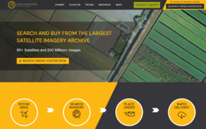 Best for specialist imagery procurement with human advisory support. Apollo Mapping is headquartered in Chicago with roots and support operations in Colorado, and has operated as an imagery reseller since at least 2004. It is a human-in-the-loop broker rather than a self-serve platform. Its ImageHunter tool at imagehunter.apollomapping.com is free to search without an account and aggregates 60-plus satellites and 500 million-plus images from 19 operators.
Coverage spans optical (Vantor WorldView Legion at 30 cm, Airbus Pléiades Neo at 30 cm, Planet, BlackSky, SpaceWill SuperView NEO at 25 cm, and others), SAR (Airbus TerraSAR-X, X-band), and elevation DEMs (WorldDEM, Precision3D). The catalog includes academic and non-profit discounted pricing alongside post-processing options such as orthorectification, pansharpening, and color balancing.
| Type | Data distributor, reseller |
|---|---|
| HQ | Chicago, Illinois, USA |
| Founded | 2004 |
| Ownership | Independent |
| Website | apollomapping.com |
The company has been recognized annually as an Airbus and Maxar reseller since 2012, a relationship that continues under the Vantor name and indicates long-standing authorized distribution agreements. Quotes are returned within four business hours. Full price lists require a form submission, though individual sensor prices appear in blog posts: SPOT 6/7 archive at $4.75/km², PlanetScope archive at $1.80/km², and Jilin-1 50 cm archive at $8/km² (per a 2023 blog post, confirmed live, though treat as potentially stale given the form-gated current list).
For buyers who value expert guidance over self-serve speed, Apollo Mapping’s model is the closest this list gets to a specialist procurement advisor, though ordering is quote-and-email rather than instant self-serve and the full price list is form-gated.
7. Geocento
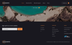 Best for government and enterprise buyers needing a white-label procurement network. Geocento, a UK company incorporated in December 2011 (Companies House #07868159) and based at Harwell Campus, Oxfordshire, operates the EarthImages platform: a web application and API suite brokering imagery from 20-plus suppliers and 250-plus satellites. Sensor coverage spans optical (15 cm HD to medium-resolution), SAR, hyperspectral, night imagery, and video.
Named optical providers include Airbus, Vantor, Planet, Satellogic, SIIS, Deimos Imaging, 21AT, MDA, and free-tier ESA/NASA/USGS sources. SAR coverage includes Airbus TerraSAR-X and MDA RADARSAT. Tasking and archive search both run through the EarthImages application.
| Type | Data aggregator, software tool |
|---|---|
| HQ | Didcot, Oxfordshire, UK |
| Founded | 2011 |
| Ownership | Independent |
| Website | geocento.com |
The standout differentiator is the white-label enterprise option, where Geocento can deploy a branded virtual procurement network for a government or corporate client, with a custom supplier portfolio and negotiated terms, rather than requiring the buyer to use Geocento’s public storefront. ESA BIC UK (Harwell) incubated Geocento in 2012 to 2013, and the platform serves clients in 65-plus countries.
There is a direct integration with Sentinel Hub BYOC, enabling purchased commercial imagery to transfer automatically into a Sentinel Hub account.
Pricing is entirely quote-based with no published rates, which makes upfront budgeting harder before engaging the sales process. The EarthImages application shows estimated prices for catalog orders once you are inside the platform. For buyers who need a configurable procurement infrastructure rather than a fixed marketplace, Geocento is the specialist option.
8. Arlula
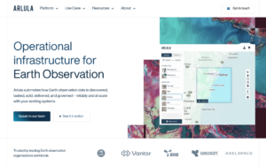 Best for development teams building automated EO data pipelines. Arlula is a Sydney-based EO infrastructure company founded in 2018, backed by Lockheed Martin Ventures (strategic, 2023) and a March 2026 seed round of AUD 3.4 million led by Paspalis Capital. Its core product is Geostack, a modular SaaS platform providing archive search, satellite tasking, data normalization, constellation orchestration, and order fulfillment through a single API, with outputs in STAC-compliant, cloud-optimized format.
Connected source operators include SIIS (KOMPSAT-3, KOMPSAT-3A optical and KOMPSAT-5 X-band SAR), BlackSky (high-resolution optical, collect-to-delivery in up to 90 minutes), LC60 (Australia’s first commercial EO operator, ~80 cm optical), 21AT (TripleSat), and NSPO FORMOSAT-5 (2 m PAN / 4 m MS). The ML-based Constellation Orchestration module coordinates multi-operator tasking scheduling and event-driven imaging triggers.
| Type | Data aggregator, software tool |
|---|---|
| HQ | Sydney, NSW, Australia |
| Founded | 2018 |
| Ownership | Independent |
| Website | arlula.com |
Arlula is the most developer-focused platform on this list and the furthest from a consumer imagery store: it is primarily used by satellite operators distributing their data and by enterprise teams building automated GEOINT pipelines. Pricing is not published and all access requires a direct sales conversation.
An Arlula Dashboard provides a web console for non-developer buyers, but the platform’s center of gravity is the API and its pipeline automation capabilities rather than self-serve ordering. The publicly named operator list is small compared to other platforms here, and access is enterprise-sales only with no published pricing, which means it is not suited to buyers who need immediate cost visibility or a ready-to-order catalog.
How to choose a satellite imagery aggregator
With aggregators I stopped comparing catalogue sizes years ago. What decides the outcome is whether the platform can quote my exact area without a sales call, and how quickly it hands back a usable file, so the ordering path matters more than the supplier count.
The right aggregator depends on three variables: what sensor types you need, how much you want to own the ordering workflow, and how much pricing visibility matters before you commit a budget.
Start with modality, not brand
If your workflows touch more than one sensor type, narrow the list to platforms that cover all of them with a single account. Only Sfera Technologies and UP42 handle optical, SAR, thermal, and hyperspectral in one place. SkyWatch and SkyFi are strong on optical and SAR but have thinner or no thermal and hyperspectral coverage.
If RF/ELINT signal intelligence is part of the picture, only Sfera Technologies offers it through an aggregator interface. If Sentinel archive data at scale is the primary need and tasking is not required, Sentinel Hub is the cost-efficient dedicated infrastructure. Trying to force an archive API into a tasking workflow wastes integration time (or vice versa).
Weigh self-serve pricing against advisory support
Transparent upfront pricing, the kind SkyFi and Sfera Technologies’ optical tiers offer, removes a procurement bottleneck when budgets need approval before an order is placed. Platforms that require a quote call (Apollo Mapping, Geocento, Arlula) are slower to first order but often deliver better guidance on optimal tasking parameters, cloud-cover windows, and license terms for complex or regulated use cases.
Government procurement teams in particular may find the human-advisory model faster for framework contracts than self-serve systems that require per-order approval chains.
Match the access model to your team
SkyFi and SkyWatch both offer web and mobile interfaces with minimal technical onboarding. UP42 and Arlula are built for developer teams: their value is in the API and SDK, not the point-and-click console. SkyWatch’s ArcGIS integration is the fastest path for GIS teams that live in Esri products.
Sentinel Hub’s Processing Unit model suits data scientists who want to run time-series queries across decades of archive data without managing downloads. Geocento’s white-label option is worth exploring if you need to build an imagery procurement system for an organization with multiple internal users who require a branded, access-controlled interface rather than a public storefront.
Check catalog size against your AOI
Catalog breadth numbers (40-plus partners, 700-plus sensors, 250-plus satellites) are marketing figures that describe the maximum possible scope. What matters is whether specific satellites have archive coverage over your area of interest for your target dates, and whether tasking is feasible within your response time window. Use the free search tools (ImageHunter for Apollo Mapping, EXPLORE for SkyWatch, EO Browser for Sentinel Hub) to check actual archive density before choosing a platform.
An aggregator is chosen for breadth rather than for one sensor, so the sharper question is what the data has to answer. The use case guides cover 25 verticals, each with the providers and the free sources that actually serve that application.
Verdict
For most commercial procurement teams looking for the single broadest starting point, Sfera Technologies’ combination of being the only platform here with RF/ELINT alongside the four core imaging modalities, published optical pricing, satellite tasking, and its own ground stations puts it at the top. Its ground-station network is a meaningful secondary capability for operators who also need downlink services.
SkyFi is the cleaner choice for buyers who want transparent upfront pricing and zero contract overhead across optical and SAR, including a mobile app for field access. UP42 is the better pick if developer API access, a unified credit wallet and wider derived-data catalog (thermal, hyperspectral, lidar, AIS) are priorities. SkyWatch wins for teams embedded in Esri GIS workflows who need commercial imagery inside ArcGIS without a third-party portal.
Sentinel Hub occupies a distinct lane: it is the right infrastructure for time-series archive processing at scale but is not a tasking platform. Apollo Mapping and Geocento suit procurement teams that value human expertise over automation, and Geocento’s white-label option adds an enterprise deployment capability the others do not offer. Arlula is best evaluated by development teams building automated pipelines rather than by buyers who need a ready-to-order catalog today.
Frequently asked questions
The questions below cover the most common decision points when evaluating a satellite imagery aggregator for the first time.
What is a satellite imagery aggregator?
A satellite imagery aggregator is a platform that gives buyers access to data from multiple satellite operators through a single account, search interface, and billing relationship rather than requiring separate contracts with each operator. The aggregator handles upstream distribution agreements and passes license terms through to the buyer. See the “How we picked” section for the six criteria that distinguish a strong aggregator from a shallow catalog.
What is the difference between an aggregator and buying direct from a satellite operator?
Buying direct gives you the full depth of one operator’s catalog and often the best per-unit price for high-volume single-constellation use, while an aggregator trades some of that price efficiency for breadth across constellations and reduced contracting overhead. If you need optical one day and SAR the next, or your AOI requires different sensors for different conditions, an aggregator saves significant procurement friction. See the “How to choose” section for a full breakdown of the trade-offs.
Are satellite imagery aggregators cheaper than buying direct?
Not necessarily, and often the opposite, because aggregators add a margin on top of operator pricing. The cost trade-off is procurement time and contract complexity rather than per-km² rate, so aggregators save overhead but typically cost more per unit than a direct volume agreement. For large recurring orders of a single data type, a direct operator contract is usually better value. Learn more in the “How to choose” section.
Can you task new imagery through a satellite imagery aggregator?
Yes, most platforms on this list support tasking: SkyFi, Sfera Technologies, UP42, SkyWatch, Apollo Mapping, Geocento, and Arlula all offer new-acquisition tasking alongside archive search, while Sentinel Hub is archive and processing only. Tasking parameters such as minimum area and lead time vary by the underlying operator, not the aggregator. See the “The 8 best satellite imagery aggregators” section for tasking availability by platform.
Which satellite imagery aggregator is best for beginners?
SkyFi is the most accessible starting point because it requires no contract, shows prices before checkout, has a mobile app, and does not require developer experience. SkyWatch EXPLORE is a close second, with a clean web interface, pay-as-you-use pricing, and a 700-plus sensor catalog that gives a broad view of what is available. Browse the full comparisons in the “satellite imagery aggregators compared” table.
Which satellite imagery aggregator is best for developers?
UP42 and Arlula are the strongest options for developer teams. UP42 offers a REST API, a Python SDK, STAC-compliant delivery, and instant credit-based pricing that integrates into automated workflows, while Arlula’s Geostack is designed for teams building automated EO pipelines with event-driven tasking triggers. SkyWatch BUILD also provides a programmable API with a revenue-sharing model for developers embedding EO data in their own applications. Compare all three in the “The 8 best satellite imagery aggregators” section.
Which satellite imagery aggregator is best for SAR data?
For the broadest SAR access from a single account, Sfera Technologies covers three X-band source operators (Capella Space, SIIS/KOMPSAT-5, Hisdesat/PAZ) and UP42 covers four (Capella Space, ICEYE, Umbra, and Synspective StriX, plus TerraSAR-X via Airbus). SkyFi’s confirmed pricing at $450 per scene archive and $675 per scene tasking is the most transparent on this list for SAR purchases. See the “satellite imagery aggregators compared” table for a side-by-side view of all eight platforms.

My passions are Earth Observation and Satellites, and my profession is Data Analysis. I combine both within ObservationData.com to show you the use cases of Earth Observation, to help you find the right provider, and to share your experiences.