 Pixxel is an India-US hyperspectral satellite operator whose Firefly constellation delivers spectral detail invisible to conventional optical imagery, making it one of a very short list of commercial providers in this niche.
Google-led Series B funding, active US government contracts with NASA and the NRO, and a completed six-satellite constellation launched in 2025 confirm it as a credible operator, not a pre-revenue concept.
This review works through Pixxel’s sensor specs, the Aurora analytics platform, its per-km² pricing structure, where the constellation genuinely delivers, and which alternatives are worth comparing before you commit.
Table of Contents
Key Takeaways
- Pixxel suits buyers who need sub-10-metre hyperspectral imagery for mining, agriculture, or energy
- Firefly delivers 135+ VNIR bands at 5 m GSD, making it the highest spatial resolution in commercial hyperspectral as of mid-2026
- We weighed all the strengths and limitations: strong spectral depth, but the SWIR gap matters for mineralogy and emissions buyers
About Pixxel
Pixxel Space Technologies was founded in February 2019 by Awais Ahmed and Kshitij Khandelwal, two engineers who set out to build what they describe as “a health monitor for the planet.” The US parent entity, Pixxel Space Technologies, Inc., is headquartered in El Segundo, California, while the primary engineering and manufacturing base in Bengaluru, India, is operated through the Indian subsidiary PixxelSpace India Private Limited, where the Megapixxel satellite facility is located.
The company has raised a total of $95 million across all funding rounds, including a $60 million Series B led by Google. Its investor roster spans deep-tech VCs (Radical Ventures, Lightspeed), institutional capital (M&G Catalyst, Glade Brook Capital), and strategic backers including In-Q-Tel. That combination of commercial and government-adjacent capital is consistent with Pixxel’s dual-market approach across commercial enterprise and US federal programmes.
| Name | Pixxel |
|---|---|
| Website | pixxel.space |
| Legal name | Pixxel Space Technologies, Inc. |
| Address | Third Floor, 722, Chinmaya Mission Hospital road, Stage 2, Indiranagar, Bengaluru 560038, Karnataka, India |
| Founded | February 27, 2019 |
| Ownership | Private, VC-backed ($95M total funding; Series B led by Google) |
| Leadership | Awais Ahmed (Founder & CEO); Kshitij Khandelwal (Founder & CTO); Eiji Yafuso (Chief Science Officer) |
| Products & data | Hyperspectral satellite imagery (VNIR, 135+ bands, 5 m GSD, tasking + archive); Aurora Earth Observation Studio (analytics platform, free/Pro/Enterprise); AI model marketplace; spectral indices |
| Pricing | Archive from $6/km²; tasking from $8/km²; Aurora platform from $0 (free Standard tier) |
| Languages | English |
Pixxel has also been recognized as a World Economic Forum Technology Pioneer 2024, TIME Best Inventions 2023, and among Fast Company’s Top 10 Most Innovative Space Companies in 2023. These are independent third-party acknowledgments of the company’s technical standing.
Is Pixxel legit?
Pixxel is an established, operating company. It has flown six commercial satellites, holds active contracts with two of the most demanding government clients in the world, and publishes transparent pricing on a live documentation portal. For a buyer, the question is fit rather than legitimacy: whether the current constellation meets your coverage, revisit, and spectral requirements.
Ownership and funding
Pixxel is a private company. The US parent entity (Pixxel Space Technologies, Inc.) is incorporated in Delaware, with the Indian subsidiary PixxelSpace India Private Limited registered separately as the primary operating and manufacturing entity in Bengaluru.
The $95 million in total disclosed funding includes a Google-led $36 million Series B closed in June 2023, extended by a further $24 million in December 2024 with M&G Catalyst and Glade Brook Capital participating. The funding trail is documented in Pixxel’s own newsroom and covered by the trade press.
The latest disclosed equity round is the Series B extension closed December 2024. As of mid-2026, no Series C has been publicly announced. Buyers with long procurement timelines should note this, though it does not affect the operating constellation or customer contracts.
Track record and customers
Pixxel’s government contract history is unusually strong for a company of its age. The US National Reconnaissance Office awarded a five-year Strategic Commercial Enhancements contract in 2023, then issued a second NRO contract in 2026. NASA separately contracted Pixxel under the Commercial Smallsat Data Acquisition programme as part of a $476 million award for Earth science research.
These are mission-critical clients with rigorous technical vetting. Their repeated engagement constitutes meaningful third-party validation of the constellation’s real-world performance.
Named commercial customers span agriculture (Coactive Science, Ministry of Agriculture India), climate and insurance (Kita), environmental intelligence (4EI in the UAE), and agritech (DataFarming in Australia). Pixxel also holds a lead role in a consortium signed with IN-SPACe to build India’s National Earth Observation Constellation, awarded in 2025, which signals meaningful domestic governmental trust beyond the US contracts.
Compliance and data rights
Pixxel publishes a privacy policy identifying both the US parent and PixxelSpace India Private Limited as data controllers, with legal contact at [email protected]. The company operates under both Indian and US regulatory frameworks, which is relevant for buyers with data-residency or ITAR considerations.
Aurora wallet payments are accepted by Visa, Mastercard, American Express, and Discover, with bank transfer available for orders over $5,000 (wire transfer is required for amounts exceeding that threshold). Customers with compliance requirements should confirm data processing jurisdiction and any additional contract terms directly with Pixxel’s sales team.
Data and capabilities
Pixxel’s commercial core product is its own hyperspectral satellite imagery. The Aurora platform also integrates open-source EO datasets alongside Pixxel’s proprietary hyperspectral data, but the company does not resell imagery from other commercial satellite operators. What you are primarily purchasing is the Firefly constellation’s own VNIR hyperspectral data, delivered via Aurora’s cloud-native interface.
The Firefly constellation
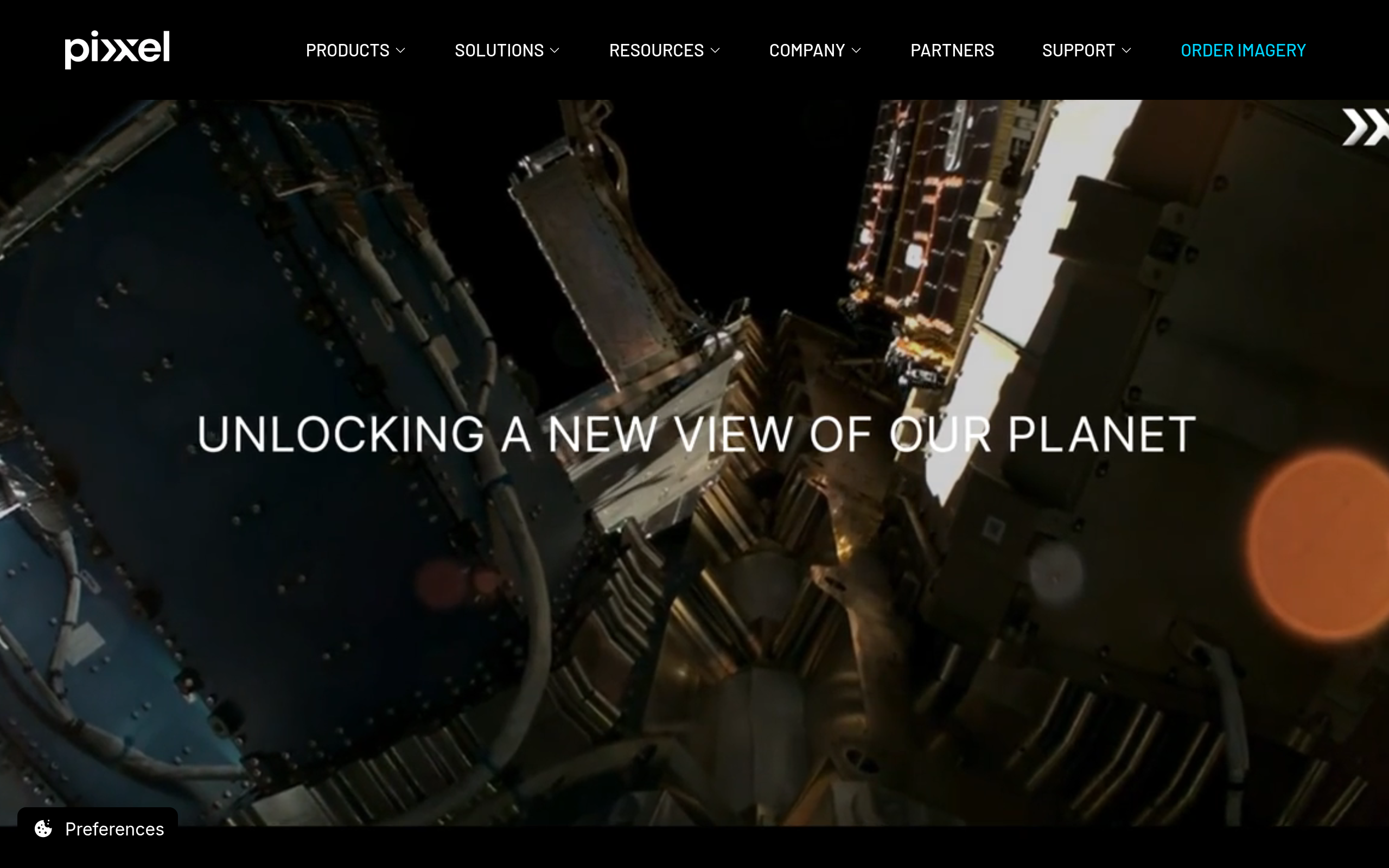
The Firefly Phase 1 constellation comprises six hyperspectral microsatellites, each weighing approximately 50 kg and operating in a sun-synchronous orbit at 550 km altitude. The first three satellites launched on the SpaceX Transporter-12 rideshare in January 2025. The second three launched as rideshare payloads on a SpaceX Falcon 9 NAOS mission on August 26-27, 2025, completing Phase 1.
Before the commercial constellation, Pixxel flew two technology-demonstration satellites. Shakuntala (also referred to as TD-2) launched April 2022 on SpaceX Transporter-4 and has since deorbited. Anand launched November 2022 via ISRO PSLV. These pathfinder missions, including Shakuntala’s sub-15 kg hyperspectral camera at 10 m resolution, de-risked the sensor design before the commercial Firefly series entered production.
The current Firefly sensor specification for Phase 1 is 135+ VNIR spectral bands at 5-metre ground sample distance, with a 40-kilometre swath and a 24-hour global revisit frequency. The spectral range covers 450 to 900 nanometres.
Several Pixxel marketing pages cite “250+ VNIR and SWIR bands.” That figure appears to describe the full capability of future Honeybee-generation satellites, which will extend coverage into the shortwave infrared. Buyers should treat the 135+ bands figure from the /firefly product page as the authoritative reference for procurement specifications.
The next-generation Honeybee series will extend coverage to 470-2500 nm (VNIR + SWIR) at 5 m GSD. Pixxel has indicated a Honeybee-0 tech demonstrator is planned for 2026, but the launch date and full commercial Honeybee constellation timeline have not been publicly confirmed. For data downlink, Pixxel partners with KSAT (Kongsberg Satellite Services), whose global ground station network handles data retrieval. Pixxel does not offer ground station services to third parties.
Aurora analytics platform
Aurora is Pixxel’s cloud-native Earth Observation Studio, accessible at aurora.pixxel.space. The platform supports no-code imagery exploration, a library of AI-powered spectral models covering crop stress, LULC classification, mineral detection, forest health, and oil spill detection, plus 20+ preset spectral indices and custom index creation. Workflow automation and a developer API are included across all tiers.
Archive and tasking orders are placed directly through Aurora using a wallet-and-token system, with imagery costs billed per km² separately from the platform subscription fee. This separation means platform and data costs are independently scalable depending on how much analysis you run versus how much imagery you order.
The model marketplace is a genuine differentiator for buyers who need ready-to-run AI pipelines rather than raw spectral cubes. Pre-trained models allow users to receive insights-ready outputs without building their own inversion algorithms. The quality and accuracy of those models should be validated against your specific geography and crop type before operational deployment.

Pricing
Pixxel publishes per-km² imagery prices publicly via its documentation portal, which places it among the more transparent operators in the hyperspectral segment. Aurora platform access is separate from imagery order costs.
| Product | Price | Unit | Notes |
|---|---|---|---|
| VNIR Hyperspectral Archive | $6 | per km² | 20% discount for archive older than 1 year |
| VNIR Hyperspectral Tasking | $8 | per km² | +15% for cloud cover guarantee at ≤10%; express delivery surcharge planned |
| Aurora Standard | $0 | per user/month | Free; open-source data access, archive and tasking (token-based), indices, model insights |
| Aurora Professional | $150 | per user/month | 150 free tokens/month; 30-day free trial; AOI up to 5,000 km²; 2h/month live tutorials |
| Aurora Enterprise | $180 | per user/month (annual) | 300 free tokens/month; 30-day free trial; 5,000 km² AOI; 6h/month tutorials; $200/month if billed monthly |
The per-km² model suits buyers with defined AOIs and periodic tasking needs. For a 100 km² monthly tasking programme, the imagery cost alone runs $800/month, plus the Aurora subscription if you need the analytics layer. Programmes covering large areas or requiring continuous monitoring should request volume pricing rather than relying on self-serve catalogue rates.
Published rates may be outdated data. Before contracting, confirm current pricing directly with Pixxel, as per-km² rates can change without notice. Custom programmes are available on request.
Who it’s for
Pixxel’s strongest fit is with buyers who genuinely need spectral fingerprinting, not just colour imagery. Multispectral data handles a large proportion of agricultural monitoring and land cover mapping. Hyperspectral is warranted when you need to discriminate subtle chemical or mineralogical signatures that multispectral bands collapse into noise.
Agriculture and precision farming
Crop stress detection based on chlorophyll fluorescence shifts, soil nutrient mapping, and early disease identification are use cases where hyperspectral’s narrow-band sensitivity outperforms multispectral. Pixxel’s combination of 5-metre resolution and 135+ bands means individual field rows are distinguishable and spectrally characterised.
The Aurora crop stress and soil models are ready-to-apply, lowering the barrier for agronomists who prefer not to build their own spectral models. Validated pilots with the Indian Ministry of Agriculture and Australian agritech company DataFarming are on record.
Mining and geological mapping
Mineral identification and exploration-stage geological mapping are well-served by hyperspectral imagery. The Firefly 450-900 nm VNIR range covers diagnostic absorption features for iron oxides and certain alteration indicators, making it applicable to iron-oxide alteration mapping and tailings monitoring. Pixxel addresses this use case with dedicated solution pages and AI model assets for mineral detection.
The principal absorption features for clay minerals and carbonates, however, sit in the SWIR range at 1,400-2,500 nm, which the current Firefly Phase 1 constellation does not cover. For mineralogical alteration mapping where clay and carbonate discrimination is required, SWIR coverage is essential. That means waiting for the Honeybee generation or sourcing complementary SWIR imagery from providers such as Orbital Sidekick’s GHOSt VSWIR constellation.
Energy and environmental monitoring
Oil spill detection, pipeline right-of-way monitoring, and hydrocarbon surface expression mapping are confirmed use cases with active NRO and commercial customer engagements. The 24-hour revisit enables near-daily change detection over fixed infrastructure. Water quality monitoring (algal blooms, turbidity), biodiversity habitat mapping, and GHG monitoring are also cited use cases. VNIR-only coverage limits methane detection capability compared to dedicated SWIR-band instruments, which is worth noting for emissions-monitoring buyers.
Where it’s less competitive
Buyers with purely optical requirements at sub-1-metre resolution will find Pixxel’s 5-metre GSD too coarse for detailed infrastructure or urban mapping work. Wide-area SAR or metre-class optical change detection sits outside Pixxel’s offering entirely. Organisations with tight budgets should factor in that per-km² pricing accumulates quickly at continental scale, and large programmes are better served by custom volume arrangements than self-serve catalogue orders.
Strengths and limitations
In my analysis of Pixxel’s constellation, what stands out most is the gap between spectral depth and constellation maturity. The sensor specs are genuinely excellent for the hyperspectral segment. The commercial track record is still accumulating.
- Highest spatial resolution in a commercial hyperspectral constellation (5 m GSD, 135+ VNIR bands)
- Transparent per-km² pricing with a free Aurora platform tier for evaluation and onboarding
- Strong government validation: NRO five-year contract (2023), second NRO contract (2026), and NASA CSDA programme (2024)
- Vertically integrated stack from satellite to no-code analytics platform, with developer API access
- Global distribution network spanning 30+ reseller partners including UP42, SkyFi, and European Space Imaging
- Phase 1 covers six satellites: 24-hour revisit is achievable but high-frequency temporal stacks will be thinner than mature constellations
- VNIR-only coverage (450-900 nm) in the current constellation; SWIR extension requires next-generation Honeybee satellites with no disclosed launch timeline
- Band-count tension in Pixxel’s own marketing (135+ vs. 250+) requires buyers to use the /firefly product spec as the authoritative reference
- Per-km² imagery pricing accumulates at scale; large-area continuous-monitoring programmes need custom volume pricing
- Wire transfer is required for orders over $5,000; no enterprise-billing flexibility for smaller organisations until that threshold
The pros clearly outweigh the cons for the right buyer profile. Where Pixxel falls short is around constellation scale and spectral range, not around credibility or technical execution.
Pixxel alternatives
Pixxel competes in a narrow segment. The relevant alternatives are other hyperspectral operators or routes that give you hyperspectral data as part of a broader multi-sensor procurement.
| Provider | Sensor type | Spatial resolution | Spectral range | Best for |
|---|---|---|---|---|
| Pixxel (Firefly) | Hyperspectral VNIR | 5 m | 135+ bands, 450-900 nm | Highest-resolution commercial hyperspectral; agriculture, mining, energy |
| Wyvern (Dragonette) | Hyperspectral VNIR | 5.3 m | 23-31 bands, 445-870 nm | Fewer spectral bands; open data programme; smaller budgets |
| Orbital Sidekick (GHOSt) | Hyperspectral VSWIR | 8 m HSI / 3 m Pan | ~468 bands, 400-2500 nm | SWIR coverage for pipeline monitoring and mineralogy |
| Kuva Space (Hyperfield) | Hyperspectral VNIR | 25 m | 100+ bands, 475-950 nm | Landscape-scale; wider swath; European operator |
| Sfera Technologies | Multi-sensor aggregator (hyperspectral + optical + SAR + thermal + RF) | Varies by sensor | Multi-sensor | Hyperspectral as part of a wider multi-sensor order; global ground-station tasking; single vendor |
Wyvern is the closest direct peer in resolution class, but its Dragonette Gen 1 satellites carry significantly fewer spectral bands (23-31 vs. 135+), which limits spectral discrimination capability. Wyvern does offer a free open-data programme that Pixxel does not match, making it a lower-cost entry point for evaluation projects.
Orbital Sidekick is the more relevant alternative for buyers who need SWIR coverage across the 400-2500 nm range, particularly in pipeline monitoring and energy-sector mineralogy, at the cost of coarser spatial resolution. Kuva Space’s 25-metre GSD suits landscape-scale analysis where sub-10-metre detail is not required.
For buyers who need hyperspectral data alongside SAR, thermal, or optical imagery from a single procurement route, a multi-sensor aggregator can broker Pixxel’s Firefly data bundled with complementary sensor types. That route trades direct-operator pricing for the convenience of a unified, multi-sensor order.
Pixxel tops our guide to the best hyperspectral imagery providers.
Verdict
Pixxel is the right choice for buyers with a specific need for high-resolution VNIR hyperspectral imagery and who want a commercially available, government-validated operator rather than a research programme. The Firefly Phase 1 spec, 5 m GSD at 135+ spectral bands, is technically the strongest offering in commercial hyperspectral as of mid-2026, and the Aurora platform lowers the barrier without requiring in-house spectral processing expertise.
The caveats are real. Phase 1 covers six satellites, capable but constrained for high-revisit applications. The VNIR-only coverage means SWIR-dependent mineralogy and dry-matter analysis require either waiting for Honeybee or supplementing with a VSWIR provider. The band-count tension in Pixxel’s own marketing means buyers must treat the dedicated /firefly product page as the authoritative specification source rather than the broader marketing copy. Per-km² pricing requires careful modelling before committing to large-area programmes.
For a mining exploration company needing mineralogical alteration mapping, an agricultural insurer building crop stress indices, or a government agency requiring continuous pipeline monitoring, Pixxel is a serious and credible option backed by two NRO contracts, a NASA award, and a completed first-phase constellation. For buyers who need submetre resolution, SAR capability, SWIR coverage beyond 900 nm, or multi-sensor flexibility from day one, look at alternatives alongside or instead of Pixxel.
Frequently asked questions
Below are the most common questions buyers ask about Pixxel’s technology, pricing, and company background.
How does Pixxel work?
Pixxel operates its own hyperspectral satellites, which capture imagery by splitting incoming light into hundreds of narrow spectral bands. You task a satellite via the Aurora platform, specify your AOI, and receive processed spectral image cubes you can analyze directly in Aurora or export for external processing. Full sensor and platform details are in the section “Data and capabilities“.
Is Pixxel a legit company?
Yes. Pixxel is a real, operating company with six commercial satellites in orbit, NRO and NASA contracts, and $95 million in disclosed VC funding. The legitimacy question is settled. The relevant buyer question is whether Pixxel’s Phase 1 constellation fits your spectral, resolution, and revisit requirements. More detail is in the section “Is Pixxel legit?“
How much does Pixxel cost?
Hyperspectral imagery is priced per km²: archive starts at $6/km² and tasking at $8/km². The Aurora analytics platform has a free Standard tier, with Professional at $150/user/month and Enterprise at $180/user/month (annual billing). All pricing details are in the section “Pricing“, including the wallet and token system for Aurora platform orders.
Does Pixxel have a free tier?
Yes. The Aurora Standard tier is a free platform tier that includes access to open-source data, archive and tasking ordering (token-based), spectral indices, and model insights. Imagery orders are billed separately at the per-km² rate. There is no free imagery allocation. Check “Pricing” for the full tier comparison.
Who owns Pixxel?
Pixxel is privately held, founded and led by Awais Ahmed (CEO) and Kshitij Khandelwal (CTO). The Series B funding round was led by Google, with other investors including Radical Ventures, Lightspeed, M&G Catalyst, and In-Q-Tel. No single investor controls the company. Ownership details are in the section “Is Pixxel legit?“
When was Pixxel founded?
Pixxel was founded on February 27, 2019 by Awais Ahmed and Kshitij Khandelwal in Bengaluru, India. The company began flying technology-demonstration satellites in 2022 and completed its commercial Phase 1 constellation in August 2025. More context is in the section “About Pixxel“.
Where is Pixxel based?
Pixxel’s primary engineering and manufacturing base is in Bengaluru, Karnataka, India (Indiranagar office and Megapixxel manufacturing facility). The US parent entity, Pixxel Space Technologies, Inc., operates from El Segundo, California. The full address is in the section “About Pixxel“.
What are Pixxel’s alternatives?
The nearest hyperspectral alternatives are Wyvern (5.3 m VNIR, fewer bands, free data programme), Orbital Sidekick (VSWIR to 2,500 nm, pipeline/energy focus), and Kuva Space (25 m VNIR, wider swath). For buyers wanting a single vendor across multiple sensor types including hyperspectral, a multi-sensor aggregator is worth considering. The full comparison is in the section “Pixxel alternatives“.

My passions are Earth Observation and Satellites, and my profession is Data Analysis. I combine both within ObservationData.com to show you the use cases of Earth Observation, to help you find the right provider, and to share your experiences.