Choosing a satellite imagery provider is harder than it looks: specifications are scattered across datasheets, pricing is rarely public, and the term “provider” covers everything from constellation operators to self-serve marketplaces. If your need is high-volume single-constellation work, buying direct from the operator is almost always cheaper. If you need free archive imagery for research, Sentinel-2 and Landsat are there. This list focuses on the commercial procurement decision in between.
The ten providers below were selected independently and scored against six criteria. The list intentionally mixes satellite operators, which own and fly their own constellations, with multi-source access platforms that aggregate data from multiple operators. That span is acknowledged upfront, because the right answer depends entirely on whether you need one sensor done well or multiple modalities from a single account.
The profiles run from the strongest overall operator picks down to the most specialized. Planet leads on monitoring-scale coverage, Vantor on VHR accuracy, and Airbus on the breadth of a combined optical-plus-SAR platform. Further down the list you will find the SAR specialists, the daily-analytics builds, and the self-serve access platforms, including SkyFi for contract-free ordering and Sfera as the pick for multi-source access with transparent entry pricing.
Table of Contents
Key takeaways
- Planet leads monitoring workloads as the only operator with near-daily global 3.7 m coverage plus hyperspectral
- Capella and ICEYE are the SAR specialist picks for buyers who need all-weather imaging regardless of cloud
- Rankings weight constellation capability and pricing transparency toward what a procurement team can act on
How we picked the best satellite imagery providers
Six criteria shaped this ranking. For a broad provider category spanning operators and access platforms, data quality at the sensor level matters most: resolution and modality determine what analysis is possible, so these criteria lead the list.
- Data quality: native sensor resolution, spectral modalities available (optical, SAR, hyperspectral, thermal, RF), and the depth of the constellation underpinning the product
- Coverage and revisit: global reach, daily or sub-daily revisit capability, and the number of operational satellites sustaining that cadence
- Pricing transparency: whether per-km² or per-scene rates are public before a sales conversation is required
- Licensing and access: self-serve ordering, API and STAC delivery, and whether a standard commercial license covers the use case or requires negotiation
- Delivery speed: time from tasking request to data in hand, and whether that path goes through a direct operator API or a brokered workflow
- Support and trust signals: compliance certifications, named reference customers, institutional backing, and the provider’s operational track record
The comparison table below summarizes the most decision-critical attributes before the detailed profiles. Delivery, integration, and trust details are covered in each provider’s profile in the section that follows. Providers are ordered from strongest overall pick to most specialized.
Satellite imagery providers compared
The table brings all ten providers side by side on five attributes relevant to a procurement decision. One fact per cell, so you get an at-a-glance reference before reading the full profiles.
| Provider | Primary modality | Best resolution | Pricing transparency | Self-serve ordering | Best for |
|---|---|---|---|---|---|
| Planet | Optical (monitoring + tasking + hyperspectral) | 30 cm (Pelican tasking) | Published tiers from $2,700/yr (monitoring) and $6/km² (archive tasking) | Yes (Planet Select via SkyFi portal) | Near-daily global monitoring at scale |
| Vantor | Optical VHR | 30 cm-class (WorldView Legion, 34 cm native) | Not published (credits model, rates on request) | Yes (Vantor Hub) | Highest-accuracy commercial VHR optical imagery |
| Airbus Defence and Space | Optical + X-band SAR | 30 cm (Pléiades Neo) | Not published (quote-based, free trial available) | Yes (OneAtlas platform) | Combined optical and SAR from one platform |
| BlackSky | Optical (high-revisit) | 35 cm (Gen-3) | Not published (quote-based) | Yes (Spectra AI platform) | Time-diverse revisits for change monitoring |
| Satellogic | Optical + hyperspectral | 50 cm (super-resolution) | Not published (contact sales) | API available (contact sales for access) | Sub-meter optical with built-in hyperspectral per satellite |
| Capella Space | SAR (X-band) | 25 cm (Spotlight Ultra) | Not published (contact/quote) | Yes (Capella Console + REST API) | High-resolution SAR with rapid, flexible tasking |
| ICEYE | SAR (X-band) | 25 cm Dwell Precise (16 cm Gen4) | Not published (contact-based) | Yes (API + tasking platform) | World’s largest SAR constellation for persistent monitoring |
| EarthDaily Analytics | Multispectral/hyperspectral | 5 m (VNIR) | Not published (Pioneer Program) | Pioneer Program (early access) | Daily global change detection with science-grade ARD |
| SkyFi | Multi-source (optical, SAR, aerial) | 30 cm (Vantor via platform) | Prices shown before checkout for all modalities | Yes (web, mobile, API) | Contract-free self-serve ordering across operators |
| Sfera | Multi-source (optical, SAR, thermal, hyperspectral, RF) | 25 cm (SAR via Capella) | Optical per-km² published (SAR/thermal/RF on request) | Web app for optical (contact for SAR/thermal/RF) | Multi-modality access with transparent optical entry pricing |
Every claim in the profiles below comes from each provider’s own published pages. Where data was not publicly available, that gap is noted rather than filled with an estimate.
The 10 best satellite imagery providers
The profiles below give full detail on sensor capability, pricing structure, and ideal buyer for each provider, in order from the strongest overall pick to the most specialized.
1. Planet
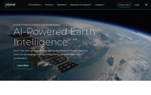 Best for near-daily global optical monitoring at scale. Planet, incorporated as Planet Labs PBC and publicly traded on the NYSE as PL, is a San Francisco satellite operator founded in 2010 by three NASA scientists. The company has deployed 462 satellites since 2013 and maintains approximately 200 in orbit, making it the world’s largest commercial Earth observation fleet by satellite count.
The core product is PlanetScope, delivered by the SuperDove (Dove Gen3+) constellation at 3.7 m GSD across eight spectral bands, with near-daily global coverage and over 25 terabytes of imagery per day. For higher resolution, the SkySat constellation provides 50 cm panchromatic imagery with sub-daily revisit, and the newer Pelican Gen-1 delivers 50 cm orthorectified imagery with commercial operations begun in 2025. Pelican Gen-2, targeting 30 cm at a 6 km swath, is planned for 2026. The NVIDIA Jetson Orin on-board AI platform on Pelican satellites enables on-orbit edge computing for object detection before downlink.
Tanager, the hyperspectral constellation launched in August 2024 and engineered by NASA’s Jet Propulsion Laboratory, adds 424-band VSWIR coverage (400–2,500 nm) at 30 m and weekly revisit, primarily targeting methane and CO2 emission detection.
| Type | Satellite operator, imagery provider, analytics provider |
|---|---|
| HQ | San Francisco, CA, USA |
| Founded | 2010 |
| Ownership | Public (NYSE: PL) |
| Website | planet.com |
Pricing for monitoring is published via area-based annual subscriptions: PlanetScope Area Under Management starts at $2,700 per year for a 50 km² Tier Three AOI. SkySat tasking via the Planet Select portal (powered by SkyFi) is published at $6/km² for archive, $12/km² for flexible tasking, and $40/km² for assured tasking with a 25 km² minimum. Delivery from capture is as fast as three hours for SkySat tasking.
The Planet Insights Platform (built on Sentinel Hub) starts at $28 per month, includes free Sentinel and Landsat data, and carries a 30-day free trial. Named customers include the UK’s Rural Payments Agency, Kazakhstan Space Agency, Bayer, Google, and NASA’s Carbon Mapper program.
The main trade-off is the subscription-based pricing structure: for buyers who need occasional single captures rather than ongoing area monitoring, Planet’s model can feel optimized for large-AUM enterprise workflows rather than ad hoc procurement. In my analysis of the PlanetScope monitoring tiers, the minimum $2,700/year entry point is reasonable for a 50 km² AOI but climbs sharply for global coverage, and SkySat tasking requires the SkyFi portal rather than a direct Planet API for self-service. Our Planet review covers the platform’s pricing tiers and licensing in detail.
2. Vantor
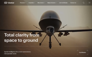 Best for the highest-accuracy very-high-resolution optical imagery on the market. Vantor is the brand formed when Maxar Intelligence rebranded on October 1, 2025 (maxar.com now fully redirects to vantor.com). It is a Westminster, Colorado-based satellite operator, taken private by Advent International in 2023. Vantor Holdings, Inc. is named as the trademark holder in the site footer.
The constellation carries 10 imaging satellites, including six WorldView Legion (WVL) satellites with a 34 cm native Pan GSD (delivered as “30 cm-class” products), WorldView-3 at 31 cm Pan, WorldView-2 at 46 cm, GeoEye-1 at 41 cm, and WorldView-1 at 50 cm. All six WVL satellites were in orbit by February 2025, completing the six-satellite constellation. The constellation collects approximately 7 million square kilometers per day, including 3.5 million at 30 cm-class resolution, with up to 15 revisits per day for high-priority locations. The Vantor Direct Access program delivers imagery as fast as 15 minutes after collection. Rapid Access guarantees six-hour delivery.
Note: the “15 cm HD” product is an ML super-resolution upscale of 30 cm native imagery, not a native 15 cm sensor, as the Vivid Mosaic page confirms. An upcoming expansion announced in April 2026 includes Vantage (20 cm-class, first expected 2029) and Pulse (40 cm-class high-revisit fleet, first expected 2027), which would enable revisit rates of every 15 minutes globally. The SAR product WorldView Radar, powered by Umbra’s constellation, is available in beta via Vantor Hub.
| Type | Satellite operator, imagery provider, analytics provider |
|---|---|
| HQ | Westminster, CO, USA |
| Ownership | Private (Advent International) |
| Website | vantor.com |
The Vantor Hub provides a self-serve web portal with STAC-compliant catalog, tasking API, and basemap streaming. Vantor also maintains a 20-plus year archive covering over 6 billion square kilometers at 30 cm resolution. Named customers include the Netherlands Ministry of Defence (approximately €13.6 million multi-year Hub contract), the U.S. Army’s One World Terrain program, Google Earth, HERE Technologies, Mapbox, and TomTom.
The Tensorglobe AI platform can be deployed on-premises in classified or sovereign environments. Pricing is not published on vantor.com. The Hub uses a credits model, but actual credit rates require a sales contact, which limits budget planning for first-time buyers. Our detailed Vantor review covers the credits model and access tiers.
3. Airbus Defence and Space
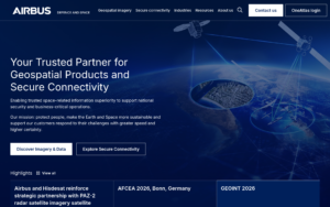 Best for buyers who need both optical and SAR imagery from a single integrated platform. Airbus Defence and Space, registered as Airbus Defence and Space SAS (Toulouse, France) and operating as the Intelligence and Space Digital division of Airbus SE (AIR.PA), has delivered commercial Earth observation since SPOT 1 launched in 1986, giving it the longest continuous commercial optical archive of any provider here.
The optical constellation covers Pléiades Neo at 30 cm Pan (two operational satellites after the December 2022 Vega-C launch failure destroyed Neo 5 and 6, which originally targeted a four-satellite constellation for twice-daily global revisit), Pléiades 1A/1B at 50 cm with a 20 km swath, and SPOT 6 at 1.5 m with a 60 km swath. The AI-enhanced HD15 product upscales 30 cm Neo imagery to 15 cm visual “clarity,” not native resolution.
The Radar Constellation, comprising TerraSAR-X, TanDEM-X (both operating since 2007/2010 under a DLR partnership), and PAZ (operated by Hisdesat since 2018), delivers X-band SAR across six modes from 25 cm Staring SpotLight to 40 m Wide ScanSAR, with global mean revisit under 24 hours and a 4/7-day interferometric repeat cycle for InSAR applications. A January 2026 framework agreement adds Synspective’s Japanese X-band SAR constellation to improve equatorial coverage. The PREMIUM NRT service delivers SAR imagery with an average ±1 hour latency globally.
| Type | Satellite operator, imagery provider, analytics provider |
|---|---|
| HQ | Toulouse, France |
| Founded | 1986 (EO operations start, Airbus SE founded 1970) |
| Ownership | Subsidiary of Airbus SE (Euronext: AIR) |
| Website | space-solutions.airbus.com |
Access is via the OneAtlas platform (optical and DEM products), the Radar Portal (radar.oneatlas.airbus.com), and a SAR developer API (docs.sar.api.intelligence.airbus.com). Free trial “Guest Access” is available for both optical and radar. Airbus distributes through 106 geospatial resellers in 49 countries and partners with UP42, Apollo Mapping, Geocento, and GAF AG, among others. Named customers include the French Ministry of Defence, German Bundeswehr, NATO AGS Force, and Nestlé.
Pricing is not published and each project requires a quote. The limitation worth flagging: TerraSAR-X and TanDEM-X are aging assets (launched 2007 and 2010), and their end-of-life timeline is not stated on the site, though PAZ 2 is announced as a continuity satellite. Our Airbus Defence and Space review covers the constellation roadmap and platform access.
4. BlackSky
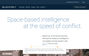 Best for time-diverse revisit monitoring of high-priority locations. BlackSky, incorporated as BlackSky Technology Inc. and publicly traded on the NYSE as BKSY, is headquartered in Herndon, Virginia. Its current generation, Gen-3, delivers 35 cm imagery with four satellites in commercial operations as of March 2026. The company targets 12 Gen-3 satellites by end-2026 and describes an ultimate goal of the world’s largest VHR constellation.
Gen-3 includes RGB, panchromatic, and SWIR bands (SWIR minimum scene 1.8 km², GSD ~1.2 m), and product types span daytime, nighttime, burst (5 frames per pass), stereo pairs and sets, and Area 2×1 mosaics. The mid-inclination orbit (~42-59°), distinct from the sun-synchronous tracks that most optical satellites use, is optimized for multiple time-diverse imaging opportunities over mid-latitude targets throughout the day.
BlackSky states imagery delivery “as little as 60 minutes after collection” at the 16-satellite target constellation. The Spectra AI platform integrates object detection and classification across 35-plus object types (vessels, aircraft, vehicles, people). The company went public via SPAC merger with Osprey Technology Acquisition Corp. in September 2021 and is listed on NYSE as BKSY.
| Type | Satellite operator, imagery provider, analytics provider |
|---|---|
| HQ | Herndon, VA, USA |
| Founded | 2014 (inferred, not stated on site) |
| Ownership | Public (NYSE: BKSY) |
| Website | blacksky.com |
Investors include RRE Ventures and Jana Partners, and the board is chaired by RRE’s Will Porteous. The limitation to weigh: with only four Gen-3 satellites in commercial operations as of March 2026, the headline “60-minute delivery” and “hourly revisit” claims are conditional on a 16-satellite target constellation that has not yet been reached, so actual revisit performance today is more conservative than the marketing implies. Pricing is not published and access requires a direct sales engagement. Our BlackSky review examines how the current constellation size maps to real-world revisit windows.
5. Satellogic
 Best for sub-meter optical imagery with built-in hyperspectral on every satellite. Satellogic, incorporated as Satellogic Inc. and traded on NASDAQ as SATL, was founded in 2010 by Emiliano Kargieman and Gerardo Richarte and listed via SPAC in January 2022. The company is headquartered in Davidson, North Carolina, with operations in Montevideo, Buenos Aires, Córdoba, and Barcelona.
Each NewSat (Aleph-1) spacecraft carries both a multispectral camera (4-band B/G/R/NIR, native 70 cm GSD at 470 km altitude, 50 cm with patented super-resolution post-processing) and a hyperspectral camera (32 VNIR bands, 483–831 nm, 25 m GSD, up to 145 km swath) in the same satellite bus, making co-registered optical and hyperspectral capture available on every tasking order. The company states 57 satellites launched with 100% deployment success rate. Most recent launches include NewSat-53 and NewSat-54 on SpaceX Transporter-16 in March 2026.
Geolocation accuracy is 10 m CE90 for orthorectified products. Vantor includes Satellogic in its virtual constellation and SkyFi carries Satellogic optical imagery via its marketplace. The NextGen 30 cm-class platform with on-orbit AI, announced October 2025, has a first satellite expected operational in 2027.
| Type | Satellite operator, imagery provider |
|---|---|
| HQ | Davidson, NC, USA |
| Founded | 2010 |
| Ownership | Public (NASDAQ: SATL) |
| Website | satellogic.com |
A third-party source notes a CFO departure in June 2026 while a successor is sought, which is the kind of transition worth monitoring for enterprise procurement teams. Pricing is not published on the site and requires a sales contact.
In my assessment of the constellation specs, Satellogic stands out as the only sub-meter optical operator in this list that pairs hyperspectral collection per-satellite by design, rather than as a separate mission or sensor type. The limitation is that the hyperspectral payload resolves at 25 m, not at the sub-meter optical GSD, so the two sensor streams serve complementary rather than identical analytical functions. Our Satellogic review covers the product levels and access models in detail.
6. Capella Space
 Best for high-resolution commercial SAR with rapid, flexible tasking. Capella Space, incorporated as Capella Space Corp. and headquartered in Louisville, Colorado, was founded in 2016 by Payam Banazadeh at Stanford University and acquired by IonQ Inc. (NYSE: IONQ) in July 2025 for $311 million in IonQ stock. It is now operated as an IonQ subsidiary, with Frank Backes as Capella CEO.
The third-generation Acadia-class satellites deliver X-band SAR at 9.3–9.9 GHz with up to 600 MHz imaging bandwidth. The Spotlight Ultra mode achieves 25 cm azimuth resolution over a 5×5 km scene, among the sharpest commercial SAR here, with ICEYE’s Gen4 reaching 16 cm. The mode set spans Spotlight (0.5 m), Spotlight Wide (1.0 m, 10×20 km), Stripmap (1.2 m, 5–100 km length), and Parallel Stripmap (1.2 m, double-coverage in one pass).
Data products are STAC-compliant Cloud Optimized GeoTIFFs delivered via an AWS GovCloud data path. Scheduling cycles run every 20 minutes for a rolling one-week window, with sub-20-minute tasking confirmation. The constellation uses both SSO and mid-inclination orbits, yielding 2–15 revisit opportunities per day. An InSAR service with 3-day repeat cadence launched commercially in May 2026, supporting millimeter-scale deformation monitoring in three spatial dimensions.
| Type | Satellite operator, imagery provider |
|---|---|
| HQ | Louisville, CO, USA |
| Founded | 2016 |
| Ownership | Subsidiary of IonQ Inc. (NYSE: IONQ) |
| Website | capellaspace.com |
The Capella Console web UI and REST API provide self-serve access. The data path aligns to US NIST 800-171 requirements. Pre-acquisition investors included NightDragon (Series C lead) and DCVC. The constellation count on the site shows 20 named missions (Capella-1 through Capella-20) since 2018. An independent TLE source indicates approximately nine active satellites as of May 2026, though Capella does not publish a current active count.
Pricing is not published and access requires a direct sales or API contact. The acquisition by IonQ, a quantum computing company, introduces integration uncertainty that buyers building multi-year programs may want to track. Our Capella Space review covers the sensor modes and access details.
7. ICEYE
 Best for persistent area monitoring backed by the world’s largest SAR constellation. ICEYE, registered as ICEYE Oy and headquartered in Espoo, Finland, was co-founded in 2014 by Rafal Modrzewski and Pekka Laurila. The company completed a Series F round of EUR 1 billion led by General Atlantic in June 2026, at a valuation over EUR 10 billion, following a Series E of EUR 150 million led by General Catalyst in December 2025.
ICEYE also carries a EUR 300 million revolving credit facility and reports EUR 250 million-plus in 2025 revenue with EUR 100 million-plus in profitability and EUR 1.5 billion in backlog.
ICEYE has launched 70 X-band SAR satellites since 2018 (as stated in its own Transporter-16 press release, March 2026), producing the largest SAR constellation commercially. The Gen4 generation, reaching commercial operations in September 2025, achieves up to 16 cm resolution, 1,200 MHz imaging bandwidth, a 400 km high-resolution field of regard, and sub-15-minute revisit capability at the constellation level. Standard imaging modes range from Dwell Precise (25 cm, 5×5 km) down to Scan Wide (27 m, up to 200×600 km).
Data is delivered natively in Cloud Optimized GeoTIFF. The default SLA is delivery within 8 hours of downlink, with an average under 4 hours. ICEYE also offers Flood Insights, Wildfire Insights, and Hurricane Insights as structured analytics products built on top of the SAR data stream.
| Type | Satellite operator, imagery provider, analytics provider |
|---|---|
| HQ | Espoo, Finland |
| Founded | 2014 |
| Ownership | Private (Series F, General Atlantic lead) |
| Website | iceye.com |
ICEYE also sells sovereign intelligence systems: the Polish MikroSAR, a Portuguese Atlantic Constellation satellite, and a Rheinmetall-ICEYE joint venture for European space reconnaissance all flew on the March 2026 Transporter-16 launch, indicating a meaningful sovereign deployment track record. ICEYE US operates as a separate US-entity subsidiary.
Pricing is not published on iceye.com and access requires a sales conversation. The limitation to flag is that the imaging-mode matrix is deep enough that selecting the right mode (Dwell vs. Spot vs. Strip vs. Scan) for a given use case requires more upfront product knowledge than optical imagery procurement typically demands. Our ICEYE review covers the mode selection decision and sovereign system options.
8. EarthDaily Analytics
 Best for broad-area daily change detection with science-grade, CEOS-ARD compliant imagery. EarthDaily Analytics Corp., headquartered in Vancouver, BC, was founded in 2021 in partnership with Antarctica Capital and acquired Descartes Labs in October 2024, integrating the Descartes Labs analytics platform and its Government subsidiary into the combined company.
The EarthDaily Constellation targets ten satellites, with seven in orbit as of June 2026 (EDC-01 launched in 2025, and EDC-02 through EDC-07 launched May 3, 2026 on a SpaceX Falcon 9 rideshare). Full commercial operation is targeted for August 2026, about a year behind the original 2025 target. Each satellite carries 16 imaging systems across 22 spectral bands covering visible through SWIR, in a Loft Orbital spacecraft bus.
The constellation images at 5 m GSD across its VNIR bands. The constellation flies at 594 km altitude, 97.8° SSO, with 13:00 LTDN.
The data is designed for time-series consistency, delivering CEOS-ARD compliant output characterized as “AI-ready” rather than single-image tasking. EarthOne is the platform UI. The platform API and Ag API support programmatic access. The company has a $1.2 million NRO commercial optical EO contract awarded directly in 2026 and serves agriculture and insurance customers including Liberty Mutual Reinsurance and Tokio Marine Seguradora. A Bloomberg Terminal crop intelligence integration went live in July 2025. EarthDaily Federal is the US public-sector division, led by Nicole Toigo.
| Type | Satellite operator (nascent), imagery provider, analytics provider |
|---|---|
| HQ | Vancouver, BC, Canada |
| Founded | 2021 |
| Ownership | Private (Antarctica Capital, Trinity Capital) |
| Website | earthdaily.com |
The honest limitation: EarthDaily’s constellation is still ramping toward full deployment through 2026, so the daily-everywhere cadence it is designed for is not yet fully online. Because the constellation is purpose-built for monitoring cadence rather than single-image tasking, it is a less direct fit for use cases that require on-demand single-scene ordering. Our EarthDaily Analytics review covers what the Pioneer Program evaluation entails and how the analytics layer stacks up post-Descartes acquisition.
9. SkyFi
 Best for contract-free self-serve ordering across multiple optical and SAR operators. SkyFi, incorporated as Optisense, Inc. and headquartered in Austin, Texas, is a satellite imagery marketplace that accesses imagery from 40-plus data and analytics partners, aggregating approximately 150 satellites across optical, SAR, aerial, and open multispectral. Its core differentiation is a checkout flow where buyers select an area of interest, sensor, and resolution, and the price is calculated before payment is required, with no contract or minimum spend.
Optical archive starts at $15 per image, SAR archive at $450 per scene, and SAR tasking at $675 per scene (confirmed on the live pricing page and FAQ as of June 2026). Aerial imagery starts at $35 per image. Optical providers include Vantor (WorldView constellation, 30–50 cm), Planet SkySat (50 cm), and Satellogic. SAR comes from ICEYE US and Umbra at 25 cm spotlight.
SkyFi is the only platform in this list with native iOS and Android apps and an ATAK plugin for defense field operators. ICEYE US operates a white-label SkyFi storefront at iceyeus.skyfi.com, and SkyFi also powers white-label storefronts for Vantor and Planet, indicating meaningful operator trust in its infrastructure. SOC 2 Type II certification covers enterprise procurement compliance. The platform operates in 179 countries with archive delivery under 24 hours stated. CEO is Luke Fischer. Bill Perkins is listed as Founder and Owner.
| Type | Data aggregator, analytics provider, software tool |
|---|---|
| HQ | Austin, TX, USA |
| Ownership | Private (Optisense, Inc.) |
| Website | skyfi.com |
SkyFi is a marketplace, which means it adds a margin over direct operator pricing. For buyers who consistently need a single sensor type at high volume, a direct operator contract will almost always produce a lower per-unit cost. The platform’s value is in removing contracting overhead and providing upfront cost visibility across modalities. Compare the full catalog and pricing structure in our SkyFi review.
10. Sfera
 Best for flexible multi-source access with transparent optical pricing and no operator lock-in. Sfera, registered as Sfera Technologies Ltd. and headquartered in Sofia, Bulgaria, was founded in 2019 by Zdravko Dimitrov. Sfera is a data aggregator: it brokers imagery from named third-party satellite operators and publishes per-km² pricing for optical without requiring a quote, an unusual transparency in a sector where most providers require a sales conversation before any number appears.
The optical catalog covers resolutions from 0.3 m to 3.2 m, with archive pricing starting at $4/km² for 1.0 m multispectral and reaching $30/km² for 0.3 m daily tasking. The minimum order area is as low as 15 km² for some tiers, smaller than many resellers require.
Beyond optical, Sfera brokers X-band SAR from three source operators (Capella Space at 0.25 m–1.2 m, SIIS/KOMPSAT-5 at 0.85 m–20 m, and Hisdesat/PAZ at 0.25 m–40 m), thermal imagery from SatVu (MWIR, ~3.5 m) and Aistech (LWIR, ~26–39 m), hyperspectral from Wyvern’s Dragonette constellation (31 bands, 5.3 m), and RF/ELINT from Unseenlabs (BRO constellation) for maritime dark-ship tracking and land-based radar geolocation. SAR, thermal, hyperspectral, and RF data are priced on contact, not published.
Separately, Sfera operates a commercial ground station network of 12 active sites spanning Europe, the Middle East, Asia, the Americas, Africa, and Oceania, available as a standalone B2B service from €3/minute with an API-first access model across UHF, VHF, S-band, and X-band.
| Type | Data aggregator, imagery provider, ground-station services, RF data provider |
|---|---|
| HQ | Sofia, Bulgaria |
| Founded | 2019 |
| Ownership | Private (investor: Bulgarian Angels Club) |
| Website | sfera.earth |
Sfera does not operate its own satellites, which is both the limitation and the design choice: the company’s own site frames it as “Sfera is the result of prior efforts to create a lean EO satellite mission. We realized that not sensor availability, but data delivery is the key problem.” No named reference customers are published, and funding details are not disclosed beyond the Bulgarian Angels Club investor note.
For procurement teams evaluating a new vendor, the absence of public case studies requires more due diligence than the larger platforms demand. The honest trade-off is that Sfera’s optical pricing transparency is a genuine procurement advantage over most of its peers, while the modality breadth is unique at this price entry point. Our Sfera review covers the full pricing table and the ground station service in detail.
How to choose a satellite imagery provider
The right provider depends on three variables: what sensor type your analysis requires, how much collection capacity you need over time, and whether you need one sensor done well or multiple modalities from a single account.
Operators versus access platforms
The ten providers in this list split into two camps. Operators (Planet, Vantor, Airbus, BlackSky, Satellogic, Capella, ICEYE, EarthDaily) own and fly their own satellites and sell data directly. Access platforms (SkyFi, Sfera) broker data from multiple operators through a single account. Buying direct gives you the full depth of one constellation and generally the best unit price at volume.
Buying through a platform removes contracting overhead and lets you switch between sensors without separate agreements, at a markup. For most commercial buyers starting out, an access platform is the faster path to first data. For buyers with consistent high-volume needs from a specific sensor, a direct operator agreement typically pays off within six to twelve months.
Optical resolution requirements
For change detection at monitoring scale, Planet’s 3.7 m SuperDove is the workhorse: near-daily global at an area-subscription price that makes sense for large AOIs. For mapping and object analysis, 50 cm and below is the practical threshold: Vantor at 30 cm-class, Airbus Pléiades Neo at 30 cm, BlackSky Gen-3 at 35 cm, and Satellogic’s super-resolution 50 cm are the main options. The resolution claims all state a best-case figure. Actual usable resolution at your off-nadir angle will be coarser than the nadir-spec headline.
SAR requirements
If cloud cover, night imaging, or all-weather collection is a hard requirement, the optical operators above are the wrong starting point. For SAR, Capella leads on single-scene resolution at 25 cm. ICEYE leads on constellation size and persistent coverage, with the Gen4 generation now reaching 16 cm. Airbus covers SAR as a complement to its optical products from the same platform, which is useful if you need fused optical-SAR workflows. All three SAR providers require a sales conversation to get pricing.
Specialty modalities
Hyperspectral at satellite scale is currently available via Planet’s Tanager (30 m, methane/CO2 focus), Satellogic’s per-satellite VNIR payload (25 m, vegetation and water quality), and Sfera’s brokered Wyvern data (5.3 m, 31 bands). Thermal is a Sfera specialty via SatVu MWIR and Aistech LWIR, though both are quote-based. RF/ELINT for maritime surveillance runs only through Sfera’s Unseenlabs feed at this level of commercial accessibility. EarthDaily’s 22-band constellation is purpose-built for time-series analytics at 5 m GSD across its VNIR bands, though it is still ramping toward full deployment in 2026.
Budget and pricing visibility
Only Planet, SkyFi, and Sfera’s optical tier publish prices before a sales conversation. Planet’s monitoring subscriptions start at $2,700/year, SkyFi’s archive optical starts at $15/image, and Sfera’s optical archive starts at $4/km². All other providers in this list require a quote before any number appears. That is not unusual in an enterprise data market, but it does mean that budget planning for a first-time order with Vantor, Airbus, BlackSky, Capella, ICEYE, Satellogic, or EarthDaily requires committing to a sales process before seeing a figure.
Verdict
Planet leads this list for the breadth of its monitoring offer: near-daily 3.7 m global coverage, sub-50 cm tasking (SkySat and Pelican), hyperspectral via Tanager, and the Insights Platform all justify the top rank for buyers with ongoing monitoring needs across multiple use cases. The closest challenge to Planet’s position comes from Airbus, which pairs 30 cm optical with a fully integrated X-band SAR constellation in a single platform and a 40-year archive depth that Planet cannot match.
Vantor is the clear pick for highest single-scene accuracy: the WorldView Legion constellation at 30 cm-class with up to 15 daily revisits, Direct Access at 15-minute delivery, and the 20-plus-year archive remain unmatched on the VHR optical side. BlackSky’s time-diverse mid-inclination revisit model is a better fit than Planet or Vantor for buyers who specifically need multiple images of the same site at different times of day. Satellogic is the natural choice when hyperspectral and sub-meter optical need to come from the same tasking order.
For SAR-only workflows, Capella and ICEYE both reach 25 cm catalog resolution (ICEYE’s Gen4 extends to 16 cm), with ICEYE also leading on constellation depth and persistent-monitoring analytics. EarthDaily’s positioning as a science-grade daily-change-detection platform is distinct from any other entry here, but the constellation ramp-up means it is still more of a forward-looking Pioneer Program engagement than a ready-to-order catalog in mid-2026.
SkyFi and Sfera address different procurement preferences: SkyFi is the fastest path to a first order with published checkout prices across optical and SAR. Sfera adds thermal, hyperspectral, and RF/ELINT to the optical transparency model, and its ground station network is a meaningful secondary capability for operators who also need downlink services from one vendor.
Frequently asked questions
The questions below cover the most common decision points when evaluating a satellite imagery provider for the first time.
What is the difference between a satellite operator and an imagery provider?
A satellite operator owns and flies its own constellation and sells data directly, while an imagery provider may instead broker data from several operators through one account, as Sfera and SkyFi do. The distinction matters most for pricing at high volume, where operators offer direct volume deals that brokers mark up. See the section “How to choose a satellite imagery provider” for when each model fits.
Which satellite imagery provider has the best resolution?
For optical imagery, the headline leaders are Vantor (34 cm native from WorldView Legion), Airbus Pléiades Neo (30 cm), and BlackSky Gen-3 (35 cm), while Capella Space and ICEYE both reach 25 cm in their finest SAR Spotlight modes. Resolution claims are always nadir-best-case figures, and usable resolution varies with off-nadir angle. Compare all providers in the “satellite imagery providers compared” table.
Can you get satellite imagery without a contract?
Yes, SkyFi requires no contract, shows prices before checkout, and has no minimum spend, and Planet’s tasking is also available contract-free via Planet Select. Free public archives like Sentinel-2 (10 m) and Landsat (30 m) need no commercial terms at all, the right tool for coarse-resolution research. See the “The 10 best satellite imagery providers” section for access models.
Which provider is best for SAR imagery?
Capella Space leads on single-scene resolution (25 cm Spotlight Ultra) and ICEYE leads on constellation size, persistent monitoring analytics, and sovereign deployment track record. Airbus’s Radar Constellation offers X-band SAR as part of a combined optical-SAR platform, the natural choice if you already use Pléiades for optical. Pricing for all three requires a sales quote. See the “How to choose” section for the SAR-specific guidance.
Which satellite imagery provider publishes its pricing?
Only three providers in this list publish prices before a sales conversation: Planet (monitoring subscriptions from $2,700/year, tasking from $6/km²), SkyFi (archive optical from $15/image, SAR archive from $450/scene), and Sfera (optical archive from $4/km²). All other providers require a quote. Price transparency varies significantly by modality even within one provider, where Sfera publishes optical prices but not SAR or thermal. See the “satellite imagery providers compared” table for the transparency column across all ten providers.
What is a good satellite imagery provider for beginners?
SkyFi is the most accessible starting point: no contract, prices shown before checkout, a mobile app, and no developer experience required. Planet’s free 30-day trial on the Insights Platform covers Sentinel-2, Landsat, and MODIS with API access, making it the best free entry point for developers evaluating the ecosystem before a subscription commitment. See the full comparison in the “The 10 best satellite imagery providers” section.
Is it cheaper to buy satellite imagery direct from the operator or through a broker?
Direct operator contracts are almost always cheaper per unit at high volume because aggregators add a margin on top of operator pricing. The cost trade-off is procurement time and contract complexity versus per-km² rate: for a single-modality buyer with consistent high volume, a direct agreement with Planet, Capella, or ICEYE will typically outperform a marketplace price within six to twelve months. See the “How to choose” section for the full operator-versus-platform breakdown.

My passions are Earth Observation and Satellites, and my profession is Data Analysis. I combine both within ObservationData.com to show you the use cases of Earth Observation, to help you find the right provider, and to share your experiences.