
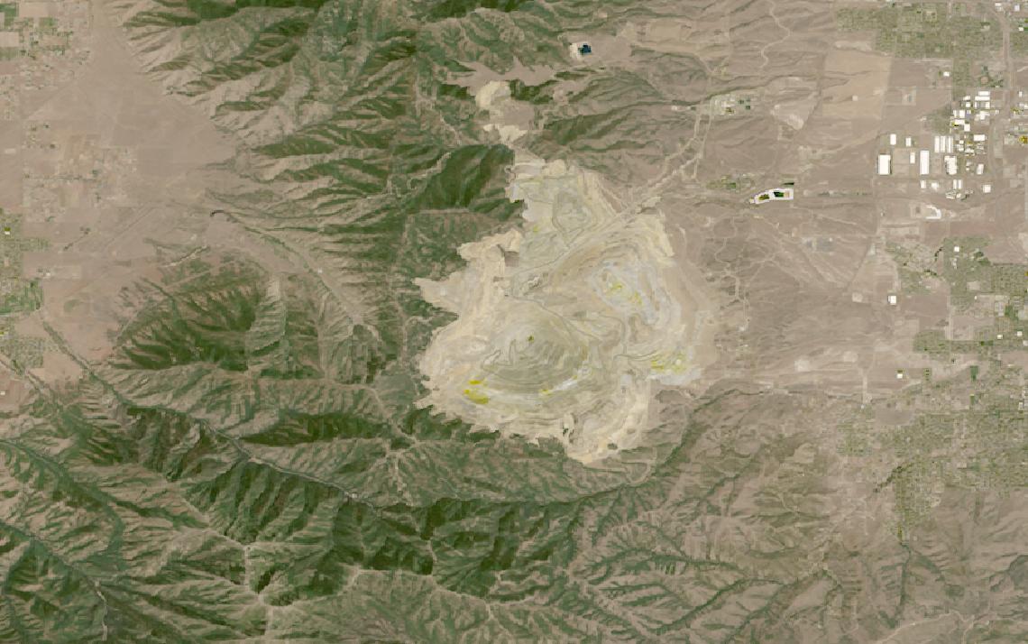
Deformation and contamination develop across hazardous terrain no crew can walk often enough to catch them early.
Satellite data measures the same dam face on schedule, turning slow or invisible change into a trend.
This guide matches mining tasks to the right data and provider, from deformation to compliance.
Table of Contents
Key takeaways
- Mining operators lean on continuous deformation monitoring across pits and tailings facilities that ground crews cannot match
- Tailings dam safety runs on SAR-based InSAR, but mineral exploration pulls in hyperspectral alteration mapping instead
- The shortlist narrows fast once you know whether you need millimetric deformation data or broad optical site coverage
Every mining program needs a data baseline before any provider enters the conversation. The summary below sets out the sensors, resolution, and cadence that operational mine monitoring runs on.
| Primary sensors | SAR (InSAR), hyperspectral, multispectral optical |
|---|---|
| Working resolution | 3-20 m SAR, 0.3-5 m optical and hyperspectral |
| Typical revisit | Six to twelve days with Sentinel-1 |
| Core indices | Millimetric deformation, VNIR alteration signatures |
| Entry cost | Free via Sentinel-1 archive, or quote-based tasking |
| Main constraint | Deformation trends need a multi-year SAR archive |
Those figures cover the baseline most tailings and pit-monitoring programs run on. Departures into exploration-grade mineralogy, continuous seepage monitoring, or third-party audit evidence change both the sensor mix and the cost.
How satellite data is used in mining
Satellite data enters mining programs at several distinct points in the operating and compliance cycle, each pulling on a different sensor type and delivering a different kind of decision support to site managers, geologists, and compliance teams.
Tailings dam and slope stability monitoring
The mining industry’s own tailings safety framework reinforces this shift toward continuous monitoring. The Global Industry Standard on Tailings Management, published in August 2020 by the Global Tailings Review and co-convened by the International Council on Mining and Metals, UNEP, and the Principles for Responsible Investment, sets out six topic areas across 15 principles and 77 auditable requirements.
Its own monitoring requirement is explicit that “a comprehensive monitoring system must support the full implementation of the Observational Method“, with a performance-based approach to how tailings facilities are designed, built, and operated. The standard names no specific technology: InSAR has become a common way operators meet that expectation, not a requirement written into the standard itself.
ICMM members committed their highest-consequence facilities to conformance by August 2023, with all other facilities not yet in safe closure following by August 2025.
TRE ALTAMIRA builds its InSAR service on exactly this deformation-trend question. The company processes third-party SAR data, mainly Sentinel-1 and a multi-year Airbus framework agreement covering TerraSAR-X and PAZ, through its proprietary SqueeSAR algorithm, and its own technology page states an average displacement rate precision below 1 millimeter per year. Barrick’s Lumwana copper mine is among its named monitoring engagements, and the company partners with IDS GeoRadar on a joint mines-monitoring offering.
3vGeomatics runs a parallel service from Vancouver, now inside Orica’s GeoSolutions division after a 2024 acquisition, which gives it a direct line into one of the mining industry’s own technology providers. Its Displacement DataStream product updates displacement measurements rapidly after each new image acquisition rather than on a fixed reporting cycle, and the company lists open-pit slope stability, underground shaft monitoring, and tailings dam deformation among its core use cases.
Other SAR constellations feed similar analytics indirectly: Synspective’s StriX satellites, for instance, support a tailings-dam InSAR partnership with Insight Terra, reinforcing how widely this same deformation-monitoring approach has spread across the industry.
Mineral exploration and alteration mapping
Exploration geology depends on distinguishing rock and soil types that look identical in a standard three-band photo. Hyperspectral sensors split reflected light into dozens of narrow bands, and specific absorption patterns across those bands correspond to specific minerals and alteration zones that often signal a nearby ore body. Pixxel’s Firefly constellation delivers this at 5-meter resolution with daily revisit across a 40-kilometer swath.

That coverage resolves iron oxides and several other alteration indicators well, but it is not the full mineralogical picture. Diagnostic absorption features for clay minerals and carbonates, two of the most useful indicators in porphyry and epithermal exploration, sit in the shortwave-infrared range, which current commercial hyperspectral constellations are only beginning to add. Full clay and carbonate discrimination still typically calls on airborne campaigns or narrower, project-specific tasking.
Sfera Technologies offers hyperspectral access at 5.3 meters across 31 spectral bands as part of a broader multi-sensor contract, without operating any satellites of its own, giving exploration teams a single point of contact alongside optical, SAR, and thermal data for the same project area.
Mine site and stockpile monitoring
Day-to-day operations need a different kind of picture: how much material sits in a stockpile, whether haul roads and pit benches match the plan, and whether a new pit extension has broken ground. Planet’s PlanetScope constellation revisits the same site nearly every day at 3-meter resolution, priced as a standing area subscription rather than one-off orders.
Airbus markets its Pléiades Neo constellation directly at this problem, naming oil, gas, mining, and energy customers as a vertical it serves with 30-centimeter optical data for project planning, exploration, and production monitoring. Its SPOT satellites add a wider 60-kilometer swath, useful for covering an entire concession boundary in a single pass rather than stitching scenes together.
Water quality and tailings seepage detection
A tailings facility that is leaking rarely announces itself on the surface first; it shows up as a change in downstream water chemistry. Satelytics runs spectral algorithms over multispectral and hyperspectral imagery, sourced from whatever satellite, aircraft, or drone a customer already uses, tuned to flag acid rock drainage and tailings pond condition among its published mining use cases.
The same sensor-agnostic approach extends to broader water chemistry: the platform’s published detection list includes several dissolved-metal and salinity indicators, plus biological markers like chlorophyll-a, giving compliance teams a documented, repeatable record rather than a one-time lab sample.
Environmental compliance and rehabilitation tracking
Mine closure plans increasingly need to prove that rehabilitated land is actually recovering, not just that seed was spread. Repeated multispectral imagery tracks vegetation indices across a former pit or waste-rock dump over successive growing seasons, turning a rehabilitation claim into a comparable, dated record rather than a single site-visit photo.
The same imagery stream doubles as audit evidence for the tailings governance commitments mining companies increasingly operate under: a continuously updated archive is easier to hand to an auditor or regulator than a file of ad hoc inspection reports.
Illegal and artisanal mining detection
Unauthorized excavation leaves a distinctive signature: bare soil and disturbed vegetation where a land-cover map says there should be none. Pixxel lists illegal mining detection alongside its exploration and geological mapping use cases, and frequent optical revisit is what actually catches it early, since a gap of weeks between images lets a small operation come and go unnoticed.
SAR-based operators add a second layer: constellations designed for daily or sub-daily revisit, such as ICEYE’s, keep working through the cloud cover that hides many remote and artisanal mining sites from optical sensors for weeks at a time.
Canopy is a different obstacle, and radar does not simply solve it. The X-band wavelengths that commercial SAR constellations fly interact mostly with leaves at the top of the tree crown, so an excavation under closed forest shows up once it has opened a clearing large enough to read as bare ground, not before.
What satellite data you need for mining
Different mining tasks require different sensor modalities, resolutions, and revisit frequencies. The table below maps each common task to the data specifications it requires.
| Task | Sensor modality | Resolution | Revisit | Key index / band |
|---|---|---|---|---|
| Tailings dam deformation | SAR (InSAR) | 3-20 m | 6-12 days | Sub-cm/year displacement |
| Open-pit slope stability | SAR (InSAR) | 3-20 m | 6-12 days | Millimetric displacement rate |
| Mineral exploration and alteration mapping | Hyperspectral | 5 m | Daily | VNIR alteration signatures |
| Mine site and stockpile monitoring | Multispectral optical | 0.3-3 m | Daily to sub-daily | Change detection, volumetrics |
| Water quality and tailings seepage | Multispectral optical | 3-10 m | Days | Turbidity and chemical indices |
| Environmental compliance and rehabilitation | Multispectral optical | 3-30 m | Weekly to seasonal | NDVI, land cover change |
| Illegal and artisanal mining detection | Multispectral optical or SAR | 3-10 m | Daily to weekly | Land cover change |
With data requirements mapped, the next step is identifying which providers can supply them. The section below covers the most relevant options for mining programs, from InSAR analytics specialists to imagery operators.
Satellite data providers for mining
The providers below have documented mining use cases and data products that map to the tasks in the table above. The mix spans SAR analytics specialists, satellite operators, and multi-source access points.
| Provider | Type | Best for | Key mining spec | Entry point |
|---|---|---|---|---|
| TRE ALTAMIRA | Analytics platform | Tailings dam and slope InSAR | Sub-mm/year SqueeSAR precision | Quote-based |
| 3vGeomatics | Analytics platform | Near-real-time slope monitoring | Rapid updates per acquisition | Enterprise contract |
| Planet | Satellite operator | Near-daily mine site monitoring | PlanetScope 3 m, daily revisit | Imagery from $2,700 per year |
| Airbus | Satellite operator | Mine site exploration imagery | Pléiades Neo, 30 cm optical | Quote or UP42 marketplace |
| Satelytics | Analytics platform | Tailings pond and dam alerts | Sensor-agnostic spectral analytics | Contact for pricing |
| Pixxel | Satellite operator | Mineral exploration mapping | 5 m hyperspectral, daily revisit | Free tier, then $150 per month |
| Sfera Technologies | Multi-source access point | Several sensor types in one contract | Optical, SAR, hyperspectral | From $4 per km² optical |
For a ranked shortlist of providers across the wider market, our guide to the best satellite imagery providers covers head-to-head specifications beyond mining. Exploration teams evaluating spectral data specifically should also review the best hyperspectral imagery providers guide, which ranks the current commercial options for mineral mapping.
How to choose satellite data for mining
My reading of tailings monitoring is that the standard drives the buying, not the technology. Operators need a defensible monitoring system, InSAR happens to deliver one, and the deformation record only counts if it is continuous rather than sampled when convenient.
The first decision is what the data has to prove. A deformation trend line for a tailings dam and a mineral map for an exploration lease are different products built from different sensors, and a provider strong at one is rarely the cheapest route to the other. Dam safety is a repeated-measurement problem; exploration is closer to a one-time or periodic mapping exercise.
Regulatory and safety exposure sets the second cut. Programs answering to a tailings governance framework need a continuous, auditable time series rather than an occasional survey, which is why analytics providers built specifically for deformation monitoring tend to fit that requirement better than a general imagery subscription. A single high-resolution image proves nothing about trend or rate of movement.
Terrain and climate decide the sensor mix next. Optical imagery works well for exploration mapping and site monitoring in dry, open environments, but humid or high-altitude mining regions lose days to cloud. SAR deformation monitoring keeps measuring through cloud and at night, which is why it dominates dam and slope safety work regardless of climate.
Radar carries its own geometric constraint. Because a SAR sensor looks sideways rather than straight down, steep terrain produces layover and radar shadow, and a pit wall facing away from the satellite may return no usable signal at all. Which orbit and look direction a provider can offer over your structure is therefore a technical question worth asking early.
Budget and scale follow from how often you need an answer. Continuous monitoring of an active pit or tailings facility is cheaper on a standing subscription or contract than on repeated one-off orders, while a single exploration campaign or a due-diligence survey ahead of an acquisition is the case for per-scene or archive access instead.
Data rights carry particular weight for compliance and safety work: verify whether your intended use, including regulatory submission, third-party audit, and insurer disclosure, is permitted under the provider’s standard license before committing, since dam-safety evidence often needs to leave your own organization.
Verdict
Mining is the vertical where satellite monitoring has moved from a nice-to-have to an operating habit, driven as much by tailings safety governance as by the economics of watching thousands of hectares from orbit instead of on foot. Deformation monitoring on Sentinel-1 and commercial SAR is a mature, if never fully commoditized, service category, sold almost entirely as an analytics product rather than raw imagery.
Teams responsible for tailings dam and slope safety should start with TRE ALTAMIRA or 3vGeomatics, both pure-play InSAR analytics providers built around exactly that deformation-trend question. Exploration and geology teams need hyperspectral data that resolves mineral alteration, which narrows the field to Pixxel’s own constellation or a broker relationship for archive access. Day-to-day site and stockpile monitoring is a broader optical job that Planet and Airbus both serve well, at different resolution and revisit points.
Programs that span all three, deformation, exploration, and routine site monitoring, draw on SAR, hyperspectral, and optical data from different operators, and a single multi-source contract can replace several separate vendor relationships. For a full ranked view of the imagery market, see our satellite imagery providers guide. For hyperspectral exploration work, the hyperspectral imagery providers ranking covers the current commercial options.
Frequently asked questions
Below are answers to the questions mining buyers most commonly ask. Each answer points to the section where the full detail lives.
How is satellite data used in mining?
Satellite data covers six workflows in mining: tailings dam and slope stability monitoring, mineral exploration and alteration mapping, mine site and stockpile monitoring, water quality and seepage detection, environmental compliance and rehabilitation tracking, and illegal or artisanal mining detection. The detail is in “How satellite data is used in mining“.
Does the GISTM require satellite monitoring?
No. The Global Industry Standard on Tailings Management requires a comprehensive monitoring system that supports the Observational Method, not any specific technology. InSAR has become a common way operators meet that requirement, not a mandate written into the standard itself. The distinction is explained in “How satellite data is used in mining“.
Can satellites detect tailings dam failure risk before it happens?
InSAR analytics can detect and track ground deformation at millimeter-scale precision, the leading indicator monitoring programs use to flag a facility moving outside its expected behavior. It measures movement, not risk directly, so it feeds into a facility’s broader monitoring system rather than replacing it. More on this is in “How satellite data is used in mining“.
What resolution do I need for mineral exploration?
Commercial hyperspectral constellations currently deliver around 5-meter resolution, fine enough for alteration mapping in the visible and near-infrared range that flags iron oxides and similar surface indicators. Full clay and carbonate discrimination needs shortwave-infrared bands that today’s commercial hyperspectral fleets are only beginning to add. The full task-to-resolution mapping is in “What satellite data you need for mining“.
Which satellite data providers are best for mining?
TRE ALTAMIRA and 3vGeomatics lead on InSAR deformation analytics for tailings dams and slopes, Pixxel supplies the hyperspectral data exploration teams need, and Planet and Airbus cover day-to-day site and stockpile monitoring at different resolutions. Provider details and access models are in “Satellite data providers for mining“.
Can satellites replace ground-based slope monitoring instruments?
No, and providers do not position it that way. Ground-based radar, GNSS, and piezometers give continuous, real-time readings at a single structure, while satellite InSAR adds wide-area context and a historical baseline across sites that are not instrumented. Choosing between or combining the two is covered in “How to choose satellite data for mining“.

My passions are Earth Observation and Satellites, and my profession is Data Analysis. I combine both within ObservationData.com to show you the use cases of Earth Observation, to help you find the right provider, and to share your experiences.
