
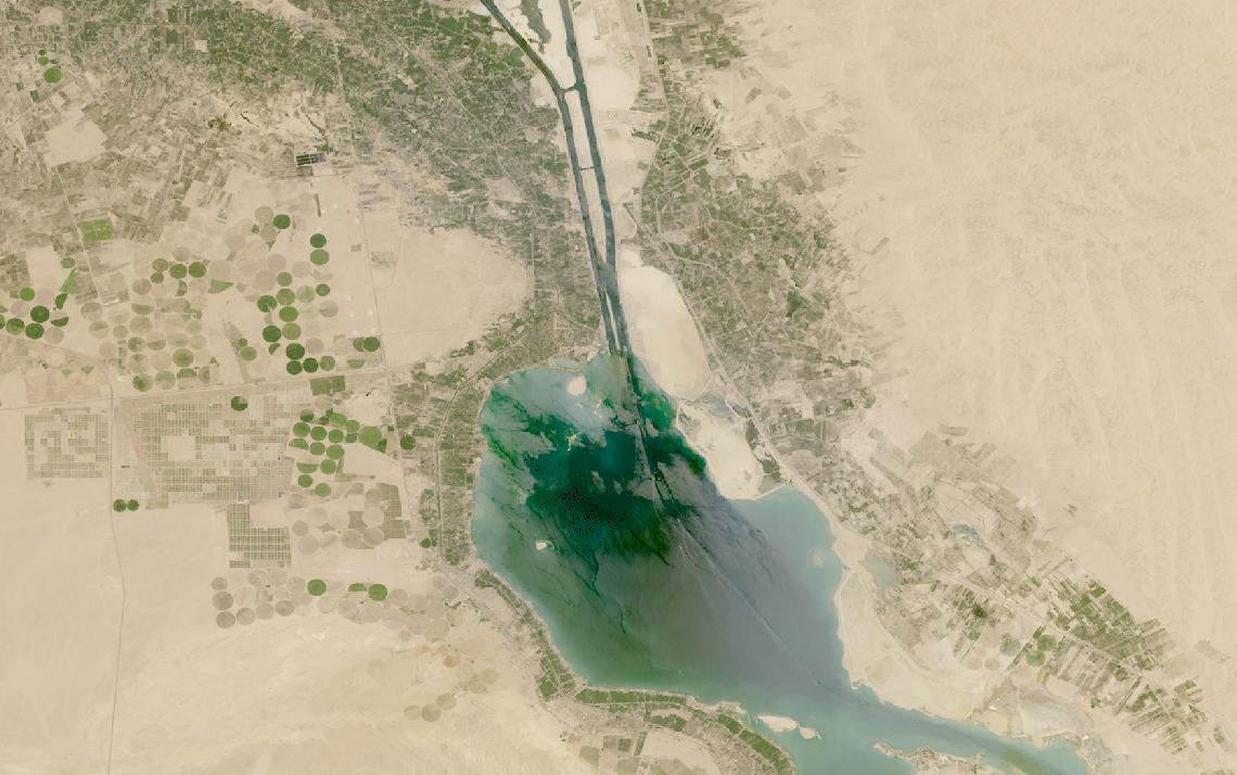
Contested territory denies ground access, and national assets are committed elsewhere.
Satellite data gives repeatable, independent observation of any location, whatever the weather or hour.
This guide matches defense missions to the right data and provider.
Table of Contents
Key takeaways
- Defense programs increasingly supplement national assets with commercial VHR optical, SAR, and RF data
- Wide-area monitoring runs on VHR optical, but all-weather coverage needs SAR once cloud cover or darkness rules out imaging
- The shortlist narrows fast once you know whether the mission needs persistent tasking, all-weather SAR, or RF emitter geolocation
Before evaluating any single provider, a defense program has to settle what its mission actually requires from the data. The summary below sets out the sensor mix, resolution, and delivery speed that operational defense tasking depends on.
| Primary sensors | VHR optical, SAR, RF geolocation |
|---|---|
| Working resolution | 0.16-1 m for imaging modes |
| Typical revisit | Sub-daily for tasked targets |
| Core indices | Change detection, object counts |
| Entry cost | Quote-based, or from $675 per scene |
| Main constraint | Export and licensing vary by vendor |
Those figures cover the baseline most tasking programs run on. Missions that depart from it, through persistent wide-area watch, all-weather SAR, or covert RF geolocation, change both the sensor mix and the delivery timeline.
How satellite data is used in defense
Satellite data enters defense and intelligence programs at several distinct points in the decision cycle, each drawing on a different sensor type and delivery speed depending on what the mission needs to know.
Persistent wide-area surveillance
Wide-area surveillance depends on revisiting the same location often enough to catch a change before it goes stale. Vantor’s WorldView Legion satellites revisit a single target up to 15 times in a single day, a cadence built for monitoring facilities, borders, and activity that shifts over time.
BlackSky takes a different orbital approach to the same problem. Its constellation flies at mid-inclination rather than the sun-synchronous orbit most optical operators use, producing passes at different times of day over the same target instead of one fixed daily pass, useful for catching activity tied to a specific hour.
All-weather and night imaging with SAR
Optical sensors cannot see through cloud, smoke, or darkness, which is a real problem in any theater where weather cannot be controlled. Synthetic aperture radar solves this by transmitting its own signal and measuring the return, so it images day or night and through cloud cover.
Capella Space, ICEYE, and Umbra each operate dedicated X-band SAR constellations built around this capability. Capella’s Spotlight Ultra mode reaches 0.25 m resolution, ICEYE’s Gen4 satellites reach up to 16 cm, and Umbra sells its 25 cm Spotlight product at published per-scene prices rather than a quote-only model.
Airbus adds a third route into the same modality. Its Radar Constellation, built on TerraSAR-X, TanDEM-X, and PAZ, reaches 25 cm resolution in Staring SpotLight mode and delivers data through a premium service averaging about one hour globally, alongside the same operator’s 30 cm optical constellation.
RF geolocation of emitters
Not every target radiates in a way a camera or radar can see, but almost everything that transmits does. HawkEye 360 flies its satellites in formation-flying clusters of three, using the time and frequency differences between when each satellite receives a signal to calculate where it came from on the ground, at sea, or in the air.
This geolocation method, known as TDOA and FDOA, covers communications, navigation, and radar emissions. It is particularly suited to identifying vessels that have switched off their tracking systems, since a radar or radio emission gives away a ship’s position independent of whether it broadcasts its location.
Tasking and revisit for time-critical targets
Some defense missions cannot wait for the next scheduled pass. Vantor’s Direct Access program lets customers with their own receiving equipment get imagery as fast as 15 minutes after collection, while its Rapid Access tier guarantees six-hour delivery for less urgent orders.
Capella schedules new tasking requests every 20 minutes and confirms whether a request was accepted in under 20 minutes. BlackSky advertises sub-90-minute delivery from collection to customer, and ICEYE’s Tactical Access product delivers imagery to a dedicated antenna in under an hour.
Change detection and damage assessment
A single image shows a place; two images taken apart in time show what happened to it. Vantor’s Sentry product runs this comparison continuously across hundreds of sites at once, flagging new construction, equipment movement, or other change without an analyst reviewing every frame.
BlackSky’s Spectra platform runs a similar comparative analysis on its own archive, and its AI models classify more than 35 object types automatically, from vehicles to vessels to aircraft. The result is a running record of what changed at a site rather than a single snapshot.
Commercial imagery in open-source intelligence
Commercially available imagery is no longer a niche supplement to national intelligence collection. Vantor’s GEGD program alone distributes GEOINT to more than a million users and, per the company, supports 90 percent of the US Government’s foundational geospatial intelligence.
Named government and alliance customers appear across nearly every operator in this space: Airbus counts NATO’s Allied Ground Surveillance Force among its customers, and ICEYE has a standing SAR data agreement with NATO’s Allied Command Operations. This breadth is what lets analysts corroborate a single event from more than one commercial source.
That arrangement now has a permanent frame. NATO’s Alliance Persistent Surveillance from Space programme declared Initial Operational Capability on 4 December 2025, three years after launch, and unites national and commercial contributions from 18 Allies in a virtual constellation named Aquila.
The point for a buyer is what that says about the market: an alliance with its own reconnaissance satellites still contracts commercially, and routes the result into Allied Command Operations’ own intelligence cycle.
What satellite data you need for defense
Different defense tasks call for different sensor types, resolutions, and revisit rates. The table below maps each common task to the data specifications it requires.
| Task | Sensor modality | Resolution | Revisit | Key index / band |
|---|---|---|---|---|
| Wide-area surveillance | Multispectral optical | 0.3-0.5 m | Sub-daily to daily | Pan-sharpened RGB |
| Persistent site monitoring | VHR optical (tasked) | 0.3-1 m | Multiple times daily | Change detection |
| All-weather monitoring | SAR (X-band) | 0.25-3 m | Sub-daily | Backscatter change |
| Denied or cloud-heavy areas | SAR (X-band) | 0.25-1 m | Daily or better | Coherent change |
| Emitter geolocation | RF (SDR payload) | Non-imaging | Recurring passes | TDOA/FDOA fix |
| Time-critical tasking | VHR optical or SAR | 0.25-0.5 m | Minutes to hours | Priority tasking |
| Maritime domain awareness | SAR and RF | 0.25-3 m | Sub-daily | Dark-vessel ID |
| Open-source reporting | Commercial VHR archive | 0.3-1.5 m | As available | Annotated imagery |
With data requirements mapped, the next step is identifying which providers can supply them. The section below covers the operators most relevant to defense and intelligence programs, across optical, SAR, and RF.
Satellite data providers for defense
The providers below have documented defense and intelligence use cases that map to the tasks in the table above. The list includes Vantor, the imagery business formerly known as Maxar Intelligence, alongside optical, SAR, and RF operators each suited to a different tasking and delivery profile.
| Provider | Type | Best for | Key defense spec | Entry point |
|---|---|---|---|---|
| Vantor | Optical satellite operator | Time-critical VHR tasking | 15-min Direct Access delivery | Quote or UP42 marketplace |
| Airbus | Satellite operator | Combined optical-SAR access | SAR delivery in about 1 hour | Quote or UP42 marketplace |
| BlackSky | Optical satellite operator | Rapid-revisit tactical ISR | 35 cm Gen-3 optical resolution | Subscription (quote-based) |
| Capella Space | SAR satellite operator | All-weather SAR tasking | 0.25 m Spotlight Ultra SAR | Quote or UP42 marketplace |
| ICEYE | SAR satellite operator | Sovereign SAR systems | 16 cm Gen4 resolution | Quote or UP42 marketplace |
| Umbra | SAR satellite operator | Published-price SAR tasking | 25 cm ground-projected SAR | From $675 per 1 m scene |
| HawkEye 360 | RF satellite operator | RF emitter geolocation | TDOA/FDOA dark-vessel ID | Subscription, quote-based |
For a ranked shortlist of providers by imagery type, our guide to the best high-resolution satellite imagery providers covers the full market with head-to-head specifications. Programs that also need rapid, self-serve tasking should review our guide to the best satellite tasking services, which ranks providers by delivery speed.
How to choose satellite data for defense
The question I would put first in a defense program is not resolution but tasking priority, because in a crisis every buyer wants the same satellites over the same coordinates. In my experience what decides the outcome is where you sit in the queue when the window is short.
The first question is what decision the imagery has to support. A persistent watch over a facility and a single time-critical tasking order are different products built from different parts of the same constellation, and a provider strong at one is not always the fastest route to the other.
Operational domain decides the sensor mix more than any other factor. Maritime monitoring leans on SAR and RF together, since a vessel that goes dark on tracking systems still shows up on radar or gives away a radio emission. Denied or cloud-heavy theaters favor SAR over optical because weather cannot be scheduled around.
Delivery speed varies by an order of magnitude across this market. Vantor’s Direct Access and ICEYE’s Tactical Access both promise imagery within about an hour to customers with dedicated receiving equipment, while standard tasking without that infrastructure runs from a few hours to whatever a quote-based contract specifies. Match the tier to how time-sensitive the decision actually is.
Licensing terms restrict what a buyer can do with the imagery after delivery, including whether it can be used to train machine learning models or shared with a subcontractor, and these terms differ by provider and by customer category.
Export and clearance status vary just as much. Some providers market themselves specifically around eligibility for allied government buyers outside the United States, while others handle that question only through direct negotiation. Confirm both data rights and export eligibility before signing rather than after.
European programs answer to Regulation (EU) 2021/821, the Union export control regime for dual-use items, which reaches brokering, technical assistance and transfers rather than shipped goods alone.
Verdict
Defense and intelligence is the vertical where commercial satellite data most directly supplements, rather than replaces, government-owned collection. Optical, SAR, and RF now cover nearly every observation gap a single national system leaves open.
Programs built around persistent, wide-area watch fit Vantor’s revisit cadence or BlackSky’s time-diverse orbit. Programs where cloud cover or darkness cannot be scheduled around need SAR, and Capella Space, ICEYE, and Umbra all reach quarter-meter-class resolution through different pricing and delivery models. Missions built around detecting a signal rather than a shape belong with HawkEye 360.
Programs that combine several of these needs, such as wide-area monitoring, all-weather SAR, and time-critical tasking, draw on optical, radar, and RF data from different operators and benefit from evaluating providers side by side rather than committing to a single sensor type early.
For the full ranked view of the optical market, see our high-resolution satellite imagery providers guide. For all-weather coverage, the SAR data providers ranking covers the current commercial options.
Frequently asked questions
Below are answers to the questions defense and intelligence buyers most commonly ask. Each answer points to the section where the full detail lives.
How is satellite data used in defense?
Satellite data supports six main workflows: wide-area surveillance, all-weather SAR imaging, RF geolocation of emitters, time-critical tasking, change detection, and open-source verification with commercial imagery. The detail is in “How satellite data is used in defense“.
Which satellite data providers are best for defense?
Vantor and Airbus lead on very high-resolution optical tasking, Capella Space, ICEYE, and Umbra cover all-weather SAR at similar resolutions with different pricing models, and HawkEye 360 is the only dedicated RF geolocation operator in this list. Provider details and access models are in “Satellite data providers for defense“.
Can commercial satellite imagery replace military reconnaissance satellites?
Commercial data supplements government-owned collection rather than replacing it, extending coverage, adding revisit capacity, and providing an independently sourced record that can be shared more widely than classified imagery. How that supplementary role plays out across sensor types is covered in “How satellite data is used in defense“.
What resolution do defense and intelligence programs need?
Wide-area surveillance and persistent monitoring work at 0.3 to 1 meter, which is what tasked VHR optical constellations deliver. All-weather SAR tasking reaches as fine as 16 centimeters in spotlight modes, while RF geolocation does not produce an image at all, only a location fix. The full task-to-resolution mapping is in “What satellite data you need for defense“.
How does RF geolocation detect hidden threats or vessels?
Satellites flying in formation measure tiny differences in when and at what frequency they receive the same signal, which is enough to calculate where the transmitter is located on the ground, at sea, or in the air. This works on any system radiating a signal, whether or not it broadcasts its position. The method is explained in “How satellite data is used in defense“.
Are there export or licensing restrictions on defense satellite data?
Licensing terms restrict redistribution and machine-learning use of the imagery, and these terms differ by provider and customer category. Export and clearance eligibility also vary, and some providers market themselves specifically for allied government buyers outside the United States. Both points are covered in “How to choose satellite data for defense“.

My passions are Earth Observation and Satellites, and my profession is Data Analysis. I combine both within ObservationData.com to show you the use cases of Earth Observation, to help you find the right provider, and to share your experiences.
