
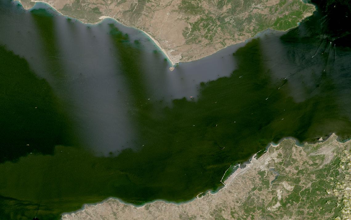
Vessel activity spreads across ocean areas no patrol fleet can watch continuously.
Satellite data watches every vessel and coastline day and night, turning sightings into a record.
This guide matches maritime monitoring tasks to the right data and provider.
Table of Contents
Key takeaways
- Maritime vessel tracking runs on AIS, but RF and SAR detection cover vessels that go dark
- Detecting a vessel that has gone dark takes RF geolocation or SAR imagery, not AIS alone
- The shortlist narrows once you know whether you need RF or SAR tasking or a fused intelligence platform
Before any provider enters the picture, a maritime program has to settle what it needs from the data itself. The summary below sets out the sensors, resolution, and cadence that vessel monitoring depends on.
| Primary sensors | SAR, RF geolocation, satellite AIS |
|---|---|
| Working resolution | 0.25-1.2 m for SAR vessel imagery |
| Typical revisit | Multiple times daily with tasked SAR |
| Core indices | AIS position, RF geolocation, SAR backscatter |
| Entry cost | From $675 per 1 m SAR scene |
| Main constraint | AIS is self-reported and can be switched off |
Those figures cover the baseline that most vessel-tracking programs run on. Programs that depart from it, through defense-grade RF, oil spill response, or ice-route safety, change both the sensor mix and the cost.
How satellite data is used in maritime
Satellite data enters maritime programs at six distinct workflow stages, each relying on different sensor types and delivering different forms of decision support to enforcement agencies, insurers, and commodity traders.
Vessel detection and dark vessel monitoring (SAR)
SAR imagery sees a vessel the way optical cameras cannot. Radar backscatter picks a metal hull out against open water day or night, through cloud, fog, or the kind of storm cover that would blank an optical sensor entirely. That all-weather property makes SAR the default choice for finding a vessel that has no interest in being found.
ICEYE runs its SAR fleet on daily coherent revisit over a monitored area, comparing today’s pass against yesterday’s rather than waiting for clear skies. Capella Space takes a different angle: its tasking system confirms a request in under 20 minutes and can return to the same patch of ocean multiple times in a single day, useful when a vessel’s last position is only hours old.
Neither operator has to be the only way in. Ursa Space runs a SAR-based Vessel Watch product on top of tasking access to Umbra, Capella, and ICEYE, so an analyst can pull whichever constellation is best positioned over a target area rather than committing to one operator’s orbit and revisit schedule.
RF geolocation and AIS gap analysis
SOLAS Chapter V, Regulation 19 has required AIS carriage since December 31, 2004, for every ship of 300 gross tonnage and upwards engaged on international voyages, cargo ships of 500 gross tonnage and upwards not engaged on international voyages, and all passenger ships regardless of size. Flag states may exempt individual vessels from the requirement.
AIS is self-reported, and a crew that wants to disappear can simply switch the transponder off. Fishing fleets carry a second transponder for that reason. Article 9 of Council Regulation (EC) No 1224/2009 obliges Member States to operate a satellite-based vessel monitoring system, and every EU fishing vessel of 12 metres length overall or more must carry a device that reports its position into it.
Both systems still depend on hardware aboard the vessel staying switched on and untampered with. That is the practical reason RF geolocation and SAR exist as an independent check rather than as a legal mandate to observe from orbit.
RF geolocation works because a vessel’s radar, radio, and satellite communications equipment keeps transmitting even when the AIS transponder goes quiet. Unseenlabs geolocates those signals from its own constellation of monosatellites, each independently detecting emitters across roughly 300,000 km² in a single pass. HawkEye 360 triangulates the same category of signals using time-difference and frequency-difference of arrival across formations of satellites.
HawkEye 360’s Vessel Custody ID product keeps a persistent identity on a vessel of interest across multiple collections, whether or not it is broadcasting AIS. Spire Global folds a similar RF geolocation capability, spanning VHF through X-band, into a constellation that also carries its weather and aviation payloads.
Illegal, unreported and unregulated fishing
Council Regulation (EC) No 1005/2008 established a Community system to prevent, deter, and eliminate illegal, unreported, and unregulated fishing, built around a catch certificate requirement for fishery products entering the EU market. The regulation defines IUU fishing simply as fishing activity that is illegal, unreported, or unregulated, without prescribing how enforcement agencies must monitor it.
That gap is where satellite detection fits. Unseenlabs lists anti-IUU enforcement among its core maritime use cases, geolocating vessels inside an exclusive economic zone regardless of whether they are broadcasting. Windward runs the same problem through behavioral AI instead of raw geolocation, flagging deceptive patterns such as AIS gaps, spoofed positions, and ship-to-ship transfers that often accompany unlicensed fishing.
Satellogic’s own use cases list illegal fishing and illicit transshipment detection alongside its sub-meter optical imagery, giving an enforcement agency a visual confirmation to pair with an RF or behavioral alert.
Oil spill detection
Oil on water dampens the small capillary waves that normally scatter radar energy back to a SAR satellite, so a slick appears as a dark patch against the brighter backscatter of open water. That contrast holds at night and through cloud cover, which is exactly when a spill is likely to go unnoticed by a passing ship or aircraft.
ICEYE lists oil spill detection among its own maritime monitoring use cases, running the same SAR constellation it uses for vessel detection over a suspected slick. Because SAR imagery cannot tell a mineral oil slick from a natural biogenic film such as algae or fish oil on its own, an operator typically pairs the radar detection with wind data and a follow-up pass before confirming a spill.
Port and cargo activity
Port congestion, tanker queues, and refinery throughput move commodity prices before any customs filing catches up, which is why traders watch the water itself rather than waiting for paperwork. Kpler built its business on exactly that gap, fusing AIS vessel positions with customs records, refinery data, and satellite imagery of storage tanks into a single trade-intelligence feed.
Capella Space’s use cases list port monitoring alongside its core vessel-detection work, giving a terminal operator or a trader the same SAR tasking used for dark-vessel search but pointed at berths, anchorages, and tank farms instead of open water. The output answers a narrower but commercially sharper question: not just where a vessel is, but how long it has been sitting there.
Sea ice and route safety
Polar shipping routes present a specific problem: for months at a time there is no daylight for an optical sensor to work with, yet ice conditions can change enough between passes to close a route that was open the week before. SAR solves the daylight problem outright, since it images by emitting its own radar signal rather than reflecting sunlight, and ICEYE lists ice monitoring among its environmental use cases alongside its vessel-detection work.
Route safety is not only about ice extent. Spire Global’s GNSS radio occultation data feeds ocean weather models that shipping companies use for voyage routing and vessel-performance planning, an application the company lists directly among its own use cases, layering weather risk on top of whatever ice or vessel picture the radar imagery provides.
What satellite data you need for maritime
Different maritime tasks call for different sensor modalities, resolutions, and revisit cadence, and mixing them up wastes budget on the wrong spec. The table below maps each common task to the data requirements it actually demands.
| Task | Sensor modality | Resolution | Revisit | Key index / band |
|---|---|---|---|---|
| Vessel detection | SAR | 0.25-1.2 m | Multiple times daily | Radar backscatter |
| Dark vessel geolocation | RF (VHF to X-band) | ~1 km accuracy | Multiple passes daily | TDOA/FDOA or monosatellite fix |
| AIS position tracking | Satellite and terrestrial AIS | Exact position report | Continuous | MMSI, GPS position |
| IUU fishing enforcement | SAR, RF, and AIS fusion | 1-3 m | Daily | Behavioral anomaly flag |
| Oil spill detection | SAR (C-band or X-band) | 10-30 m | Per event | Backscatter dampening |
| Port and cargo monitoring | Very high resolution SAR | 0.25-1.2 m | Daily | Berth occupancy, tank level |
| Sea ice and route safety | SAR | 10-100 m | Daily | Ice edge backscatter |
| Ocean weather for routing | GNSS radio occultation | Global atmospheric profile | Daily | Atmospheric and ocean forecast data |
| Trade and commodity intelligence | AIS, imagery, and customs fusion | N/A | Continuous | Tank fill level, vessel position |
With the data requirements mapped, the next step is finding which providers actually supply them. The section below covers the operators and analytics platforms most relevant to maritime programs, from RF geolocation specialists to trade-intelligence aggregators.
Satellite data providers for maritime
The providers below have documented maritime use cases that map to the tasks above, spanning pure-play RF operators, SAR satellite operators with their own imagery catalogs, and the trade-intelligence platforms that fuse AIS with customs and imagery data.
| Provider | Type | Best for | Key maritime spec | Entry point |
|---|---|---|---|---|
| Unseenlabs | RF satellite operator | Dark vessel RF detection | ~300,000 km² per RF pass | Demo booking |
| HawkEye 360 | RF satellite operator | Vessel Custody ID tracking | TDOA/FDOA RF geolocation | Subscription, quote-based |
| Spire Global | Multi-payload satellite operator | Multipurpose RF plus weather data | VHF-to-X-band RF coverage | Talk to sales |
| ICEYE | SAR satellite operator | SAR dark-vessel detection | Daily persistent monitoring | Quote or UP42 marketplace |
| Capella Space | SAR satellite operator | Fast-tasking SAR imagery | Sub-20-minute tasking confirmation | Quote or UP42 marketplace |
| Kpler | Data aggregator | Commodity and vessel intelligence | AIS, imagery, and customs fusion | Demo request |
| Windward | Analytics platform | Deceptive shipping detection | AI fusion of AIS, EO, SAR, RF | Enterprise contract |
For a full ranked comparison of the radar side of this market, see our guide to the best SAR data providers, which scores every operator on resolution and tasking speed. Programs leaning on signals intelligence instead of imagery should also check our best RF intelligence providers ranking, which covers the RF specialists in more depth.
How to choose satellite data for maritime
The first decision is what the data has to prove. A single dark-vessel search and a standing trade-intelligence feed are different products, and a vendor strong at one rarely gives you the other. Vessel detection is a tasking exercise on RF or SAR; commodity intelligence is a fusion exercise across AIS and customs data.
Regulatory exposure sets the second cut. A fisheries enforcement agency working an IUU case needs geolocation it can act on quickly, and Unseenlabs and HawkEye 360 build for exactly that: an emitter, a fix, and a position, independent of AIS. A sanctions or compliance team building a case file needs an audit trail across time, not a single detection, the strength Kpler and Windward bring through years of indexed AIS and behavioral history.
Geography decides the sensor mix next. Optical monitoring loses months of coverage in the tropics and through the polar night, so high-latitude routes or persistent cloud cover call for SAR as the primary sensor, not a fallback. AIS-based tools stay useful wherever a vessel chooses to broadcast, which is most of the fleet, but not the part that matters most for enforcement.
Budget and coverage area follow from how continuously you need to watch. A standing subscription over a busy strait or an EEZ costs less per observation than one-off tasking, while a single search for a vessel with a known last position is the case for on-demand tasking instead of an area-wide contract. Confirm that your intended use, whether a regulatory filing, an insurance claim, or public disclosure, is permitted under the provider’s standard license.
Verdict
Maritime is the vertical where the gap between self-reported and independently observed data matters most. AIS tells you where a cooperative vessel says it is; RF geolocation and SAR tell you where a vessel actually is, whether or not it wants to be found. What separates the providers above is which half of that picture they build for.
Teams chasing dark vessels for enforcement or defense should look first at Unseenlabs, HawkEye 360, ICEYE, and Capella Space, since a fix or an image is exactly what a case file needs. Teams building continuous commercial awareness, from sanctions screening to freight and commodity flows, get more out of Kpler and Windward, whose value is years of fused history rather than a single detection.
Spire Global sits between both groups, adding RF geolocation and ocean weather data to whichever stack it joins.
For the radar side of that shortlist, our best SAR data providers guide ranks every SAR operator on resolution and revisit. For the signals side, the best RF intelligence providers guide covers the RF specialists on constellation size and coverage in more depth.
Frequently asked questions
Below are answers to the questions maritime buyers most commonly ask. Each answer points to the section where the full detail lives.
How is satellite data used in maritime monitoring?
Satellite data covers six main workflows: SAR-based vessel and dark-vessel detection, RF geolocation that fills the gaps AIS leaves open, illegal and unregulated fishing enforcement, oil spill detection, port and cargo monitoring, and sea ice and route safety. Each workflow draws on a different sensor type, from radar backscatter to radio-frequency triangulation to plain AIS position reports. The detail is in “How satellite data is used in maritime“.
Does AIS satisfy maritime tracking requirements on its own?
SOLAS Chapter V, Regulation 19 has required AIS carriage since December 31, 2004, for most ships of 300 gross tonnage and up and all passenger ships. AIS is self-reported and can be switched off, which is why RF geolocation and SAR exist as an independent check rather than a legal substitute. More detail is in “How satellite data is used in maritime“.
What resolution do I need to detect a vessel by satellite?
Routine vessel detection runs on SAR imagery in the sub-meter to a few meters class, and port and berth-level monitoring uses the same fine end of that range. RF geolocation works on a completely different scale, fixing an emitter’s position to roughly a kilometer rather than resolving a shape. The full task-to-spec mapping is in “What satellite data you need for maritime“.
Which satellite data providers are best for maritime?
Unseenlabs, HawkEye 360, and Spire Global lead on RF geolocation, ICEYE and Capella Space lead on SAR vessel detection, and Kpler and Windward lead on fused trade and compliance intelligence. Which one fits depends on whether you need a fix or a feed. Provider details and access models are in “Satellite data providers for maritime“.
Can satellites detect vessels that have turned off AIS?
Yes. RF geolocation picks up a vessel’s radar, radio, or satellite communications emissions independent of its AIS transponder, and SAR imagery sees the hull itself regardless of what the vessel is broadcasting. Together they are the standard check on AIS gaps, though neither is a legal requirement under SOLAS. This capability is covered in “How satellite data is used in maritime“.
How do I choose between RF, SAR, and AIS-based data for maritime monitoring?
Start with what you need to prove: RF and SAR both find a vessel independent of AIS, but SAR also gives you a viewable image, while RF works on emissions alone. AIS-fused platforms such as Kpler and Windward add years of trade and behavioral history that neither raw RF nor SAR provides by itself. The decision factors are laid out in “How to choose satellite data for maritime“.

My passions are Earth Observation and Satellites, and my profession is Data Analysis. I combine both within ObservationData.com to show you the use cases of Earth Observation, to help you find the right provider, and to share your experiences.
